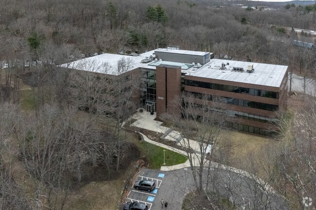
Property Record
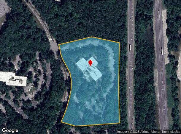
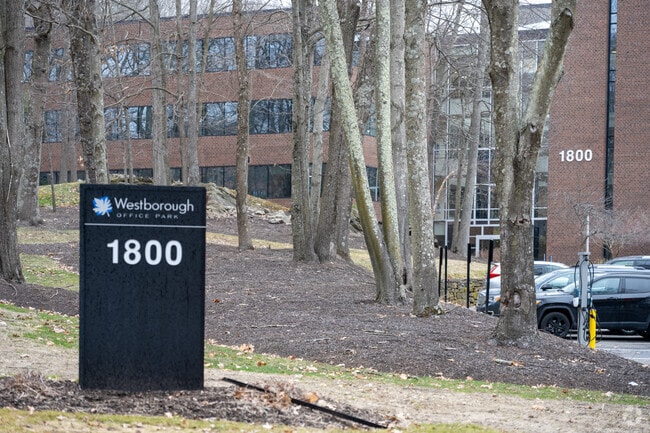
1800 W Park Dr, Westborough, MA 01581
NEARBY LISTINGS FOR SALE OR LEASE
Property Detail
1800 W Park Dr
Officebuilding
Worcester
X
Massachusetts
25027C0662F
9.61 AC
2025
The Boroughs
2025
Boston
761200
Worcester, MA-CT
105,000 SF
WBOR-000030-000051
DEMOGRAPHICS near 1800 W Park Dr
1 Mile
3 Mile
5 Mile
2024 Total Population
755
21,952
83,937
2029 Population
750
21,885
83,505
Pop Growth 2024-2029
(0.66%)
(0.31%)
(0.51%)
Average Age
39
40
40
2024 Total Households
267
8,180
31,296
HH Growth 2024-2029
(0.37%)
(0.28%)
(0.55%)
Median Household Inc
$173,076
$123,910
$124,129
Avg Household Size
2.80
2.60
2.60
2024 Avg HH Vehicles
2.00
2.00
2.00
Median Home Value
$709,507
$628,055
$597,549
Median Year Built
1982
1978
1977
Nearby Places
Map Layers
Map Styles
 Street
 Aerial
- Restaurants
- Banks
- Shops
- Fitness
- Groceries
PUBLIC TRANSPORTATION
COMMUTER RAIL
Southborough (Framingham/Worcester Line - Massachusetts Bay Transportation Authority Commuter Rail (Purple Line))
DRIVE
WALK
Distance
Southborough (Framingham/Worcester Line - Massachusetts Bay Transportation Authority Commuter Rail (Purple Line))
11 min
5.6 mi
Westborough (Framingham/Worcester Line - Massachusetts Bay Transportation Authority Commuter Rail (Purple Line))
DRIVE
WALK
Distance
Westborough (Framingham/Worcester Line - Massachusetts Bay Transportation Authority Commuter Rail (Purple Line))
13 min
6.3 mi
AIRPORT
General Edward Lawrence Logan International
DRIVE
WALK
Distance
General Edward Lawrence Logan International
43 min
33.7 mi
SALE & LEASE HISTORY
LISTING DATE
SALE/LEASE

Sep 25, 2016
For Lease
Nov 03, 2017
For Lease
Nov 01, 2017
For Lease
Nearby Properties
Address
Land Use
TOTAL SIZE
Lot Size
Zoning
Address
Land Use
TOTAL SIZE
Lot Size
Zoning
274,000 SF
32 AC
M-1
Address
Land Use
TOTAL SIZE
Lot Size
Zoning
367,779 SF
59.22 AC
IB
Address
Land Use
TOTAL SIZE
Lot Size
Zoning
263,979 SF
0.12 AC
EROD
Address
Land Use
TOTAL SIZE
Lot Size
Zoning
7,383 SF
80.70 AC
RA
Address
Land Use
TOTAL SIZE
Lot Size
Zoning
237,337 SF
16.65 AC
IB
Address
Land Use
TOTAL SIZE
Lot Size
Zoning
8,160 SF
11 AC
RA
Address
Land Use
TOTAL SIZE
Lot Size
Zoning
19.07 AC
IP
Address
Land Use
TOTAL SIZE
Lot Size
Zoning
320,540 SF
20.02 AC
BA
Address
Land Use
TOTAL SIZE
Lot Size
Zoning
300,989 SF
66.90 AC
I
Address
Land Use
TOTAL SIZE
Lot Size
Zoning
24.95 AC
I
Address
Land Use
TOTAL SIZE
Lot Size
Zoning
578,873 SF
94.26 AC
IB
Address
Land Use
TOTAL SIZE
Lot Size
Zoning
314,677 SF
97.28 AC
Address
Land Use
TOTAL SIZE
Lot Size
Zoning
347,607 SF
51.50 AC
IP
Address
Land Use
TOTAL SIZE
Lot Size
Zoning
15.20 AC
BA
Address
Land Use
TOTAL SIZE
Lot Size
Zoning
677,238 SF
92.81 AC
IB
Address
Land Use
TOTAL SIZE
Lot Size
Zoning
299,149 SF
28.81 AC
I
Address
Land Use
TOTAL SIZE
Lot Size
Zoning
204,205 SF
14.59 AC
IP
Address
Land Use
TOTAL SIZE
Lot Size
Zoning
1,976 SF
81.69 AC
RA
Address
Land Use
TOTAL SIZE
Lot Size
Zoning
37.84 AC
LI
Address
Land Use
TOTAL SIZE
Lot Size
Zoning
386,463 SF
23.80 AC
I
Address
Land Use
TOTAL SIZE
Lot Size
Zoning
216,218 SF
97.33 AC
Address
Land Use
TOTAL SIZE
Lot Size
Zoning
32.51 AC
IB
Address
Land Use
TOTAL SIZE
Lot Size
Zoning
281,079 SF
11.81 AC
Address
Land Use
TOTAL SIZE
Lot Size
Zoning
296,330 SF
24.88 AC
IB
Address
Land Use
TOTAL SIZE
Lot Size
Zoning
82,554 SF
11.15 AC
RB
Address
Land Use
TOTAL SIZE
Lot Size
Zoning
67,760 SF
11.65 AC
RB
Address
Land Use
TOTAL SIZE
Lot Size
Zoning
6,420 SF
28 AC
IP
Address
Land Use
TOTAL SIZE
Lot Size
Zoning
27,836 SF
4.22 AC
RB
Address
Land Use
TOTAL SIZE
Lot Size
Zoning
216,518 SF
6.64 AC
R
Address
Land Use
TOTAL SIZE
Lot Size
Zoning
97,171 SF
27.77 AC
M-1
The World's #1 Commercial Real Estate Marketplace
Connect with us
© 2026 CoStar Group
The information above has been obtained from sources believed reliable. While we do not doubt its accuracy we have not verified it and make no guarantee, warranty or representation about it. It is your responsibility to independently confirm its accuracy and completeness. Any projections, opinions, assumptions, or estimates used are for example only and do not represent the current or future performance of the property. The value of this transaction to you depends on tax and other factors which should be evaluated by your tax, financial, and legal advisors. You and your advisors should conduct a careful, independent investigation of the property to determine to your satisfaction the suitability of the property for your needs.