Property Record
18000 Duval Rd, Moseley, VA 23120
NEARBY LISTINGS FOR SALE OR LEASE
Property Detail
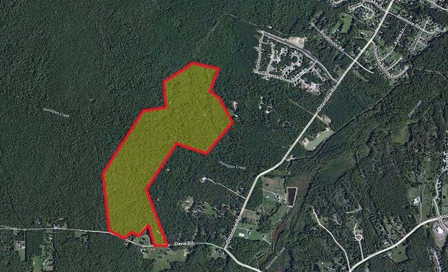
18000 Duval Rd
Richmond, VA
N/L Duval Road Parcel A
705-68-03-05-700-000
N/L OF DUVAL RD PARCEL 1
Taxexempt
Chesterfield
AE
Virginia
51145C0300C
130 AC
0
Outlying Chesterfield
2025
Richmond VA
101003
DEMOGRAPHICS near 18000 Duval Rd
1 Mile
3 Mile
5 Mile
2024 Total Population
1,675
24,699
61,181
2029 Population
1,903
27,702
68,011
Pop Growth 2024-2029
+ 13.61%
+ 12.16%
+ 11.16%
Average Age
35
36
38
2024 Total Households
509
7,771
20,697
HH Growth 2024-2029
+ 13.75%
+ 12.21%
+ 11.09%
Median Household Inc
$162,431
$155,787
$136,925
Avg Household Size
3.30
3.10
2.90
2024 Avg HH Vehicles
2.00
2.00
2.00
Median Home Value
$441,255
$430,639
$401,058
Median Year Built
2011
2010
2003
Nearby Places
Map Layers
Map Styles
 Street
 Aerial
- Restaurants
- Banks
- Shops
- Fitness
- Groceries
PUBLIC TRANSPORTATION
AIRPORT
Richmond International
DRIVE
WALK
Distance
Richmond International
53 min
33.2 mi
Freight Ports
Virginia Port Authority - Richmond
DRIVE
WALK
Distance
Virginia Port Authority - Richmond
42 min
21.8 mi
Nearby Properties
Address
Land Use
TOTAL SIZE
Lot Size
Zoning
Address
Land Use
TOTAL SIZE
Lot Size
Zoning
257,400 SF
85.42 AC
A - AGRICU
Address
Land Use
TOTAL SIZE
Lot Size
Zoning
318,965 SF
9.34 AC
C3 - COMMU
Address
Land Use
TOTAL SIZE
Lot Size
Zoning
100 SF
21.18 AC
R9 - SINGL
Address
Land Use
TOTAL SIZE
Lot Size
Zoning
95,857 SF
24.56 AC
C3 - COMMU
Address
Land Use
TOTAL SIZE
Lot Size
Zoning
64,809 SF
16.15 AC
O2 - CORP
Address
Land Use
TOTAL SIZE
Lot Size
Zoning
104,621 SF
25.53 AC
R9 - SINGL
Address
Land Use
TOTAL SIZE
Lot Size
Zoning
53,900 SF
7.70 AC
R12 - SING
Address
Land Use
TOTAL SIZE
Lot Size
Zoning
58,250 SF
21.74 AC
I1 - LT IN
Address
Land Use
TOTAL SIZE
Lot Size
Zoning
50,668 SF
8.29 AC
C3 - COMMU
Address
Land Use
TOTAL SIZE
Lot Size
Zoning
73,969 SF
24.40 AC
R9 - SINGL
Address
Land Use
TOTAL SIZE
Lot Size
Zoning
1,409.61 AC
I2 - GEN I
Address
Land Use
TOTAL SIZE
Lot Size
Zoning
6,943 SF
20.05 AC
I1 - LT IN
Address
Land Use
TOTAL SIZE
Lot Size
Zoning
45,800 SF
31.66 AC
A - AGRICU
Address
Land Use
TOTAL SIZE
Lot Size
Zoning
235.15 AC
R9 - SINGL
Address
Land Use
TOTAL SIZE
Lot Size
Zoning
100,086 SF
5.72 AC
C5 - GEN B
Address
Land Use
TOTAL SIZE
Lot Size
Zoning
71,940 SF
4.17 AC
I1 - LT IN
Address
Land Use
TOTAL SIZE
Lot Size
Zoning
174.79 AC
A - AGRICU
Address
Land Use
TOTAL SIZE
Lot Size
Zoning
17,343 SF
3.68 AC
R9 - SINGL
Address
Land Use
TOTAL SIZE
Lot Size
Zoning
15,206 SF
5.70 AC
A - AGRICU
Address
Land Use
TOTAL SIZE
Lot Size
Zoning
44,100 SF
3.17 AC
C5 - GEN B
Address
Land Use
TOTAL SIZE
Lot Size
Zoning
21,998 SF
3.08 AC
C3 - COMMU
Address
Land Use
TOTAL SIZE
Lot Size
Zoning
11,945 SF
4.27 AC
C5 - GEN B
Address
Land Use
TOTAL SIZE
Lot Size
Zoning
5,456 SF
2.59 AC
C3 - COMMU
Address
Land Use
TOTAL SIZE
Lot Size
Zoning
83.46 AC
R9 - SINGL
Address
Land Use
TOTAL SIZE
Lot Size
Zoning
19,757 SF
5.11 AC
A - AGRICU
Address
Land Use
TOTAL SIZE
Lot Size
Zoning
123.21 AC
R12 - SING
Address
Land Use
TOTAL SIZE
Lot Size
Zoning
123.21 AC
R12 - SING
Address
Land Use
TOTAL SIZE
Lot Size
Zoning
10,340 SF
1.46 AC
C3 - COMMU
Address
Land Use
TOTAL SIZE
Lot Size
Zoning
9,593 SF
1.89 AC
C3 - COMMU
Address
Land Use
TOTAL SIZE
Lot Size
Zoning
104.80 AC
R15 - SING
The World's #1 Commercial Real Estate Marketplace
Connect with us
© 2026 CoStar Group
The information above has been obtained from sources believed reliable. While we do not doubt its accuracy we have not verified it and make no guarantee, warranty or representation about it. It is your responsibility to independently confirm its accuracy and completeness. Any projections, opinions, assumptions, or estimates used are for example only and do not represent the current or future performance of the property. The value of this transaction to you depends on tax and other factors which should be evaluated by your tax, financial, and legal advisors. You and your advisors should conduct a careful, independent investigation of the property to determine to your satisfaction the suitability of the property for your needs.