Property Record
18001 Applegate Rd, Applegate, CA 95703

Property Detail
18001 Applegate Rd
Sacramento-Roseville-Folsom, CA
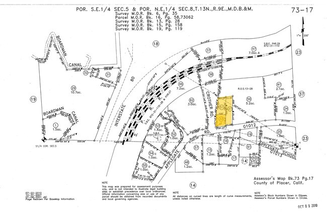
1.1 AC FR SEC 5 13 9
073-170-063
PLACER
Commercialacreage
California
B and X Area of moderate flood hazard, usually the area between the limits of the 100-year and 500-year floods.
1.10 AC
2024
Outer Placer County
2025
Sacramento
021901
NEARBY LISTINGS FOR SALE OR LEASE
-
-
View all Applegate listings for sale on LoopNet.com
DEMOGRAPHICS near 18001 Applegate Rd
1 mile
3 mile
5 mile
2024 Total Population
1,007
6,702
17,865
2029 Population
1,040
6,994
18,645
Pop Growth 2024-2029
+ 3.28%
+ 4.36%
+ 4.37%
Average Age
46
46
48
2024 Total Households
398
2,617
7,053
HH Growth 2024-2029
+ 3.27%
+ 4.36%
+ 4.35%
Median Household Inc
$88,184
$95,940
$98,754
Avg Household Size
2.50
2.50
2.50
2024 Avg HH Vehicles
3.00
3.00
3.00
Median Home Value
$645,374
$683,029
$666,829
Median Year Built
1983
1980
1981
Nearby Places
Map Layers
Map Styles
 Street
 Aerial
Transit
 Traffic
 Biking
Places
Listings with unknown addresses are not visible on the map
- Restaurants
- Banks
- Shops
- Fitness
- Groceries
PUBLIC TRANSPORTATION
COMMUTER RAIL
Colfax Amtrak Station (California Zephyr - Amtrak)
Drive
Walk
Distance
Colfax Amtrak Station (California Zephyr - Amtrak)
10 min
7.7 mi
Auburn-Conheim (Capitol Corridor - Capitol Corridor Joint Powers Authority)
Drive
Walk
Distance
Auburn-Conheim (Capitol Corridor - Capitol Corridor Joint Powers Authority)
12 min
9.2 mi
Freight Ports
Port of Stockton
Drive
Walk
Distance
Port of Stockton
103 min
89.1 mi
SALE & LEASE HISTORY
LISTING DATE
SALE/LEASE

Sep 24, 2016
For Sale
Nearby Properties
Address
Land Use
TOTAL SIZE
Lot Size
Zoning
Address
Land Use
TOTAL SIZE
Lot Size
Zoning
26,537 SF
2.48 AC
C2DC
Address
Land Use
TOTAL SIZE
Lot Size
Zoning
4,330 SF
1.30 AC
RABX
Address
Land Use
TOTAL SIZE
Lot Size
Zoning
15,740 SF
3 AC
C2DC
Address
Land Use
TOTAL SIZE
Lot Size
Zoning
2,637 SF
1.10 AC
HSDC
Address
Land Use
TOTAL SIZE
Lot Size
Zoning
12,162 SF
39.50 AC
RAB100
Address
Land Use
TOTAL SIZE
Lot Size
Zoning
18,962 SF
20.40 AC
RAB100
Address
Land Use
TOTAL SIZE
Lot Size
Zoning
3,842 SF
1.40 AC
RABX
Address
Land Use
TOTAL SIZE
Lot Size
Zoning
5,635 SF
8.80 AC
RABX
Address
Land Use
TOTAL SIZE
Lot Size
Zoning
24,881 SF
120.80 AC
RAB100
Address
Land Use
TOTAL SIZE
Lot Size
Zoning
1,944 SF
124.30 AC
RFBX
Address
Land Use
TOTAL SIZE
Lot Size
Zoning
4,154 SF
1.80 AC
C2DC
Address
Land Use
TOTAL SIZE
Lot Size
Zoning
7,996 SF
1.06 AC
Address
Land Use
TOTAL SIZE
Lot Size
Zoning
4,800 SF
0.51 AC
C2DC
Address
Land Use
TOTAL SIZE
Lot Size
Zoning
11,691 SF
1.50 AC
HSDC
Address
Land Use
TOTAL SIZE
Lot Size
Zoning
6,220 SF
0.82 AC
C2DC
Address
Land Use
TOTAL SIZE
Lot Size
Zoning
8,612 SF
5.20 AC
RSB43
Address
Land Use
TOTAL SIZE
Lot Size
Zoning
20,454 SF
1.90 AC
RSAGB40
Address
Land Use
TOTAL SIZE
Lot Size
Zoning
10,591 SF
0.68 AC
C2DC
Address
Land Use
TOTAL SIZE
Lot Size
Zoning
2,889 SF
1 AC
OPB40DC
Address
Land Use
TOTAL SIZE
Lot Size
Zoning
3,600 SF
1 AC
C2DC
Address
Land Use
TOTAL SIZE
Lot Size
Zoning
7,591 SF
5.50 AC
RAB100
Address
Land Use
TOTAL SIZE
Lot Size
Zoning
5,200 SF
0.63 AC
HSDCB43
Address
Land Use
TOTAL SIZE
Lot Size
Zoning
1 AC
RABX
Address
Land Use
TOTAL SIZE
Lot Size
Zoning
1,974 SF
1.30 AC
OPDC
Address
Land Use
TOTAL SIZE
Lot Size
Zoning
12,060 SF
1.30 AC
C3DC
Address
Land Use
TOTAL SIZE
Lot Size
Zoning
5,887 SF
1.02 AC
C2DC
Address
Land Use
TOTAL SIZE
Lot Size
Zoning
13,348 SF
36.80 AC
RAB100
Address
Land Use
TOTAL SIZE
Lot Size
Zoning
3.70 AC
RABX
Address
Land Use
TOTAL SIZE
Lot Size
Zoning
20,800 SF
2.70 AC
RSAGB40
Address
Land Use
TOTAL SIZE
Lot Size
Zoning
4,512 SF
11 AC
RAB100
The World's #1 Commercial Real Estate Marketplace
Connect with us
© 2026 CoStar Group
The information above has been obtained from sources believed reliable. While we do not doubt its accuracy we have not verified it and make no guarantee, warranty or representation about it. It is your responsibility to independently confirm its accuracy and completeness. Any projections, opinions, assumptions, or estimates used are for example only and do not represent the current or future performance of the property. The value of this transaction to you depends on tax and other factors which should be evaluated by your tax, financial, and legal advisors. You and your advisors should conduct a careful, independent investigation of the property to determine to your satisfaction the suitability of the property for your needs.