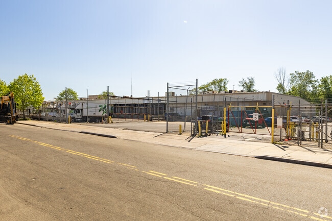
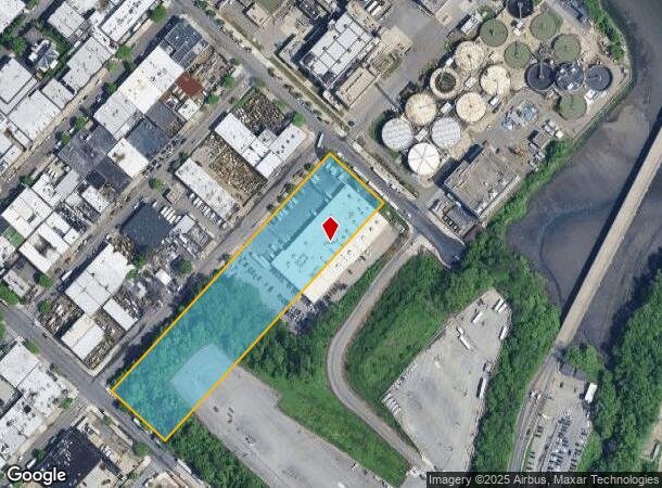
Property Record
1801 45Th St, Astoria, NY 11105
NEARBY LISTINGS FOR SALE OR LEASE
Property Detail
1801 45Th St
00777-0001
Queens
Industrialgeneral
New York
X
1
3604970094F
4 AC
0
Northeast Queens
2025
Long Island (New York)
011300
New York-Jersey City-White Plains, NY-NJ
45,000 SF
DEMOGRAPHICS near 1801 45Th St
1 Mile
3 Mile
5 Mile
2024 Total Population
28,565
809,711
2,681,565
2029 Population
26,348
755,632
2,496,965
Pop Growth 2024-2029
(7.76%)
(6.68%)
(6.88%)
Average Age
40
39
40
2024 Total Households
11,839
303,324
1,079,448
HH Growth 2024-2029
(8.27%)
(6.86%)
(7.18%)
Median Household Inc
$91,988
$64,465
$66,576
Avg Household Size
2.30
2.50
2.40
2024 Avg HH Vehicles
1.00
.00
.00
Median Home Value
$846,670
$711,427
$785,992
Median Year Built
1948
1954
1955
Nearby Places
- Restaurants
- Banks
- Shops
- Fitness
- Groceries
PUBLIC TRANSPORTATION
COMMUTER RAIL
Woodside Station (Babylon Branch - Long Island Rail Road, Far Rockaway Branch - Long Island Rail Road, Hempstead Branch - Long Island Rail Road, Long Beach Branch - Long Island Rail Road, Montauk Branch - Long Island Rail Road, Port Jefferson Branch - Long Island Rail Road, Port Washington Branch - Long Island Rail Road, Ronkonkoma Branch - Long Island Rail Road)
DRIVE
WALK
Distance
Woodside Station (Babylon Branch - Long Island Rail Road, Far Rockaway Branch - Long Island Rail Road, Hempstead Branch - Long Island Rail Road, Long Beach Branch - Long Island Rail Road, Montauk Branch - Long Island Rail Road, Port Jefferson Branch - Long Island Rail Road, Port Washington Branch - Long Island Rail Road, Ronkonkoma Branch - Long Island Rail Road)
7 min
3.3 mi
Harlem-125Th Street Station (Harlem Line - Metro-North Commuter Railroad Company (Metro-North), Hudson Line - Metro-North Commuter Railroad Company (Metro-North), New Haven Line - Metro-North Commuter Railroad Company (Metro-North))
DRIVE
WALK
Distance
Harlem-125Th Street Station (Harlem Line - Metro-North Commuter Railroad Company (Metro-North), Hudson Line - Metro-North Commuter Railroad Company (Metro-North), New Haven Line - Metro-North Commuter Railroad Company (Metro-North))
12 min
5.1 mi
AIRPORT
LaGuardia
DRIVE
WALK
Distance
LaGuardia
8 min
2.3 mi
John F Kennedy International
DRIVE
WALK
Distance
John F Kennedy International
21 min
13.1 mi
Newark Liberty International
DRIVE
WALK
Distance
Newark Liberty International
36 min
21.2 mi
Freight Ports
NY - Red Hook Container Terminal
DRIVE
WALK
Distance
NY - Red Hook Container Terminal
21 min
11.6 mi
Nearby Properties
Address
Land Use
TOTAL SIZE
Lot Size
Zoning
Address
Land Use
TOTAL SIZE
Lot Size
Zoning
5,519,372 SF
409.21 AC
C8-2
Address
Land Use
TOTAL SIZE
Lot Size
Zoning
1,502,532 SF
6.35 AC
R7B
Address
Land Use
TOTAL SIZE
Lot Size
Zoning
1,075,000 SF
6.74 AC
R7-2
Address
Land Use
TOTAL SIZE
Lot Size
Zoning
661,538 SF
11.26 AC
R7-2
Address
Land Use
TOTAL SIZE
Lot Size
Zoning
908,799 SF
2.13 AC
R10
Address
Land Use
TOTAL SIZE
Lot Size
Zoning
207.09 AC
PARK
Address
Land Use
TOTAL SIZE
Lot Size
Zoning
882,579 SF
0.51 AC
M16R10
Address
Land Use
TOTAL SIZE
Lot Size
Zoning
648,703 SF
1.45 AC
C28A
Address
Land Use
TOTAL SIZE
Lot Size
Zoning
507,265 SF
4.04 AC
C4-4
Address
Land Use
TOTAL SIZE
Lot Size
Zoning
892,550 SF
2.93 AC
M13R8
Address
Land Use
TOTAL SIZE
Lot Size
Zoning
948 SF
282.37 AC
PARK
Address
Land Use
TOTAL SIZE
Lot Size
Zoning
94,247 SF
8.63 AC
M1-4
Address
Land Use
TOTAL SIZE
Lot Size
Zoning
217,951 SF
0.91 AC
R6
Address
Land Use
TOTAL SIZE
Lot Size
Zoning
753,206 SF
5.30 AC
R6
Address
Land Use
TOTAL SIZE
Lot Size
Zoning
332,266 SF
12.57 AC
M2-1
Address
Land Use
TOTAL SIZE
Lot Size
Zoning
426,172 SF
14.30 AC
M3-1
Address
Land Use
TOTAL SIZE
Lot Size
Zoning
491,007 SF
11.85 AC
M3-1
Address
Land Use
TOTAL SIZE
Lot Size
Zoning
7,500 SF
14.56 AC
PARK
Address
Land Use
TOTAL SIZE
Lot Size
Zoning
566,233 SF
13.25 AC
M3-1
Address
Land Use
TOTAL SIZE
Lot Size
Zoning
509,090 SF
0.94 AC
R10
Address
Land Use
TOTAL SIZE
Lot Size
Zoning
655,459 SF
1.13 AC
C2-8
Address
Land Use
TOTAL SIZE
Lot Size
Zoning
139,333 SF
1.17 AC
C6-3
Address
Land Use
TOTAL SIZE
Lot Size
Zoning
127,000 SF
16.53 AC
M3-1
Address
Land Use
TOTAL SIZE
Lot Size
Zoning
447,145 SF
8.05 AC
M3-1
Address
Land Use
TOTAL SIZE
Lot Size
Zoning
1,172,005 SF
128.83 AC
M1-1
Address
Land Use
TOTAL SIZE
Lot Size
Zoning
480,000 SF
16.98 AC
M1-1
Address
Land Use
TOTAL SIZE
Lot Size
Zoning
274,910 SF
0.70 AC
R10
Address
Land Use
TOTAL SIZE
Lot Size
Zoning
250,577 SF
23.17 AC
M2-1
Address
Land Use
TOTAL SIZE
Lot Size
Zoning
251,659 SF
0.34 AC
R10
Address
Land Use
TOTAL SIZE
Lot Size
Zoning
247,615 SF
0.46 AC
R10
The World's #1 Commercial Real Estate Marketplace
Connect with us
© 2025 CoStar Group
The information above has been obtained from sources believed reliable. While we do not doubt its accuracy we have not verified it and make no guarantee, warranty or representation about it. It is your responsibility to independently confirm its accuracy and completeness. Any projections, opinions, assumptions, or estimates used are for example only and do not represent the current or future performance of the property. The value of this transaction to you depends on tax and other factors which should be evaluated by your tax, financial, and legal advisors. You and your advisors should conduct a careful, independent investigation of the property to determine to your satisfaction the suitability of the property for your needs.