Property Record
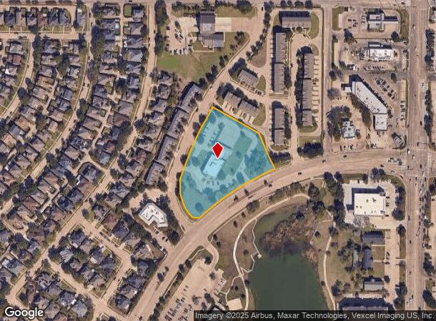
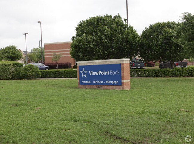
1801 Keller Springs Rd, Carrollton, TX 75006

NEARBY LISTINGS FOR SALE OR LEASE
Property Detail
1801 Keller Springs Rd
Dallas-Fort Worth-Arlington, TX
Plaza Iv Of Josey Ranch Ph 5
14089680010010000
PLAZA IV OF JOSEY RANCH PH 5 BLK 1 LT 1 ACS 2.8886 VOL94250/2695 DD122894 CO-DALLAS 0896800100100 11408968001
Financialbuilding
Dallas
X
Texas
48113C0160K
1
2024
2.89 AC
2025
South Carrollton
013716
Dallas/Ft Worth
5,743 SF
DEMOGRAPHICS near 1801 Keller Springs Rd
1 Mile
3 Mile
5 Mile
2024 Total Population
14,974
117,277
332,780
2029 Population
14,735
127,547
364,393
Pop Growth 2024-2029
(1.60%)
+ 8.76%
+ 9.50%
Average Age
39
39
38
2024 Total Households
5,044
45,047
141,113
HH Growth 2024-2029
(1.92%)
+ 9.45%
+ 9.84%
Median Household Inc
$78,831
$73,858
$80,713
Avg Household Size
2.90
2.50
2.30
2024 Avg HH Vehicles
2.00
2.00
2.00
Median Home Value
$279,299
$283,163
$347,835
Median Year Built
1978
1983
1989
Nearby Places
Map Layers
Map Styles
 Street
 Aerial
- Restaurants
- Banks
- Shops
- Fitness
- Groceries
PUBLIC TRANSPORTATION
COMMUTER RAIL
Trinity Mills Station (Green Line - Dallas Area Rapid Transit (DART))
DRIVE
WALK
Distance
Trinity Mills Station (Green Line - Dallas Area Rapid Transit (DART))
6 min
2.3 mi
DRIVE
WALK
Distance
12 min
5.9 mi
AIRPORT
Dallas Love Field
DRIVE
WALK
Distance
Dallas Love Field
26 min
14.9 mi
Dallas-Fort Worth International
DRIVE
WALK
Distance
Dallas-Fort Worth International
23 min
15.8 mi
Nearby Properties
Address
Land Use
TOTAL SIZE
Lot Size
Zoning
Address
Land Use
TOTAL SIZE
Lot Size
Zoning
417,990 SF
10.42 AC
Address
Land Use
TOTAL SIZE
Lot Size
Zoning
660,180 SF
29.95 AC
Address
Land Use
TOTAL SIZE
Lot Size
Zoning
513,871 SF
3.63 AC
Z235
Address
Land Use
TOTAL SIZE
Lot Size
Zoning
396,669 SF
18.50 AC
Address
Land Use
TOTAL SIZE
Lot Size
Zoning
321,732 SF
4.05 AC
Z235
Address
Land Use
TOTAL SIZE
Lot Size
Zoning
255,627 SF
14.79 AC
Z123
Address
Land Use
TOTAL SIZE
Lot Size
Zoning
266,871 SF
87 SF
Address
Land Use
TOTAL SIZE
Lot Size
Zoning
725,972 SF
4 AC
Address
Land Use
TOTAL SIZE
Lot Size
Zoning
189,500 SF
53.90 AC
Address
Land Use
TOTAL SIZE
Lot Size
Zoning
349,784 SF
17.71 AC
Address
Land Use
TOTAL SIZE
Lot Size
Zoning
308,779 SF
19.42 AC
Z235
Address
Land Use
TOTAL SIZE
Lot Size
Zoning
268,132 SF
16.19 AC
Z235
Address
Land Use
TOTAL SIZE
Lot Size
Zoning
397,889 SF
23.14 AC
2A
Address
Land Use
TOTAL SIZE
Lot Size
Zoning
270,915 SF
3.91 AC
Z84
Address
Land Use
TOTAL SIZE
Lot Size
Zoning
374,093 SF
21.54 AC
Z268
Address
Land Use
TOTAL SIZE
Lot Size
Zoning
711,360 SF
32.62 AC
Address
Land Use
TOTAL SIZE
Lot Size
Zoning
210,289 SF
10.16 AC
Z147
Address
Land Use
TOTAL SIZE
Lot Size
Zoning
228,674 SF
11.81 AC
Z235
Address
Land Use
TOTAL SIZE
Lot Size
Zoning
294,764 SF
18 AC
Address
Land Use
TOTAL SIZE
Lot Size
Zoning
359,462 SF
13.67 AC
1B
Address
Land Use
TOTAL SIZE
Lot Size
Zoning
293,588 SF
17.04 AC
Address
Land Use
TOTAL SIZE
Lot Size
Zoning
262,065 SF
7.77 AC
1A
Address
Land Use
TOTAL SIZE
Lot Size
Zoning
90,900 SF
10.21 AC
Address
Land Use
TOTAL SIZE
Lot Size
Zoning
268,158 SF
12.25 AC
1G
Address
Land Use
TOTAL SIZE
Lot Size
Zoning
213,216 SF
18.94 AC
Z235
Address
Land Use
TOTAL SIZE
Lot Size
Zoning
219,057 SF
12.63 AC
2B
Address
Land Use
TOTAL SIZE
Lot Size
Zoning
252,030 SF
11.68 AC
1B
Address
Land Use
TOTAL SIZE
Lot Size
Zoning
232,109 SF
4.38 AC
Address
Land Use
TOTAL SIZE
Lot Size
Zoning
277,556 SF
16 AC
1G
Address
Land Use
TOTAL SIZE
Lot Size
Zoning
211,531 SF
10 AC
The World's #1 Commercial Real Estate Marketplace
Connect with us
© 2025 CoStar Group
The information above has been obtained from sources believed reliable. While we do not doubt its accuracy we have not verified it and make no guarantee, warranty or representation about it. It is your responsibility to independently confirm its accuracy and completeness. Any projections, opinions, assumptions, or estimates used are for example only and do not represent the current or future performance of the property. The value of this transaction to you depends on tax and other factors which should be evaluated by your tax, financial, and legal advisors. You and your advisors should conduct a careful, independent investigation of the property to determine to your satisfaction the suitability of the property for your needs.