Property Record
1801 S 132Nd East Pl, Tulsa, OK 74108
NEARBY LISTINGS FOR SALE OR LEASE
-
-
View all Tulsa listings for sale on LoopNet.com
Property Detail
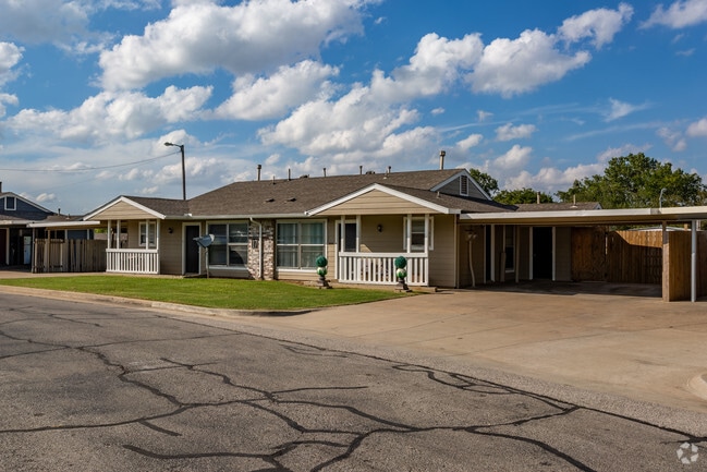
1801 S 132Nd East Pl
Tulsa, OK
Hillside Manor
18785-94-09-48240
LT 1 BLK 1
Nightclub
Tulsa
X
Oklahoma
40143C0264M
1
2025
10.02 AC
2025
Tower Heights
007308
Tulsa
85,918 SF
DEMOGRAPHICS near 1801 S 132Nd East Pl
1 Mile
3 Mile
5 Mile
2024 Total Population
11,654
71,439
147,513
2029 Population
11,956
73,725
152,923
Pop Growth 2024-2029
+ 2.59%
+ 3.20%
+ 3.67%
Average Age
34
35
36
2024 Total Households
4,005
26,417
56,601
HH Growth 2024-2029
+ 2.62%
+ 3.29%
+ 3.68%
Median Household Inc
$44,693
$44,279
$51,078
Avg Household Size
2.80
2.60
2.50
2024 Avg HH Vehicles
2.00
2.00
2.00
Median Home Value
$92,802
$127,262
$144,345
Median Year Built
1973
1974
1974
Nearby Places
Map Layers
Map Styles
 Street
 Aerial
- Restaurants
- Banks
- Shops
- Fitness
- Groceries
PUBLIC TRANSPORTATION
AIRPORT
Tulsa International
DRIVE
WALK
Distance
Tulsa International
17 min
10.1 mi
Freight Ports
Tulsa Port Of Catoosa
DRIVE
WALK
Distance
Tulsa Port Of Catoosa
18 min
11.5 mi
Nearby Properties
Address
Land Use
TOTAL SIZE
Lot Size
Zoning
Address
Land Use
TOTAL SIZE
Lot Size
Zoning
350,741 SF
28.01 AC
CS
Address
Land Use
TOTAL SIZE
Lot Size
Zoning
78,119 SF
11.11 AC
CO
Address
Land Use
TOTAL SIZE
Lot Size
Zoning
349,823 SF
203.39 AC
IL
Address
Land Use
TOTAL SIZE
Lot Size
Zoning
112,556 SF
11.07 AC
CH
Address
Land Use
TOTAL SIZE
Lot Size
Zoning
117,537 SF
14.99 AC
CO
Address
Land Use
TOTAL SIZE
Lot Size
Zoning
106,270 SF
9.47 AC
RM0
Address
Land Use
TOTAL SIZE
Lot Size
Zoning
124,648 SF
21.23 AC
IL
Address
Land Use
TOTAL SIZE
Lot Size
Zoning
62,352 SF
4.88 AC
CS
Address
Land Use
TOTAL SIZE
Lot Size
Zoning
86,980 SF
2.74 AC
RM1
Address
Land Use
TOTAL SIZE
Lot Size
Zoning
66,324 SF
12.85 AC
CS
Address
Land Use
TOTAL SIZE
Lot Size
Zoning
101,090 SF
1.70 AC
RS2
Address
Land Use
TOTAL SIZE
Lot Size
Zoning
32,370 SF
45.90 AC
AG
Address
Land Use
TOTAL SIZE
Lot Size
Zoning
40,626 SF
2.25 AC
CS
Address
Land Use
TOTAL SIZE
Lot Size
Zoning
55,425 SF
2.96 AC
IL
Address
Land Use
TOTAL SIZE
Lot Size
Zoning
252,887 SF
80.92 AC
OL
Address
Land Use
TOTAL SIZE
Lot Size
Zoning
36,334 SF
9.43 AC
CS
Address
Land Use
TOTAL SIZE
Lot Size
Zoning
28,465 SF
6.71 AC
RS3
Address
Land Use
TOTAL SIZE
Lot Size
Zoning
24,113 SF
3.54 AC
CS
Address
Land Use
TOTAL SIZE
Lot Size
Zoning
15,602 SF
3.35 AC
OL
Address
Land Use
TOTAL SIZE
Lot Size
Zoning
56,531 SF
7.79 AC
RS3
Address
Land Use
TOTAL SIZE
Lot Size
Zoning
498,836 SF
50.22 AC
CS
Address
Land Use
TOTAL SIZE
Lot Size
Zoning
30,291 SF
4.49 AC
AG
Address
Land Use
TOTAL SIZE
Lot Size
Zoning
586,347 SF
97.29 AC
SR
Address
Land Use
TOTAL SIZE
Lot Size
Zoning
18,325 SF
3.05 AC
CS
Address
Land Use
TOTAL SIZE
Lot Size
Zoning
40,202 SF
2.93 AC
RM0
Address
Land Use
TOTAL SIZE
Lot Size
Zoning
293,564 SF
23.75 AC
RM1
Address
Land Use
TOTAL SIZE
Lot Size
Zoning
14,237 SF
2.28 AC
CS
Address
Land Use
TOTAL SIZE
Lot Size
Zoning
265,350 SF
11.85 AC
RM1
Address
Land Use
TOTAL SIZE
Lot Size
Zoning
34,158 SF
4.89 AC
RS2
Address
Land Use
TOTAL SIZE
Lot Size
Zoning
22,825 SF
2.38 AC
CS
The World's #1 Commercial Real Estate Marketplace
Connect with us
© 2025 CoStar Group
The information above has been obtained from sources believed reliable. While we do not doubt its accuracy we have not verified it and make no guarantee, warranty or representation about it. It is your responsibility to independently confirm its accuracy and completeness. Any projections, opinions, assumptions, or estimates used are for example only and do not represent the current or future performance of the property. The value of this transaction to you depends on tax and other factors which should be evaluated by your tax, financial, and legal advisors. You and your advisors should conduct a careful, independent investigation of the property to determine to your satisfaction the suitability of the property for your needs.