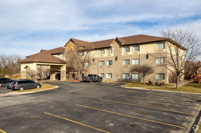
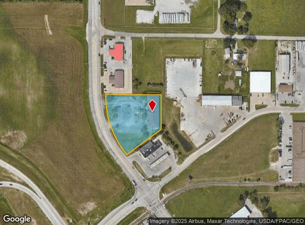
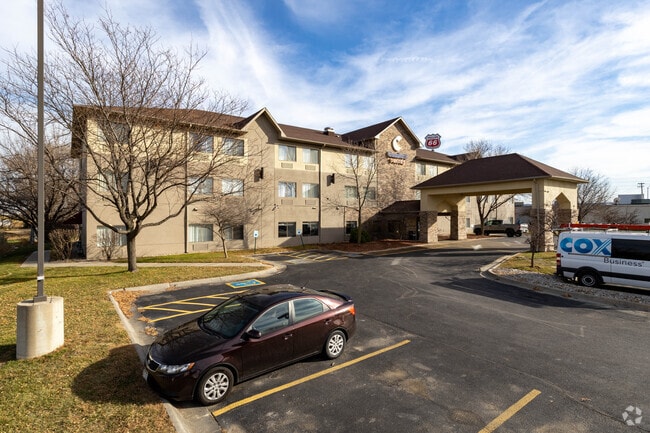
Property Record
1801 S 35Th St, Council Bluffs, IA 51501
NEARBY LISTINGS FOR SALE OR LEASE
Property Detail
1801 S 35Th St
Omaha-Council Bluffs, NE-IA
Inrip Subdivision Tract No 3
7444-04-227-003
INRIP SUB TRACT #3 LT 2
Hotelormotel
Pottawattamie
X
Iowa
31153C0085G
2
2025
2.01 AC
2025
Omaha Airport/Council Bluffs
031300
Omaha/Council Bluffs
11,160 SF
DEMOGRAPHICS near 1801 S 35Th St
1 Mile
3 Mile
5 Mile
2024 Total Population
3,856
79,443
204,464
2029 Population
3,823
80,504
207,539
Pop Growth 2024-2029
(0.86%)
+ 1.34%
+ 1.50%
Average Age
39
37
37
2024 Total Households
1,648
32,095
81,082
HH Growth 2024-2029
(0.85%)
+ 1.65%
+ 1.66%
Median Household Inc
$50,062
$49,272
$49,990
Avg Household Size
2.30
2.30
2.30
2024 Avg HH Vehicles
2.00
2.00
2.00
Median Home Value
$136,432
$138,335
$154,675
Median Year Built
1958
1952
1954
Nearby Places
Map Layers
Map Styles
 Street
 Aerial
- Restaurants
- Banks
- Shops
- Fitness
- Groceries
PUBLIC TRANSPORTATION
COMMUTER RAIL
DRIVE
WALK
Distance
7 min
3.4 mi
DRIVE
WALK
Distance
8 min
3.4 mi
AIRPORT
Eppley Airfield
DRIVE
WALK
Distance
Eppley Airfield
15 min
6.1 mi
Nearby Properties
Address
Land Use
TOTAL SIZE
Lot Size
Zoning
Address
Land Use
TOTAL SIZE
Lot Size
Zoning
1,068,760 SF
1.72 AC
Address
Land Use
TOTAL SIZE
Lot Size
Zoning
62.66 AC
P-C
Address
Land Use
TOTAL SIZE
Lot Size
Zoning
603,518 SF
5.55 AC
CBD
Address
Land Use
TOTAL SIZE
Lot Size
Zoning
36.26 AC
P-C
Address
Land Use
TOTAL SIZE
Lot Size
Zoning
534,110 SF
4.35 AC
Address
Land Use
TOTAL SIZE
Lot Size
Zoning
30.39 AC
P-C
Address
Land Use
TOTAL SIZE
Lot Size
Zoning
52.44 AC
I-2
Address
Land Use
TOTAL SIZE
Lot Size
Zoning
362,402 SF
1.94 AC
Address
Land Use
TOTAL SIZE
Lot Size
Zoning
318,811 SF
11.51 AC
Address
Land Use
TOTAL SIZE
Lot Size
Zoning
254,306 SF
0.82 AC
Address
Land Use
TOTAL SIZE
Lot Size
Zoning
426,416 SF
1.55 AC
Address
Land Use
TOTAL SIZE
Lot Size
Zoning
16.18 AC
P-C
Address
Land Use
TOTAL SIZE
Lot Size
Zoning
50.56 AC
I-1
Address
Land Use
TOTAL SIZE
Lot Size
Zoning
378,420 SF
0.72 AC
Address
Land Use
TOTAL SIZE
Lot Size
Zoning
276,622 SF
3.90 AC
Address
Land Use
TOTAL SIZE
Lot Size
Zoning
189,720 SF
1.22 AC
CBD
Address
Land Use
TOTAL SIZE
Lot Size
Zoning
346,816 SF
0.80 AC
Address
Land Use
TOTAL SIZE
Lot Size
Zoning
318,392 SF
7.77 AC
Address
Land Use
TOTAL SIZE
Lot Size
Zoning
4.22 AC
R-4
Address
Land Use
TOTAL SIZE
Lot Size
Zoning
319,440 SF
3.05 AC
Address
Land Use
TOTAL SIZE
Lot Size
Zoning
335,431 SF
0.79 AC
Address
Land Use
TOTAL SIZE
Lot Size
Zoning
27.38 AC
I-2
Address
Land Use
TOTAL SIZE
Lot Size
Zoning
10.91 AC
R-3
Address
Land Use
TOTAL SIZE
Lot Size
Zoning
149,737 SF
1.93 AC
Address
Land Use
TOTAL SIZE
Lot Size
Zoning
274,024 SF
1.46 AC
Address
Land Use
TOTAL SIZE
Lot Size
Zoning
42.97 AC
I-2
Address
Land Use
TOTAL SIZE
Lot Size
Zoning
254,548 SF
1.67 AC
Address
Land Use
TOTAL SIZE
Lot Size
Zoning
198,447 SF
1.36 AC
Address
Land Use
TOTAL SIZE
Lot Size
Zoning
162,765 SF
0.42 AC
CBD
Address
Land Use
TOTAL SIZE
Lot Size
Zoning
200,501 SF
1.78 AC
DS
The World's #1 Commercial Real Estate Marketplace
Connect with us
© 2025 CoStar Group
The information above has been obtained from sources believed reliable. While we do not doubt its accuracy we have not verified it and make no guarantee, warranty or representation about it. It is your responsibility to independently confirm its accuracy and completeness. Any projections, opinions, assumptions, or estimates used are for example only and do not represent the current or future performance of the property. The value of this transaction to you depends on tax and other factors which should be evaluated by your tax, financial, and legal advisors. You and your advisors should conduct a careful, independent investigation of the property to determine to your satisfaction the suitability of the property for your needs.