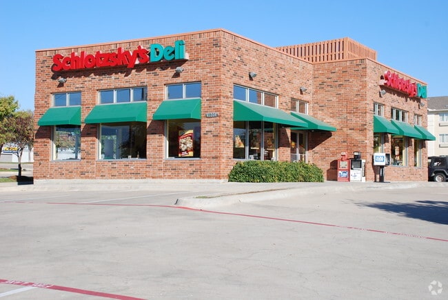
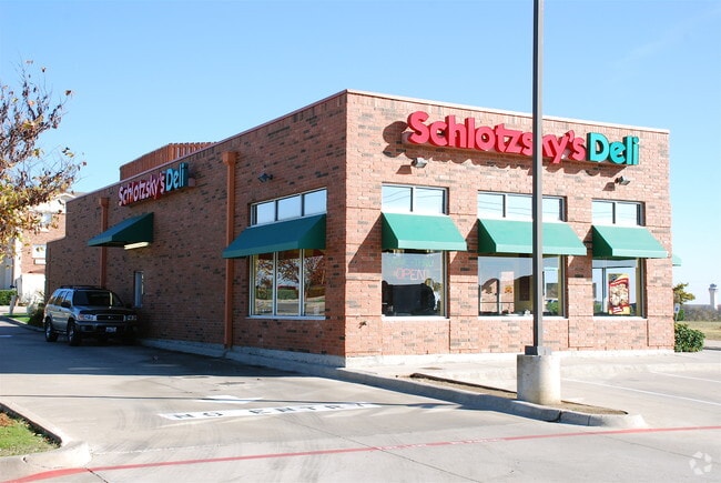
Property Record
1801 S Main St, Fort Worth, TX 76110


Property Detail
1801 S Main St
Dallas-Fort Worth-Arlington, TX
METROPLACE ADDITION 2ND INSTL BLOCK 3 LOT 4
06863191
TARRANT
Commercialnec
Texas
B and X Area of moderate flood hazard, usually the area between the limits of the 100-year and 500-year floods.
4
2024
0.69 AC
2025
Grapevine/Colleyville
104400
Dallas/Ft Worth
2,565 SF
NEARBY LISTINGS FOR SALE OR LEASE
DEMOGRAPHICS near 1801 S Main St
1 mile
3 mile
5 mile
2025 Total Population
1,774
45,945
130,206
2030 Population
1,880
48,425
136,969
Pop Growth 2025-2030
+ 5.98%
+ 5.40%
+ 5.19%
Average Age
45
40
40
2025 Total Households
881
18,125
51,602
HH Growth 2025-2030
+ 6.24%
+ 5.37%
+ 5.27%
Median Household Inc
$108,996
$109,301
$117,437
Avg Household Size
1.90
2.50
2.50
2025 Avg HH Vehicles
2.00
2.00
2.00
Median Home Value
$612,676
$492,696
$594,996
Median Year Built
2003
1989
1992
Nearby Places
Map Layers
Map Styles
 Street
 Aerial
Transit
 Traffic
 Biking
Places
Listings with unknown addresses are not visible on the map
- Restaurants
- Banks
- Shops
- Fitness
- Groceries
PUBLIC TRANSPORTATION
COMMUTER RAIL
Drive
Walk
Distance
15 min
9.7 mi
AIRPORT
Dallas-Fort Worth International
Drive
Walk
Distance
Dallas-Fort Worth International
9 min
5.1 mi
Dallas Love Field
Drive
Walk
Distance
Dallas Love Field
27 min
18.9 mi
Nearby Properties
Address
Land Use
TOTAL SIZE
Lot Size
Zoning
Address
Land Use
TOTAL SIZE
Lot Size
Zoning
3,233,905 SF
51.24 AC
Address
Land Use
TOTAL SIZE
Lot Size
Zoning
3,604,594 SF
490.43 AC
Address
Land Use
TOTAL SIZE
Lot Size
Zoning
680,063 SF
36.51 AC
Address
Land Use
TOTAL SIZE
Lot Size
Zoning
394,769 SF
20.39 AC
Address
Land Use
TOTAL SIZE
Lot Size
Zoning
500,000 SF
99.10 AC
Address
Land Use
TOTAL SIZE
Lot Size
Zoning
332,665 SF
9.83 AC
Address
Land Use
TOTAL SIZE
Lot Size
Zoning
630,765 SF
321.80 AC
Address
Land Use
TOTAL SIZE
Lot Size
Zoning
397,272 SF
12.35 AC
Address
Land Use
TOTAL SIZE
Lot Size
Zoning
360,898 SF
5.51 AC
Address
Land Use
TOTAL SIZE
Lot Size
Zoning
464,476 SF
5.08 AC
Address
Land Use
TOTAL SIZE
Lot Size
Zoning
401,397 SF
14.94 AC
Address
Land Use
TOTAL SIZE
Lot Size
Zoning
321,993 SF
18.20 AC
Address
Land Use
TOTAL SIZE
Lot Size
Zoning
264,000 SF
15.06 AC
Address
Land Use
TOTAL SIZE
Lot Size
Zoning
234,200 SF
274.75 AC
Address
Land Use
TOTAL SIZE
Lot Size
Zoning
270,453 SF
17.48 AC
Address
Land Use
TOTAL SIZE
Lot Size
Zoning
324.32 AC
Address
Land Use
TOTAL SIZE
Lot Size
Zoning
297,500 SF
99.10 AC
Address
Land Use
TOTAL SIZE
Lot Size
Zoning
320.42 AC
Address
Land Use
TOTAL SIZE
Lot Size
Zoning
235,902 SF
16.20 AC
Address
Land Use
TOTAL SIZE
Lot Size
Zoning
305,047 SF
10.16 AC
Address
Land Use
TOTAL SIZE
Lot Size
Zoning
230,666 SF
13.33 AC
Address
Land Use
TOTAL SIZE
Lot Size
Zoning
300,000 SF
27.13 AC
Address
Land Use
TOTAL SIZE
Lot Size
Zoning
150,510 SF
6.35 AC
Address
Land Use
TOTAL SIZE
Lot Size
Zoning
214,908 SF
13.55 AC
Address
Land Use
TOTAL SIZE
Lot Size
Zoning
384,878 SF
20 AC
Address
Land Use
TOTAL SIZE
Lot Size
Zoning
208,250 SF
99.10 AC
Address
Land Use
TOTAL SIZE
Lot Size
Zoning
921,172 SF
105 AC
Address
Land Use
TOTAL SIZE
Lot Size
Zoning
177,093 SF
10.79 AC
Address
Land Use
TOTAL SIZE
Lot Size
Zoning
247,505 SF
32 AC
Address
Land Use
TOTAL SIZE
Lot Size
Zoning
255,288 SF
10.57 AC
The World's #1 Commercial Real Estate Marketplace
Connect with us
© 2026 CoStar Group
The information above has been obtained from sources believed reliable. While we do not doubt its accuracy we have not verified it and make no guarantee, warranty or representation about it. It is your responsibility to independently confirm its accuracy and completeness. Any projections, opinions, assumptions, or estimates used are for example only and do not represent the current or future performance of the property. The value of this transaction to you depends on tax and other factors which should be evaluated by your tax, financial, and legal advisors. You and your advisors should conduct a careful, independent investigation of the property to determine to your satisfaction the suitability of the property for your needs.