Property Record
1815 Sw 3Rd Ave, Miami, FL 33129

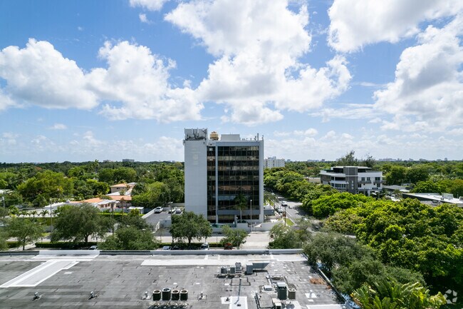
Property Detail
1815 Sw 3Rd Ave
Miami-Miami Beach-Kendall, FL
38-39 54 41 HOLLEMAN PARK PB 8-23 LOT 3 BLK 18 LOT SIZE 50.000 X 150 OR 18885-0797 1199 6 (2)
01-4138-001-2350
MIAMI/DADE
Parkinglot
Florida
6100
3
B and X Area of moderate flood hazard, usually the area between the limits of the 100-year and 500-year floods.
0.17 AC
2024
Coral Way
2025
South Florida
006715
NEARBY LISTINGS FOR SALE OR LEASE
DEMOGRAPHICS near 1815 Sw 3Rd Ave
1 mile
3 mile
5 mile
2025 Total Population
76,039
263,595
528,462
2030 Population
83,230
286,230
574,524
Pop Growth 2025-2030
+ 9.46%
+ 8.59%
+ 8.72%
Average Age
40
41
42
2025 Total Households
37,456
118,391
232,288
HH Growth 2025-2030
+ 9.06%
+ 8.79%
+ 9.05%
Median Household Inc
$100,299
$74,910
$71,590
Avg Household Size
1.90
2.10
2.20
2025 Avg HH Vehicles
1.00
1.00
1.00
Median Home Value
$677,261
$680,283
$677,812
Median Year Built
2002
1991
1979
Nearby Places
Map Layers
Map Styles
 Street
 Aerial
Layers
 Traffic
 Biking
Places
Listings with unknown addresses are not visible on the map
- Restaurants
- Banks
- Shops
- Fitness
- Groceries
PUBLIC TRANSPORTATION
TRANSIT/SUBWAY
Brickell (Metromover) (Metromover Brickell Loop - Miami-Dade Transit (Metrorail/Metromover))
Drive
Walk
Distance
Brickell (Metromover) (Metromover Brickell Loop - Miami-Dade Transit (Metrorail/Metromover))
2 min
10 min
0.5 mi
Financial District (Metromover Brickell Loop - Miami-Dade Transit (Metrorail/Metromover))
Drive
Walk
Distance
Financial District (Metromover Brickell Loop - Miami-Dade Transit (Metrorail/Metromover))
2 min
12 min
0.6 mi
Tenth Street/Promenade (Metromover Brickell Loop - Miami-Dade Transit (Metrorail/Metromover))
Drive
Walk
Distance
Tenth Street/Promenade (Metromover Brickell Loop - Miami-Dade Transit (Metrorail/Metromover))
2 min
14 min
0.7 mi
Eighth Street (Metromover Brickell Loop - Miami-Dade Transit (Metrorail/Metromover))
Drive
Walk
Distance
Eighth Street (Metromover Brickell Loop - Miami-Dade Transit (Metrorail/Metromover))
2 min
18 min
0.9 mi
COMMUTER RAIL
Brickell (Metrorail) (Metrorail Green Line - Miami-Dade Transit (Metrorail/Metromover))
Drive
Walk
Distance
Brickell (Metrorail) (Metrorail Green Line - Miami-Dade Transit (Metrorail/Metromover))
2 min
11 min
0.6 mi
Vizcaya (Metrorail Green Line - Miami-Dade Transit (Metrorail/Metromover))
Drive
Walk
Distance
Vizcaya (Metrorail Green Line - Miami-Dade Transit (Metrorail/Metromover))
3 min
1.4 mi
AIRPORT
Miami International
Drive
Walk
Distance
Miami International
24 min
12.9 mi
Fort Lauderdale/Hollywood International
Drive
Walk
Distance
Fort Lauderdale/Hollywood International
36 min
24.7 mi
Freight Ports
Port of Miami
Drive
Walk
Distance
Port of Miami
10 min
3.8 mi
SALE & LEASE HISTORY
LISTING DATE
SALE/LEASE

May 11, 2017
For Sale
Mar 31, 2017
For Lease
Jul 18, 2021
For Sale
Jan 25, 2021
For Lease
Jan 21, 2020
For Lease
Feb 07, 2018
For Lease
Nearby Properties
Address
Land Use
TOTAL SIZE
Lot Size
Zoning
Address
Land Use
TOTAL SIZE
Lot Size
Zoning
1,050,691 SF
0.83 AC
6408
Address
Land Use
TOTAL SIZE
Lot Size
Zoning
4,758,614 SF
810.91 AC
8000
Address
Land Use
TOTAL SIZE
Lot Size
Zoning
955,966 SF
38.91 AC
9600
Address
Land Use
TOTAL SIZE
Lot Size
Zoning
2,559,318 SF
2.21 AC
6407
Address
Land Use
TOTAL SIZE
Lot Size
Zoning
2,039,308 SF
2.46 AC
6401
Address
Land Use
TOTAL SIZE
Lot Size
Zoning
928,000 SF
14.30 AC
8000
Address
Land Use
TOTAL SIZE
Lot Size
Zoning
1,110,657 SF
3.83 AC
6407
Address
Land Use
TOTAL SIZE
Lot Size
Zoning
1,346,294 SF
1.89 AC
6408
Address
Land Use
TOTAL SIZE
Lot Size
Zoning
2,403,353 SF
7.37 AC
6100
Address
Land Use
TOTAL SIZE
Lot Size
Zoning
1,162,113 SF
1.92 AC
6407
Address
Land Use
TOTAL SIZE
Lot Size
Zoning
1,544,491 SF
0.97 AC
6401
Address
Land Use
TOTAL SIZE
Lot Size
Zoning
782,686 SF
0.06 AC
6401
Address
Land Use
TOTAL SIZE
Lot Size
Zoning
1,657,362 SF
1.15 AC
6401
Address
Land Use
TOTAL SIZE
Lot Size
Zoning
1,072,012 SF
1.78 AC
6407
Address
Land Use
TOTAL SIZE
Lot Size
Zoning
244,533 SF
3.53 AC
6600
Address
Land Use
TOTAL SIZE
Lot Size
Zoning
694,863 SF
1.90 AC
6407
Address
Land Use
TOTAL SIZE
Lot Size
Zoning
656,821 SF
2.06 AC
6407
Address
Land Use
TOTAL SIZE
Lot Size
Zoning
303,989 SF
1.47 AC
6600
Address
Land Use
TOTAL SIZE
Lot Size
Zoning
416,675 SF
6.48 AC
6401
Address
Land Use
TOTAL SIZE
Lot Size
Zoning
1,004,006 SF
0.92 AC
6401
Address
Land Use
TOTAL SIZE
Lot Size
Zoning
2.50 AC
6407
Address
Land Use
TOTAL SIZE
Lot Size
Zoning
585,775 SF
1.86 AC
6101
Address
Land Use
TOTAL SIZE
Lot Size
Zoning
491,308 SF
0.14 AC
6401
Address
Land Use
TOTAL SIZE
Lot Size
Zoning
903,993 SF
0.60 AC
6412
Address
Land Use
TOTAL SIZE
Lot Size
Zoning
872,245 SF
0.56 AC
6401
Address
Land Use
TOTAL SIZE
Lot Size
Zoning
727,757 SF
0.64 AC
6408
Address
Land Use
TOTAL SIZE
Lot Size
Zoning
2 AC
8000
Address
Land Use
TOTAL SIZE
Lot Size
Zoning
1,101,032 SF
5.18 AC
8000
Address
Land Use
TOTAL SIZE
Lot Size
Zoning
1,262,330 SF
1.39 AC
6402
Address
Land Use
TOTAL SIZE
Lot Size
Zoning
616,963 SF
0.75 AC
6401
The World's #1 Commercial Real Estate Marketplace
Connect with us
© 2026 CoStar Group
The information above has been obtained from sources believed reliable. While we do not doubt its accuracy we have not verified it and make no guarantee, warranty or representation about it. It is your responsibility to independently confirm its accuracy and completeness. Any projections, opinions, assumptions, or estimates used are for example only and do not represent the current or future performance of the property. The value of this transaction to you depends on tax and other factors which should be evaluated by your tax, financial, and legal advisors. You and your advisors should conduct a careful, independent investigation of the property to determine to your satisfaction the suitability of the property for your needs.