Property Record
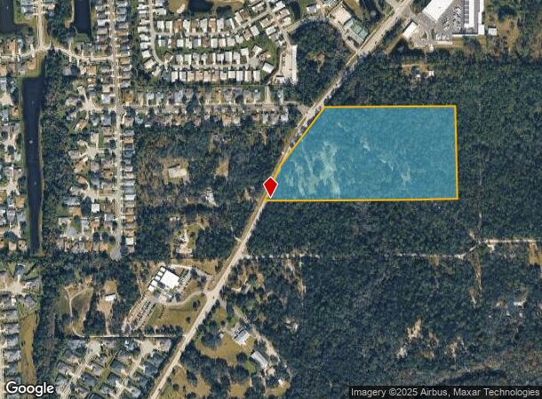
1801 Taylor Rd, Port Orange, FL 32128


NEARBY LISTINGS FOR SALE OR LEASE
Property Detail
1801 Taylor Rd
Deltona-Daytona Beach-Ormond Beach, FL
Assessors S 01/2 Se 01/4 24 16 32
6224-02-00-0021
24-16-32 N 698.24 FT OF S 738.24 FT OF W 1423.51 FT MEAS ON S/L OF LOT 1 & LOT 2 EXC S 40 FT SUB S 1/2 OF SE 1/4 PER OR 5262 PG 1293 PER OR 6724 PG 4747 PER OR 6739 PG 2955 PER OR 6739 PG 2959 PER OR 7973 PG 3110
Residentialacreage
Volusia
X
Florida
12127C0506H
1,2
2025
19.90 AC
2025
South Beach Cities
083210
Deltona/Daytona Beach
DEMOGRAPHICS near 1801 Taylor Rd
1 Mile
3 Mile
5 Mile
2024 Total Population
4,438
35,774
85,540
2029 Population
4,924
39,429
94,580
Pop Growth 2024-2029
+ 10.95%
+ 10.22%
+ 10.57%
Average Age
51
45
46
2024 Total Households
2,124
15,150
38,148
HH Growth 2024-2029
+ 11.11%
+ 10.40%
+ 10.80%
Median Household Inc
$75,564
$74,525
$58,857
Avg Household Size
2.10
2.30
2.20
2024 Avg HH Vehicles
2.00
2.00
2.00
Median Home Value
$311,100
$292,049
$250,830
Median Year Built
2001
1996
1988
Nearby Places
Map Layers
Map Styles
 Street
 Aerial
- Restaurants
- Banks
- Shops
- Fitness
- Groceries
PUBLIC TRANSPORTATION
AIRPORT
Daytona Beach International
DRIVE
WALK
Distance
Daytona Beach International
16 min
9.2 mi
Orlando Sanford International
DRIVE
WALK
Distance
Orlando Sanford International
46 min
30.0 mi
Freight Ports
Port Canaveral
DRIVE
WALK
Distance
Port Canaveral
76 min
65.3 mi
SALE & LEASE HISTORY
LISTING DATE
SALE/LEASE

Apr 28, 2020
For Sale
Nearby Properties
Address
Land Use
TOTAL SIZE
Lot Size
Zoning
Address
Land Use
TOTAL SIZE
Lot Size
Zoning
481,883 SF
0.10 AC
Address
Land Use
TOTAL SIZE
Lot Size
Zoning
33,958 SF
190.21 AC
A2
Address
Land Use
TOTAL SIZE
Lot Size
Zoning
354,546 SF
24.71 AC
Address
Land Use
TOTAL SIZE
Lot Size
Zoning
448,867 SF
5.54 AC
Address
Land Use
TOTAL SIZE
Lot Size
Zoning
416,320 SF
0.13 AC
Address
Land Use
TOTAL SIZE
Lot Size
Zoning
408,078 SF
50.07 AC
Address
Land Use
TOTAL SIZE
Lot Size
Zoning
10,360 SF
1.56 AC
Address
Land Use
TOTAL SIZE
Lot Size
Zoning
150,197 SF
16.07 AC
Address
Land Use
TOTAL SIZE
Lot Size
Zoning
412,064 SF
60 AC
Address
Land Use
TOTAL SIZE
Lot Size
Zoning
60,449 SF
7.14 AC
16PCD
Address
Land Use
TOTAL SIZE
Lot Size
Zoning
184,242 SF
14.43 AC
Address
Land Use
TOTAL SIZE
Lot Size
Zoning
165,754 SF
40.54 AC
PUD
Address
Land Use
TOTAL SIZE
Lot Size
Zoning
269,160 SF
72.17 AC
16A
Address
Land Use
TOTAL SIZE
Lot Size
Zoning
156,994 SF
47.82 AC
16A
Address
Land Use
TOTAL SIZE
Lot Size
Zoning
155,590 SF
11.08 AC
16R3H
Address
Land Use
TOTAL SIZE
Lot Size
Zoning
148,848 SF
9.99 AC
16R3H
Address
Land Use
TOTAL SIZE
Lot Size
Zoning
127,664 SF
15.07 AC
Address
Land Use
TOTAL SIZE
Lot Size
Zoning
318,038 SF
23.71 AC
16PUD
Address
Land Use
TOTAL SIZE
Lot Size
Zoning
171,924 SF
17.61 AC
Address
Land Use
TOTAL SIZE
Lot Size
Zoning
212,681 SF
21.50 AC
Address
Land Use
TOTAL SIZE
Lot Size
Zoning
111,379 SF
16.62 AC
Address
Land Use
TOTAL SIZE
Lot Size
Zoning
91,967 SF
7.31 AC
16CC
Address
Land Use
TOTAL SIZE
Lot Size
Zoning
184,730 SF
16.46 AC
Address
Land Use
TOTAL SIZE
Lot Size
Zoning
77,386 SF
24.33 AC
16A
Address
Land Use
TOTAL SIZE
Lot Size
Zoning
105,676 SF
11.77 AC
Address
Land Use
TOTAL SIZE
Lot Size
Zoning
154,409 SF
14.10 AC
Address
Land Use
TOTAL SIZE
Lot Size
Zoning
135,061 SF
4.81 AC
Address
Land Use
TOTAL SIZE
Lot Size
Zoning
137,580 SF
22.38 AC
Address
Land Use
TOTAL SIZE
Lot Size
Zoning
101,395 SF
12.65 AC
A2
Address
Land Use
TOTAL SIZE
Lot Size
Zoning
108,326 SF
7.03 AC
16R3H
The World's #1 Commercial Real Estate Marketplace
Connect with us
© 2025 CoStar Group
The information above has been obtained from sources believed reliable. While we do not doubt its accuracy we have not verified it and make no guarantee, warranty or representation about it. It is your responsibility to independently confirm its accuracy and completeness. Any projections, opinions, assumptions, or estimates used are for example only and do not represent the current or future performance of the property. The value of this transaction to you depends on tax and other factors which should be evaluated by your tax, financial, and legal advisors. You and your advisors should conduct a careful, independent investigation of the property to determine to your satisfaction the suitability of the property for your needs.