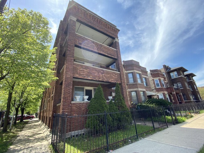
Property Record
1801 W Garfield Blvd, Chicago, IL 60636


NEARBY LISTINGS FOR SALE OR LEASE
Property Detail
1801 W Garfield Blvd
Chicago-Naperville-Elgin, IL-IN-WI
Lyons Sub
20-18-203-006-0000
(SUBDIVISION) OF BLKS 1-8 OF JOHN B LYONS SUB EX N 13 4 FT OF BLKS 1 & 2 & N 60 FT OF S 350 FT OF BLKS 7 & 8 OF WH NE SEC 18-
Apartment
Cook
X
Illinois
17031C0520J
1
2023
0.09 AC
2025
West Englewood
670400
Chicago
7,299 SF
DEMOGRAPHICS near 1801 W Garfield Blvd
1 Mile
3 Mile
5 Mile
2024 Total Population
32,053
284,959
741,605
2029 Population
29,663
267,175
702,117
Pop Growth 2024-2029
(7.46%)
(6.24%)
(5.32%)
Average Age
35
36
38
2024 Total Households
9,729
93,110
270,813
HH Growth 2024-2029
(7.87%)
(6.36%)
(5.35%)
Median Household Inc
$31,436
$37,947
$44,036
Avg Household Size
3.10
2.90
2.60
2024 Avg HH Vehicles
1.00
1.00
1.00
Median Home Value
$134,577
$193,533
$223,429
Median Year Built
1947
1948
1949
Nearby Places
Map Layers
Map Styles
 Street
 Aerial
- Restaurants
- Banks
- Shops
- Fitness
- Groceries
PUBLIC TRANSPORTATION
COMMUTER RAIL
Wrightwood Station (SouthWest Service - Northeast Illinois Regional Commuter Railroad (Metra))
DRIVE
WALK
Distance
Wrightwood Station (SouthWest Service - Northeast Illinois Regional Commuter Railroad (Metra))
9 min
4.5 mi
35Th St. - Lou Jones (Rock Island - Metra)
DRIVE
WALK
Distance
35Th St. - Lou Jones (Rock Island - Metra)
9 min
4.7 mi
AIRPORT
Chicago Midway International
DRIVE
WALK
Distance
Chicago Midway International
8 min
4.4 mi
Chicago O'Hare International
DRIVE
WALK
Distance
Chicago O'Hare International
39 min
23.3 mi
Freight Ports
Port Milwaukee
DRIVE
WALK
Distance
Port Milwaukee
117 min
91.5 mi
SALE & LEASE HISTORY
LISTING DATE
SALE/LEASE

May 25, 2023
For Sale
Feb 08, 2023
For Sale
Nearby Properties
Address
Land Use
TOTAL SIZE
Lot Size
Zoning
Address
Land Use
TOTAL SIZE
Lot Size
Zoning
4.71 AC
PD 1196
Address
Land Use
TOTAL SIZE
Lot Size
Zoning
2.98 AC
PD 1196
Address
Land Use
TOTAL SIZE
Lot Size
Zoning
460,333 SF
2.62 AC
C2-3
Address
Land Use
TOTAL SIZE
Lot Size
Zoning
134,800 SF
2.53 AC
PD 1273
Address
Land Use
TOTAL SIZE
Lot Size
Zoning
0.91 AC
PD 1177
Address
Land Use
TOTAL SIZE
Lot Size
Zoning
475,000 SF
14.01 AC
PMD 8
Address
Land Use
TOTAL SIZE
Lot Size
Zoning
3.66 AC
M2-3
Address
Land Use
TOTAL SIZE
Lot Size
Zoning
0.84 AC
B1-3
Address
Land Use
TOTAL SIZE
Lot Size
Zoning
633,057 SF
34.96 AC
PMD 8
Address
Land Use
TOTAL SIZE
Lot Size
Zoning
43,896 SF
5.18 AC
M2-1
Address
Land Use
TOTAL SIZE
Lot Size
Zoning
260,481 SF
12.93 AC
PD 463
Address
Land Use
TOTAL SIZE
Lot Size
Zoning
283,180 SF
1.41 AC
M2-3
Address
Land Use
TOTAL SIZE
Lot Size
Zoning
7,200 SF
0.22 AC
B3-3
Address
Land Use
TOTAL SIZE
Lot Size
Zoning
151,303 SF
0.88 AC
PD 568
Address
Land Use
TOTAL SIZE
Lot Size
Zoning
1.65 AC
B2-3
Address
Land Use
TOTAL SIZE
Lot Size
Zoning
1,291,800 SF
7.34 AC
M2-3
Address
Land Use
TOTAL SIZE
Lot Size
Zoning
869,660 SF
0.86 AC
PMD 8
Address
Land Use
TOTAL SIZE
Lot Size
Zoning
636,800 SF
4.02 AC
M2-3
Address
Land Use
TOTAL SIZE
Lot Size
Zoning
7.47 AC
RT-4
Address
Land Use
TOTAL SIZE
Lot Size
Zoning
113,143 SF
PMD 8
Address
Land Use
TOTAL SIZE
Lot Size
Zoning
435,677 SF
12.37 AC
M1-2
Address
Land Use
TOTAL SIZE
Lot Size
Zoning
85,990 SF
6.46 AC
PD 411
Address
Land Use
TOTAL SIZE
Lot Size
Zoning
352,529 SF
12.77 AC
PMD 8
Address
Land Use
TOTAL SIZE
Lot Size
Zoning
283,228 SF
14.47 AC
PMD 8
Address
Land Use
TOTAL SIZE
Lot Size
Zoning
55,492 SF
3.35 AC
B3-3
Address
Land Use
TOTAL SIZE
Lot Size
Zoning
13,700 SF
0.33 AC
B3-2
Address
Land Use
TOTAL SIZE
Lot Size
Zoning
168,120 SF
8.06 AC
PMD 8
Address
Land Use
TOTAL SIZE
Lot Size
Zoning
258,000 SF
13.22 AC
PMD 8
Address
Land Use
TOTAL SIZE
Lot Size
Zoning
140,140 SF
0.92 AC
PMD 8
Address
Land Use
TOTAL SIZE
Lot Size
Zoning
107,500 SF
2.88 AC
PD 363
The World's #1 Commercial Real Estate Marketplace
Connect with us
© 2026 CoStar Group
The information above has been obtained from sources believed reliable. While we do not doubt its accuracy we have not verified it and make no guarantee, warranty or representation about it. It is your responsibility to independently confirm its accuracy and completeness. Any projections, opinions, assumptions, or estimates used are for example only and do not represent the current or future performance of the property. The value of this transaction to you depends on tax and other factors which should be evaluated by your tax, financial, and legal advisors. You and your advisors should conduct a careful, independent investigation of the property to determine to your satisfaction the suitability of the property for your needs.