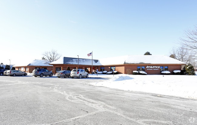
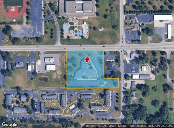
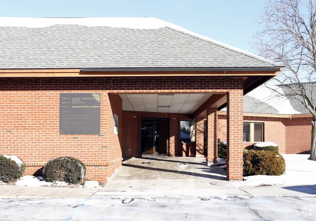
Property Record
1801 W Maumee St, Adrian, MI 49221
NEARBY LISTINGS FOR SALE OR LEASE
Property Detail
1801 W Maumee St
XA0-100-0292-01
Assessors Plat No 6
Commercialnec
BEG 767 FT N 89^06' E FROM W 1/4 COR SEC 33 T6S R3E TH N 89^06?20? E 380.34 FT; TH S 00^53?40? E 300.12 FT; TH N 88^46?40? E
X
Lenawee
26091C0189D
Michigan
2024
3.25 AC
2025
Lenawee County
061702
Toledo
21,295 SF
Adrian, MI
DEMOGRAPHICS near 1801 W Maumee St
1 Mile
3 Mile
5 Mile
2024 Total Population
3,706
24,166
34,570
2029 Population
3,687
23,925
34,215
Pop Growth 2024-2029
(0.51%)
(1.00%)
(1.03%)
Average Age
41
40
40
2024 Total Households
1,353
9,314
12,714
HH Growth 2024-2029
(0.52%)
(1.07%)
(1.10%)
Median Household Inc
$54,591
$42,285
$47,737
Avg Household Size
2.30
2.30
2.30
2024 Avg HH Vehicles
2.00
2.00
2.00
Median Home Value
$154,555
$132,137
$135,834
Median Year Built
1982
1965
1967
Nearby Places
Map Layers
Map Styles
 Street
 Aerial
- Restaurants
- Banks
- Shops
- Fitness
- Groceries
PUBLIC TRANSPORTATION
AIRPORT
Eugene F Kranz Toledo Express
DRIVE
WALK
Distance
Eugene F Kranz Toledo Express
61 min
35.9 mi
Freight Ports
Port of Toledo
DRIVE
WALK
Distance
Port of Toledo
62 min
44.3 mi
SALE & LEASE HISTORY
LISTING DATE
SALE/LEASE

Sep 25, 2016
For Lease
Nearby Properties
Address
Land Use
TOTAL SIZE
Lot Size
Zoning
Address
Land Use
TOTAL SIZE
Lot Size
Zoning
297,470 SF
31.39 AC
I-2
Address
Land Use
TOTAL SIZE
Lot Size
Zoning
19,469 SF
27.08 AC
I-2
Address
Land Use
TOTAL SIZE
Lot Size
Zoning
122,669 SF
14.27 AC
B-4
Address
Land Use
TOTAL SIZE
Lot Size
Zoning
27,436 SF
79.87 AC
CI
Address
Land Use
TOTAL SIZE
Lot Size
Zoning
119,884 SF
9.37 AC
RM-1
Address
Land Use
TOTAL SIZE
Lot Size
Zoning
136,850 SF
10.37 AC
RM-1
Address
Land Use
TOTAL SIZE
Lot Size
Zoning
35,880 SF
2.45 AC
Address
Land Use
TOTAL SIZE
Lot Size
Zoning
77,162 SF
22.82 AC
CI
Address
Land Use
TOTAL SIZE
Lot Size
Zoning
53,333 SF
6.70 AC
B-4
Address
Land Use
TOTAL SIZE
Lot Size
Zoning
86,479 SF
4.79 AC
Address
Land Use
TOTAL SIZE
Lot Size
Zoning
64,385 SF
11.08 AC
CI
Address
Land Use
TOTAL SIZE
Lot Size
Zoning
33,858 SF
14.53 AC
OS-1
Address
Land Use
TOTAL SIZE
Lot Size
Zoning
49,676 SF
0.94 AC
RM-2
Address
Land Use
TOTAL SIZE
Lot Size
Zoning
29.25 AC
B-4
Address
Land Use
TOTAL SIZE
Lot Size
Zoning
42,682 SF
6.41 AC
B-2
Address
Land Use
TOTAL SIZE
Lot Size
Zoning
73,636 SF
9.99 AC
RM-1
Address
Land Use
TOTAL SIZE
Lot Size
Zoning
86,971 SF
9.56 AC
RM-1
Address
Land Use
TOTAL SIZE
Lot Size
Zoning
17,751 SF
2.76 AC
B-2
Address
Land Use
TOTAL SIZE
Lot Size
Zoning
72,839 SF
7.05 AC
RM-1
Address
Land Use
TOTAL SIZE
Lot Size
Zoning
288,960 SF
20.14 AC
Address
Land Use
TOTAL SIZE
Lot Size
Zoning
26,404 SF
7.12 AC
ERO
Address
Land Use
TOTAL SIZE
Lot Size
Zoning
68,520 SF
7.01 AC
RM-1
Address
Land Use
TOTAL SIZE
Lot Size
Zoning
352,875 SF
12.08 AC
I-1
Address
Land Use
TOTAL SIZE
Lot Size
Zoning
123,550 SF
29.33 AC
I-1
Address
Land Use
TOTAL SIZE
Lot Size
Zoning
3.82 AC
I-1
Address
Land Use
TOTAL SIZE
Lot Size
Zoning
88,800 SF
13.84 AC
E-1
Address
Land Use
TOTAL SIZE
Lot Size
Zoning
17,154 SF
0.20 AC
B-3
Address
Land Use
TOTAL SIZE
Lot Size
Zoning
60,039 SF
12.03 AC
RM-1
Address
Land Use
TOTAL SIZE
Lot Size
Zoning
32,137 SF
2.19 AC
OS-1
Address
Land Use
TOTAL SIZE
Lot Size
Zoning
78,078 SF
7.20 AC
B-1
The World's #1 Commercial Real Estate Marketplace
Connect with us
© 2025 CoStar Group
The information above has been obtained from sources believed reliable. While we do not doubt its accuracy we have not verified it and make no guarantee, warranty or representation about it. It is your responsibility to independently confirm its accuracy and completeness. Any projections, opinions, assumptions, or estimates used are for example only and do not represent the current or future performance of the property. The value of this transaction to you depends on tax and other factors which should be evaluated by your tax, financial, and legal advisors. You and your advisors should conduct a careful, independent investigation of the property to determine to your satisfaction the suitability of the property for your needs.