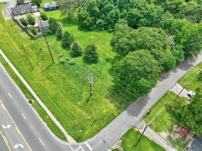
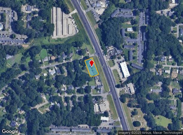
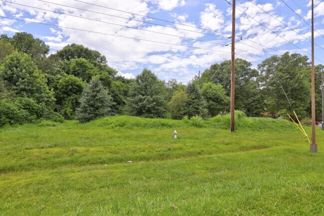
Property Record
1801 Waldrep Cir Se, Marietta, GA 30060
Current Lease Availabilities
NEARBY LISTINGS FOR SALE OR LEASE
Property Detail
1801 Waldrep Cir Se
Atlanta-Sandy Springs-Roswell, GA
Cobb County Acres
17-0278-0-043-0
ALL THAT TRACT OR PARCEL OF LAND LYING AND BEING IN THE 17TH DISTRICT, 2ND SECTION, COBB COUNTY, GEORGIA, LYING WITHIN LAND LOT 278, IDENTIFIED AS TAX PARCEL 43, ON THE FIELD MAP
Commercialacreage
Cobb
X
Georgia
13067C0116J
278
2025
0.39 AC
2025
Cumberland/Galleria
031006
Atlanta
DEMOGRAPHICS near 1801 Waldrep Cir Se
1 Mile
3 Mile
5 Mile
2024 Total Population
13,886
90,826
237,172
2029 Population
14,193
93,149
242,076
Pop Growth 2024-2029
+ 2.21%
+ 2.56%
+ 2.07%
Average Age
35
36
37
2024 Total Households
4,860
34,308
96,951
HH Growth 2024-2029
+ 2.20%
+ 2.60%
+ 2.05%
Median Household Inc
$53,862
$62,525
$72,771
Avg Household Size
2.70
2.50
2.30
2024 Avg HH Vehicles
2.00
2.00
2.00
Median Home Value
$200,681
$290,837
$333,199
Median Year Built
1973
1981
1984
Nearby Places
Map Layers
Map Styles
 Street
 Aerial
- Restaurants
- Banks
- Shops
- Fitness
- Groceries
PUBLIC TRANSPORTATION
AIRPORT
Hartsfield - Jackson Atlanta International
DRIVE
WALK
Distance
Hartsfield - Jackson Atlanta International
41 min
26.3 mi
Nearby Properties
Address
Land Use
TOTAL SIZE
Lot Size
Zoning
Address
Land Use
TOTAL SIZE
Lot Size
Zoning
553,125 SF
42.07 AC
PRD MF
Address
Land Use
TOTAL SIZE
Lot Size
Zoning
389,428 SF
22.50 AC
RM12
Address
Land Use
TOTAL SIZE
Lot Size
Zoning
437,793 SF
41.12 AC
RM-16
Address
Land Use
TOTAL SIZE
Lot Size
Zoning
357,031 SF
10.69 AC
MU
Address
Land Use
TOTAL SIZE
Lot Size
Zoning
452,366 SF
27.27 AC
PRD MF
Address
Land Use
TOTAL SIZE
Lot Size
Zoning
477,544 SF
4.61 AC
MU
Address
Land Use
TOTAL SIZE
Lot Size
Zoning
376,618 SF
22.82 AC
RM-12
Address
Land Use
TOTAL SIZE
Lot Size
Zoning
488,748 SF
32.28 AC
RM-12
Address
Land Use
TOTAL SIZE
Lot Size
Zoning
230,032 SF
19.77 AC
RM-16
Address
Land Use
TOTAL SIZE
Lot Size
Zoning
285,190 SF
25.16 AC
RM-12
Address
Land Use
TOTAL SIZE
Lot Size
Zoning
698,904 SF
36.69 AC
HI
Address
Land Use
TOTAL SIZE
Lot Size
Zoning
8,980 SF
51.17 AC
Address
Land Use
TOTAL SIZE
Lot Size
Zoning
225,315 SF
17.10 AC
RM-12
Address
Land Use
TOTAL SIZE
Lot Size
Zoning
236,808 SF
29.38 AC
PRD MF
Address
Land Use
TOTAL SIZE
Lot Size
Zoning
190,168 SF
14.60 AC
PRD MF
Address
Land Use
TOTAL SIZE
Lot Size
Zoning
222,906 SF
18.96 AC
RM-12
Address
Land Use
TOTAL SIZE
Lot Size
Zoning
148,612 SF
12.65 AC
RM-12
Address
Land Use
TOTAL SIZE
Lot Size
Zoning
176,350 SF
19.56 AC
PRD MF
Address
Land Use
TOTAL SIZE
Lot Size
Zoning
204,595 SF
15.88 AC
RM-12
Address
Land Use
TOTAL SIZE
Lot Size
Zoning
345,192 SF
22.67 AC
RM-12
Address
Land Use
TOTAL SIZE
Lot Size
Zoning
187,972 SF
11.94 AC
RM-12
Address
Land Use
TOTAL SIZE
Lot Size
Zoning
172,300 SF
15.80 AC
RM-12
Address
Land Use
TOTAL SIZE
Lot Size
Zoning
213,318 SF
19.28 AC
PRD MF
Address
Land Use
TOTAL SIZE
Lot Size
Zoning
160,030 SF
13.38 AC
RM-12
Address
Land Use
TOTAL SIZE
Lot Size
Zoning
217,980 SF
12.61 AC
PRD MF
Address
Land Use
TOTAL SIZE
Lot Size
Zoning
203,803 SF
14.63 AC
RM-12
Address
Land Use
TOTAL SIZE
Lot Size
Zoning
289,582 SF
21.01 AC
RM-12
Address
Land Use
TOTAL SIZE
Lot Size
Zoning
132,810 SF
9.50 AC
RM-12
Address
Land Use
TOTAL SIZE
Lot Size
Zoning
425,800 SF
32.52 AC
HI
Address
Land Use
TOTAL SIZE
Lot Size
Zoning
250,482 SF
16.74 AC
RM-12
The World's #1 Commercial Real Estate Marketplace
Connect with us
© 2026 CoStar Group
The information above has been obtained from sources believed reliable. While we do not doubt its accuracy we have not verified it and make no guarantee, warranty or representation about it. It is your responsibility to independently confirm its accuracy and completeness. Any projections, opinions, assumptions, or estimates used are for example only and do not represent the current or future performance of the property. The value of this transaction to you depends on tax and other factors which should be evaluated by your tax, financial, and legal advisors. You and your advisors should conduct a careful, independent investigation of the property to determine to your satisfaction the suitability of the property for your needs.