Property Record
18010 R Plz, Omaha, NE 68135


NEARBY LISTINGS FOR SALE OR LEASE
Property Detail
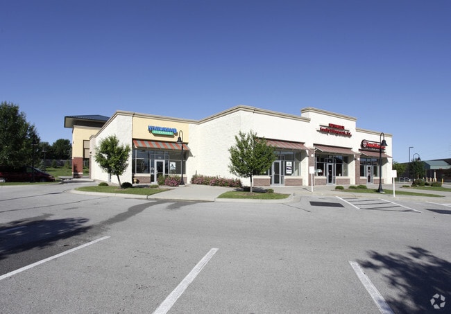
18010 R Plz
Omaha-Council Bluffs, NE-IA
180Th Plaza
2006-0102-19
180TH PLAZA REPLAT ONE LOT 2 BLOCK 0 -EX IRREG SE 69 SQFT FOR ADDL Q ST ROW- 1.145 AC
Regionalshoppingcenterormallwithanchorstore
Douglas
X
Nebraska
31153C0030H
2
2024
1.15 AC
2025
Southwest Omaha
007517
Omaha/Council Bluffs
12,402 SF
DEMOGRAPHICS near 18010 R Plz
1 Mile
3 Mile
5 Mile
2024 Total Population
11,573
83,645
159,740
2029 Population
11,635
86,232
164,818
Pop Growth 2024-2029
+ 0.54%
+ 3.09%
+ 3.18%
Average Age
37
37
38
2024 Total Households
3,811
29,108
57,846
HH Growth 2024-2029
+ 0.50%
+ 2.98%
+ 3.11%
Median Household Inc
$133,804
$118,020
$110,926
Avg Household Size
3.00
2.80
2.70
2024 Avg HH Vehicles
2.00
2.00
2.00
Median Home Value
$317,542
$287,961
$284,875
Median Year Built
2002
2001
1996
Nearby Places
Map Layers
Map Styles
 Street
 Aerial
- Restaurants
- Banks
- Shops
- Fitness
- Groceries
PUBLIC TRANSPORTATION
AIRPORT
Eppley Airfield
DRIVE
WALK
Distance
Eppley Airfield
36 min
20.8 mi
SALE & LEASE HISTORY
LISTING DATE
SALE/LEASE

Nov 28, 2016
For Lease
Mar 20, 2017
For Lease
Jan 07, 2025
For Lease
Nearby Properties
Address
Land Use
TOTAL SIZE
Lot Size
Zoning
Address
Land Use
TOTAL SIZE
Lot Size
Zoning
349,722 SF
25.22 AC
R6
Address
Land Use
TOTAL SIZE
Lot Size
Zoning
394,017 SF
11.62 AC
Address
Land Use
TOTAL SIZE
Lot Size
Zoning
449,891 SF
11.32 AC
Address
Land Use
TOTAL SIZE
Lot Size
Zoning
277,073 SF
16.78 AC
Address
Land Use
TOTAL SIZE
Lot Size
Zoning
369,614 SF
18.03 AC
CC
Address
Land Use
TOTAL SIZE
Lot Size
Zoning
299,172 SF
13.80 AC
R7
Address
Land Use
TOTAL SIZE
Lot Size
Zoning
264,001 SF
10.33 AC
Address
Land Use
TOTAL SIZE
Lot Size
Zoning
294,334 SF
19.14 AC
R6
Address
Land Use
TOTAL SIZE
Lot Size
Zoning
104,473 SF
0.78 AC
MU
Address
Land Use
TOTAL SIZE
Lot Size
Zoning
165,950 SF
11.57 AC
MH
Address
Land Use
TOTAL SIZE
Lot Size
Zoning
240,630 SF
5.38 AC
Address
Land Use
TOTAL SIZE
Lot Size
Zoning
341,379 SF
18.08 AC
Address
Land Use
TOTAL SIZE
Lot Size
Zoning
257,106 SF
21.44 AC
R6
Address
Land Use
TOTAL SIZE
Lot Size
Zoning
268,545 SF
7.53 AC
Address
Land Use
TOTAL SIZE
Lot Size
Zoning
222,090 SF
7.74 AC
R6
Address
Land Use
TOTAL SIZE
Lot Size
Zoning
144,271 SF
4.75 AC
Address
Land Use
TOTAL SIZE
Lot Size
Zoning
238,428 SF
18.64 AC
R5
Address
Land Use
TOTAL SIZE
Lot Size
Zoning
162,717 SF
6.73 AC
R6
Address
Land Use
TOTAL SIZE
Lot Size
Zoning
280,482 SF
11.64 AC
R6
Address
Land Use
TOTAL SIZE
Lot Size
Zoning
193,490 SF
9.35 AC
Address
Land Use
TOTAL SIZE
Lot Size
Zoning
89,181 SF
4.85 AC
Address
Land Use
TOTAL SIZE
Lot Size
Zoning
77,773 SF
6.93 AC
MU
Address
Land Use
TOTAL SIZE
Lot Size
Zoning
151,960 SF
13.32 AC
Address
Land Use
TOTAL SIZE
Lot Size
Zoning
103,221 SF
4.48 AC
Address
Land Use
TOTAL SIZE
Lot Size
Zoning
28,444 SF
0.85 AC
Address
Land Use
TOTAL SIZE
Lot Size
Zoning
74,311 SF
1.03 AC
Address
Land Use
TOTAL SIZE
Lot Size
Zoning
52,502 SF
3.72 AC
MU
Address
Land Use
TOTAL SIZE
Lot Size
Zoning
387,400 SF
6.13 AC
Address
Land Use
TOTAL SIZE
Lot Size
Zoning
133,134 SF
6.03 AC
Address
Land Use
TOTAL SIZE
Lot Size
Zoning
52,791 SF
8.09 AC
The World's #1 Commercial Real Estate Marketplace
Connect with us
© 2025 CoStar Group
The information above has been obtained from sources believed reliable. While we do not doubt its accuracy we have not verified it and make no guarantee, warranty or representation about it. It is your responsibility to independently confirm its accuracy and completeness. Any projections, opinions, assumptions, or estimates used are for example only and do not represent the current or future performance of the property. The value of this transaction to you depends on tax and other factors which should be evaluated by your tax, financial, and legal advisors. You and your advisors should conduct a careful, independent investigation of the property to determine to your satisfaction the suitability of the property for your needs.