Property Record
1802 N Ankeny Blvd, Ankeny, IA 50023


NEARBY LISTINGS FOR SALE OR LEASE
Property Detail
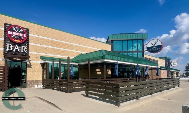
1802 N Ankeny Blvd
Des Moines-West Des Moines, IA
Georgetown Plat 10
18100392343101
LOT 1 GEORGETOWN PLAT 10
Regionalshoppingcenterormallwithanchorstore
Polk
X
Iowa
19153C0205F
1
2024
6.02 AC
2025
Ankeny
010216
Des Moines
67,027 SF
DEMOGRAPHICS near 1802 N Ankeny Blvd
1 Mile
3 Mile
5 Mile
2024 Total Population
10,989
58,237
81,586
2029 Population
11,511
61,222
85,762
Pop Growth 2024-2029
+ 4.75%
+ 5.13%
+ 5.12%
Average Age
37
37
37
2024 Total Households
4,498
23,027
31,571
HH Growth 2024-2029
+ 4.91%
+ 5.28%
+ 5.28%
Median Household Inc
$87,066
$90,489
$94,353
Avg Household Size
2.40
2.50
2.50
2024 Avg HH Vehicles
2.00
2.00
2.00
Median Home Value
$287,071
$277,799
$285,513
Median Year Built
2002
2003
2005
Nearby Places
Map Layers
Map Styles
 Street
 Aerial
- Restaurants
- Banks
- Shops
- Fitness
- Groceries
PUBLIC TRANSPORTATION
AIRPORT
Des Moines International
DRIVE
WALK
Distance
Des Moines International
32 min
19.3 mi
Freight Ports
Port Milwaukee
DRIVE
WALK
Distance
Port Milwaukee
419 min
376.0 mi
SALE & LEASE HISTORY
LISTING DATE
SALE/LEASE

Sep 25, 2016
For Lease
Oct 27, 2016
For Lease
Nearby Properties
Address
Land Use
TOTAL SIZE
Lot Size
Zoning
Address
Land Use
TOTAL SIZE
Lot Size
Zoning
2,732,552 SF
443.35 AC
Address
Land Use
TOTAL SIZE
Lot Size
Zoning
519,216 SF
42.20 AC
Address
Land Use
TOTAL SIZE
Lot Size
Zoning
272,072 SF
11.70 AC
Address
Land Use
TOTAL SIZE
Lot Size
Zoning
210,696 SF
6.57 AC
Address
Land Use
TOTAL SIZE
Lot Size
Zoning
644,942 SF
60.73 AC
M-1
Address
Land Use
TOTAL SIZE
Lot Size
Zoning
100,751 SF
12.67 AC
C-2
Address
Land Use
TOTAL SIZE
Lot Size
Zoning
192,668 SF
20.73 AC
Address
Land Use
TOTAL SIZE
Lot Size
Zoning
140,045 SF
9.29 AC
Address
Land Use
TOTAL SIZE
Lot Size
Zoning
48,839 SF
16.05 AC
Address
Land Use
TOTAL SIZE
Lot Size
Zoning
143,249 SF
7.19 AC
Address
Land Use
TOTAL SIZE
Lot Size
Zoning
143,012 SF
1.75 AC
Address
Land Use
TOTAL SIZE
Lot Size
Zoning
170,692 SF
6.54 AC
Address
Land Use
TOTAL SIZE
Lot Size
Zoning
63,664 SF
9.02 AC
Address
Land Use
TOTAL SIZE
Lot Size
Zoning
175,424 SF
8.01 AC
Address
Land Use
TOTAL SIZE
Lot Size
Zoning
162,384 SF
11.16 AC
R-3
Address
Land Use
TOTAL SIZE
Lot Size
Zoning
144,992 SF
6.03 AC
Address
Land Use
TOTAL SIZE
Lot Size
Zoning
174,602 SF
15.47 AC
Address
Land Use
TOTAL SIZE
Lot Size
Zoning
150,733 SF
18.57 AC
M-1
Address
Land Use
TOTAL SIZE
Lot Size
Zoning
291,855 SF
25.66 AC
M-1
Address
Land Use
TOTAL SIZE
Lot Size
Zoning
99,775 SF
11.26 AC
C-2
Address
Land Use
TOTAL SIZE
Lot Size
Zoning
73,392 SF
6.70 AC
Address
Land Use
TOTAL SIZE
Lot Size
Zoning
142,716 SF
11.42 AC
R3A
Address
Land Use
TOTAL SIZE
Lot Size
Zoning
51,108 SF
17.81 AC
Address
Land Use
TOTAL SIZE
Lot Size
Zoning
113,394 SF
3.95 AC
Address
Land Use
TOTAL SIZE
Lot Size
Zoning
104,792 SF
8.25 AC
Address
Land Use
TOTAL SIZE
Lot Size
Zoning
98,020 SF
4.80 AC
Address
Land Use
TOTAL SIZE
Lot Size
Zoning
104,084 SF
8.24 AC
C-2
Address
Land Use
TOTAL SIZE
Lot Size
Zoning
43,792 SF
12.50 AC
R1
Address
Land Use
TOTAL SIZE
Lot Size
Zoning
59,482 SF
5 AC
PUD
Address
Land Use
TOTAL SIZE
Lot Size
Zoning
67,486 SF
1.26 AC
PUD
The World's #1 Commercial Real Estate Marketplace
Connect with us
© 2025 CoStar Group
The information above has been obtained from sources believed reliable. While we do not doubt its accuracy we have not verified it and make no guarantee, warranty or representation about it. It is your responsibility to independently confirm its accuracy and completeness. Any projections, opinions, assumptions, or estimates used are for example only and do not represent the current or future performance of the property. The value of this transaction to you depends on tax and other factors which should be evaluated by your tax, financial, and legal advisors. You and your advisors should conduct a careful, independent investigation of the property to determine to your satisfaction the suitability of the property for your needs.