Property Record
1803 Abutment Rd, Dalton, GA 30721


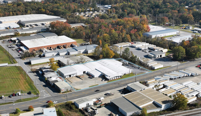
This Property Is For Sale
Property Detail
1803 Abutment Rd
12-315-01-006
L225T233 ET AL G C MURDOC
Commercialnec
Whitfield
M2
Georgia
AE The base floodplain where base flood elevations are provided. AE Zones are now used on new format FIRMs instead of A1-A30 Zones.
1.98 AC
2025
Georgia Northwest
2025
Other Market Areas
001200
Dalton, GA
37,214 SF
NEARBY LISTINGS FOR SALE OR LEASE
DEMOGRAPHICS near 1803 Abutment Rd
1 mile
3 mile
5 mile
2025 Total Population
2,407
31,171
54,832
2030 Population
2,496
31,889
56,181
Pop Growth 2025-2030
+ 3.70%
+ 2.30%
+ 2.46%
Average Age
36
37
38
2025 Total Households
752
10,434
18,862
HH Growth 2025-2030
+ 3.72%
+ 2.34%
+ 2.53%
Median Household Inc
$35,897
$49,602
$49,547
Avg Household Size
3.20
2.90
2.80
2025 Avg HH Vehicles
2.00
2.00
2.00
Median Home Value
$157,692
$226,962
$220,206
Median Year Built
1986
1981
1982
Nearby Places
Map Layers
Map Styles
 Street
 Aerial
Transit
 Traffic
 Biking
Places
Listings with unknown addresses are not visible on the map
- Restaurants
- Banks
- Shops
- Fitness
- Groceries
PUBLIC TRANSPORTATION
AIRPORT
Lovell Field
Drive
Walk
Distance
Lovell Field
43 min
31.4 mi
Nearby Properties
Address
Land Use
TOTAL SIZE
Lot Size
Zoning
Address
Land Use
TOTAL SIZE
Lot Size
Zoning
193,120 SF
41.95 AC
M-2
Address
Land Use
TOTAL SIZE
Lot Size
Zoning
500,075 SF
11.48 AC
M2
Address
Land Use
TOTAL SIZE
Lot Size
Zoning
1,183,067 SF
48.97 AC
M2
Address
Land Use
TOTAL SIZE
Lot Size
Zoning
193,716 SF
29.23 AC
Address
Land Use
TOTAL SIZE
Lot Size
Zoning
662,926 SF
67.28 AC
M2
Address
Land Use
TOTAL SIZE
Lot Size
Zoning
100,084 SF
1.47 AC
Address
Land Use
TOTAL SIZE
Lot Size
Zoning
433,597 SF
36.86 AC
M2
Address
Land Use
TOTAL SIZE
Lot Size
Zoning
341,549 SF
25.46 AC
Address
Land Use
TOTAL SIZE
Lot Size
Zoning
115,979 SF
10.60 AC
C2
Address
Land Use
TOTAL SIZE
Lot Size
Zoning
276,936 SF
37.08 AC
M-2
Address
Land Use
TOTAL SIZE
Lot Size
Zoning
760,961 SF
24.63 AC
M2
Address
Land Use
TOTAL SIZE
Lot Size
Zoning
125,756 SF
7 AC
Address
Land Use
TOTAL SIZE
Lot Size
Zoning
250,000 SF
12.50 AC
M2
Address
Land Use
TOTAL SIZE
Lot Size
Zoning
150,772 SF
12.66 AC
C2
Address
Land Use
TOTAL SIZE
Lot Size
Zoning
184,747 SF
87.57 AC
Address
Land Use
TOTAL SIZE
Lot Size
Zoning
18,016 SF
27.65 AC
M-2
Address
Land Use
TOTAL SIZE
Lot Size
Zoning
38,016 SF
18 AC
Address
Land Use
TOTAL SIZE
Lot Size
Zoning
150,000 SF
6.36 AC
M2
Address
Land Use
TOTAL SIZE
Lot Size
Zoning
1,125,548 SF
24.22 AC
M2
Address
Land Use
TOTAL SIZE
Lot Size
Zoning
283,000 SF
29.32 AC
Address
Land Use
TOTAL SIZE
Lot Size
Zoning
31,376 SF
9.64 AC
Address
Land Use
TOTAL SIZE
Lot Size
Zoning
471,045 SF
45.93 AC
M2
Address
Land Use
TOTAL SIZE
Lot Size
Zoning
261,000 SF
9.88 AC
Address
Land Use
TOTAL SIZE
Lot Size
Zoning
55,584 SF
21.34 AC
Address
Land Use
TOTAL SIZE
Lot Size
Zoning
541,013 SF
21.88 AC
Address
Land Use
TOTAL SIZE
Lot Size
Zoning
110,044 SF
8.45 AC
R-7
Address
Land Use
TOTAL SIZE
Lot Size
Zoning
243,100 SF
27.04 AC
M2
Address
Land Use
TOTAL SIZE
Lot Size
Zoning
200,586 SF
18.37 AC
C2
Address
Land Use
TOTAL SIZE
Lot Size
Zoning
234,696 SF
41.91 AC
Address
Land Use
TOTAL SIZE
Lot Size
Zoning
45,896 SF
2.22 AC
The World's #1 Commercial Real Estate Marketplace
Connect with us
© 2026 CoStar Group
The information above has been obtained from sources believed reliable. While we do not doubt its accuracy we have not verified it and make no guarantee, warranty or representation about it. It is your responsibility to independently confirm its accuracy and completeness. Any projections, opinions, assumptions, or estimates used are for example only and do not represent the current or future performance of the property. The value of this transaction to you depends on tax and other factors which should be evaluated by your tax, financial, and legal advisors. You and your advisors should conduct a careful, independent investigation of the property to determine to your satisfaction the suitability of the property for your needs.