Property Record
1803 N Main St, Roxboro, NC 27573


Property Detail
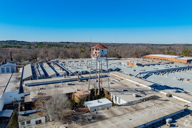
1803 N Main St
54-118
18&15/100AC/BLDGS
Officebuilding
Person
B and X Area of moderate flood hazard, usually the area between the limits of the 100-year and 500-year floods.
North Carolina
2025
18.15 AC
2025
Person County
920300
Raleigh/Durham
390,070 SF
Durham-Chapel Hill, NC
NEARBY LISTINGS FOR SALE OR LEASE
-
-
View all Roxboro listings for lease on LoopNet.com
DEMOGRAPHICS near 1803 N Main St
1 mile
3 mile
5 mile
2025 Total Population
2,525
9,593
16,718
2030 Population
2,612
9,887
17,257
Pop Growth 2025-2030
+ 3.45%
+ 3.06%
+ 3.22%
Average Age
42
42
43
2025 Total Households
1,031
4,049
7,023
HH Growth 2025-2030
+ 3.49%
+ 3.14%
+ 3.26%
Median Household Inc
$52,037
$44,274
$51,056
Avg Household Size
2.40
2.30
2.30
2025 Avg HH Vehicles
2.00
2.00
2.00
Median Home Value
$137,430
$160,492
$172,942
Median Year Built
1970
1973
1976
Nearby Places
Map Layers
Map Styles
 Street
 Aerial
Layers
 Traffic
 Biking
Places
Listings with unknown addresses are not visible on the map
- Restaurants
- Banks
- Shops
- Fitness
- Groceries
SALE & LEASE HISTORY
LISTING DATE
SALE/LEASE

Sep 25, 2016
For Lease
May 29, 2018
For Lease
Apr 15, 2025
For Lease
Nearby Properties
Address
Land Use
TOTAL SIZE
Lot Size
Zoning
Address
Land Use
TOTAL SIZE
Lot Size
Zoning
200,964 SF
42.79 AC
Address
Land Use
TOTAL SIZE
Lot Size
Zoning
54,132 SF
42.03 AC
Address
Land Use
TOTAL SIZE
Lot Size
Zoning
6,688 SF
71.17 AC
Address
Land Use
TOTAL SIZE
Lot Size
Zoning
112,896 SF
8.82 AC
Address
Land Use
TOTAL SIZE
Lot Size
Zoning
23,040 SF
173 AC
Address
Land Use
TOTAL SIZE
Lot Size
Zoning
153,823 SF
19.76 AC
Address
Land Use
TOTAL SIZE
Lot Size
Zoning
126,000 SF
32.71 AC
Address
Land Use
TOTAL SIZE
Lot Size
Zoning
968 SF
10 AC
Address
Land Use
TOTAL SIZE
Lot Size
Zoning
70,797 SF
34.92 AC
Address
Land Use
TOTAL SIZE
Lot Size
Zoning
22,292 SF
4.97 AC
Address
Land Use
TOTAL SIZE
Lot Size
Zoning
96,784 SF
11.53 AC
Address
Land Use
TOTAL SIZE
Lot Size
Zoning
62,596 SF
40 AC
Address
Land Use
TOTAL SIZE
Lot Size
Zoning
63,360 SF
8.05 AC
Address
Land Use
TOTAL SIZE
Lot Size
Zoning
236,363 SF
30 AC
Address
Land Use
TOTAL SIZE
Lot Size
Zoning
8,056 SF
2.64 AC
Address
Land Use
TOTAL SIZE
Lot Size
Zoning
15,597 SF
3 AC
Address
Land Use
TOTAL SIZE
Lot Size
Zoning
4,760 SF
14.89 AC
Address
Land Use
TOTAL SIZE
Lot Size
Zoning
15,460 SF
3.31 AC
Address
Land Use
TOTAL SIZE
Lot Size
Zoning
42,733 SF
3.99 AC
Address
Land Use
TOTAL SIZE
Lot Size
Zoning
32,808 SF
4.48 AC
Address
Land Use
TOTAL SIZE
Lot Size
Zoning
40,784 SF
0.97 AC
Address
Land Use
TOTAL SIZE
Lot Size
Zoning
32,728 SF
5.85 AC
Address
Land Use
TOTAL SIZE
Lot Size
Zoning
30,288 SF
3.89 AC
Address
Land Use
TOTAL SIZE
Lot Size
Zoning
21,120 SF
1.99 AC
Address
Land Use
TOTAL SIZE
Lot Size
Zoning
1,040 SF
26.45 AC
R1
Address
Land Use
TOTAL SIZE
Lot Size
Zoning
33,011 SF
20.85 AC
Address
Land Use
TOTAL SIZE
Lot Size
Zoning
181.34 AC
R2
Address
Land Use
TOTAL SIZE
Lot Size
Zoning
13,043 SF
4 AC
Address
Land Use
TOTAL SIZE
Lot Size
Zoning
8,901 SF
14.54 AC
The World's #1 Commercial Real Estate Marketplace
Connect with us
© 2026 CoStar Group
The information above has been obtained from sources believed reliable. While we do not doubt its accuracy we have not verified it and make no guarantee, warranty or representation about it. It is your responsibility to independently confirm its accuracy and completeness. Any projections, opinions, assumptions, or estimates used are for example only and do not represent the current or future performance of the property. The value of this transaction to you depends on tax and other factors which should be evaluated by your tax, financial, and legal advisors. You and your advisors should conduct a careful, independent investigation of the property to determine to your satisfaction the suitability of the property for your needs.