Property Record
1805 8Th Ave, Tuscaloosa, AL 35401
NEARBY LISTINGS FOR SALE OR LEASE
-
-
View all Tuscaloosa listings for sale on LoopNet.com
Property Detail
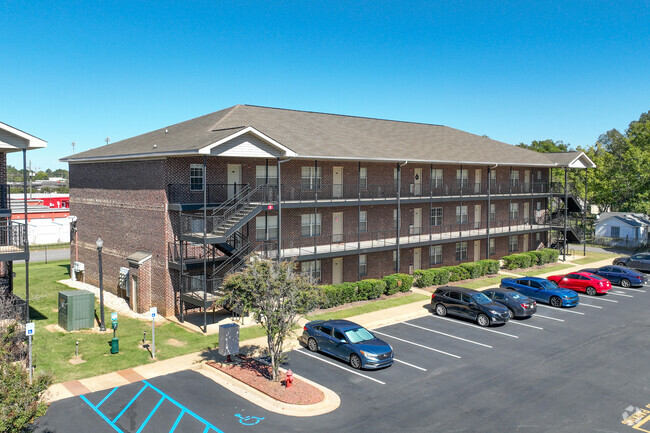
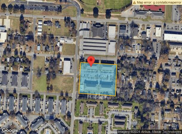
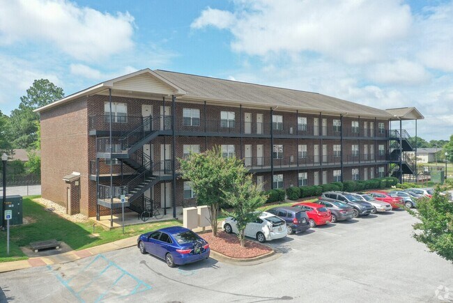
1805 8Th Ave
Tuscaloosa, AL
1805 8Th Ave
31-07-26-1-022-001.000
LOT 1 IN 1805 8TH AVENUE S/D
Apartment
Tuscaloosa
X
Alabama
01125C0508G
1
2025
3.12 AC
2024
West Tuscaloosa
011901
Birmingham
20,736 SF
DEMOGRAPHICS near 1805 8Th Ave
1 Mile
3 Mile
5 Mile
2024 Total Population
18,584
92,261
142,651
2029 Population
21,484
104,081
161,081
Pop Growth 2024-2029
+ 15.60%
+ 12.81%
+ 12.92%
Average Age
30
32
35
2024 Total Households
8,006
34,665
55,090
HH Growth 2024-2029
+ 16.71%
+ 15.19%
+ 14.32%
Median Household Inc
$23,324
$34,645
$43,468
Avg Household Size
2.00
2.10
2.20
2024 Avg HH Vehicles
2.00
2.00
2.00
Median Home Value
$252,604
$185,066
$195,012
Median Year Built
1997
1989
1989
Nearby Places
Map Layers
Map Styles
 Street
 Aerial
- Restaurants
- Banks
- Shops
- Fitness
- Groceries
PUBLIC TRANSPORTATION
COMMUTER RAIL
Tuscaloosa Amtrak Station (Crescent - Amtrak)
DRIVE
WALK
Distance
Tuscaloosa Amtrak Station (Crescent - Amtrak)
2 min
18 min
1.0 mi
Freight Ports
Port of Mobile
DRIVE
WALK
Distance
Port of Mobile
240 min
199.9 mi
Nearby Properties
Address
Land Use
TOTAL SIZE
Lot Size
Zoning
Address
Land Use
TOTAL SIZE
Lot Size
Zoning
318,383 SF
44 SF
BN
Address
Land Use
TOTAL SIZE
Lot Size
Zoning
22,791 SF
13 AC
Address
Land Use
TOTAL SIZE
Lot Size
Zoning
148,656 SF
2.79 AC
BC
Address
Land Use
TOTAL SIZE
Lot Size
Zoning
22,925 SF
13.45 AC
R4
Address
Land Use
TOTAL SIZE
Lot Size
Zoning
11,278 SF
145 AC
R3
Address
Land Use
TOTAL SIZE
Lot Size
Zoning
9,258 SF
19 AC
R4
Address
Land Use
TOTAL SIZE
Lot Size
Zoning
252,793 SF
2.73 AC
BN
Address
Land Use
TOTAL SIZE
Lot Size
Zoning
279,917 SF
4.01 AC
MX3
Address
Land Use
TOTAL SIZE
Lot Size
Zoning
24,165 SF
28 AC
BN
Address
Land Use
TOTAL SIZE
Lot Size
Zoning
8,760 SF
23 AC
R4
Address
Land Use
TOTAL SIZE
Lot Size
Zoning
40,160 SF
10.79 AC
RMF1
Address
Land Use
TOTAL SIZE
Lot Size
Zoning
25,920 SF
16 AC
RMF1
Address
Land Use
TOTAL SIZE
Lot Size
Zoning
6,579 SF
15.07 AC
RMF1
Address
Land Use
TOTAL SIZE
Lot Size
Zoning
231,339 SF
4.20 AC
MX5
Address
Land Use
TOTAL SIZE
Lot Size
Zoning
160,989 SF
1.53 AC
RMF2
Address
Land Use
TOTAL SIZE
Lot Size
Zoning
55.11 AC
I
Address
Land Use
TOTAL SIZE
Lot Size
Zoning
1.33 AC
BC
Address
Land Use
TOTAL SIZE
Lot Size
Zoning
176,360 SF
1.13 AC
RMF2
Address
Land Use
TOTAL SIZE
Lot Size
Zoning
15,888 SF
112 AC
I
Address
Land Use
TOTAL SIZE
Lot Size
Zoning
200,388 SF
1.22 AC
Address
Land Use
TOTAL SIZE
Lot Size
Zoning
21,811 SF
16 AC
R4
Address
Land Use
TOTAL SIZE
Lot Size
Zoning
110,337 SF
0.91 AC
RMF2
Address
Land Use
TOTAL SIZE
Lot Size
Zoning
105,728 SF
4.75 AC
BGO
Address
Land Use
TOTAL SIZE
Lot Size
Zoning
5,377 SF
22 AC
RMF1
Address
Land Use
TOTAL SIZE
Lot Size
Zoning
196,378 SF
1.46 AC
MX5
Address
Land Use
TOTAL SIZE
Lot Size
Zoning
173,452 SF
2.30 AC
ML
Address
Land Use
TOTAL SIZE
Lot Size
Zoning
144,660 SF
1 AC
RMF2
Address
Land Use
TOTAL SIZE
Lot Size
Zoning
110,000 SF
5.80 AC
RD
Address
Land Use
TOTAL SIZE
Lot Size
Zoning
28,796 SF
15 AC
R4
Address
Land Use
TOTAL SIZE
Lot Size
Zoning
26,576 SF
2.53 AC
RD
The World's #1 Commercial Real Estate Marketplace
Connect with us
© 2025 CoStar Group
The information above has been obtained from sources believed reliable. While we do not doubt its accuracy we have not verified it and make no guarantee, warranty or representation about it. It is your responsibility to independently confirm its accuracy and completeness. Any projections, opinions, assumptions, or estimates used are for example only and do not represent the current or future performance of the property. The value of this transaction to you depends on tax and other factors which should be evaluated by your tax, financial, and legal advisors. You and your advisors should conduct a careful, independent investigation of the property to determine to your satisfaction the suitability of the property for your needs.