Property Record
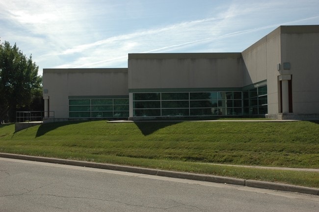
1805 Collaboration Pl, Ames, IA 50010

Property Detail
1805 Collaboration Pl
09-22-100-030
IOWA STATE UNIVERSITY RESEARCH PARK PHASE III 1ST ADD LOT:3 AMES
Officebuilding
Story
RI
Iowa
B and X Area of moderate flood hazard, usually the area between the limits of the 100-year and 500-year floods.
3
2025
2.95 AC
2025
South Ames
001302
Other Market Areas
33,874 SF
Ames, IA
NEARBY LISTINGS FOR SALE OR LEASE
DEMOGRAPHICS near 1805 Collaboration Pl
1 mile
3 mile
5 mile
2025 Total Population
6,095
49,224
71,635
2030 Population
6,288
50,197
73,049
Pop Growth 2025-2030
+ 3.17%
+ 1.98%
+ 1.97%
Average Age
31
30
33
2025 Total Households
2,116
17,912
27,433
HH Growth 2025-2030
+ 5.20%
+ 2.59%
+ 2.44%
Median Household Inc
$58,244
$53,424
$61,721
Avg Household Size
1.90
2.00
2.10
2025 Avg HH Vehicles
2.00
2.00
2.00
Median Home Value
$320,689
$272,411
$294,018
Median Year Built
2000
1991
1990
Nearby Places
Map Layers
Map Styles
 Street
 Aerial
Layers
 Traffic
 Biking
Places
Listings with unknown addresses are not visible on the map
- Restaurants
- Banks
- Shops
- Fitness
- Groceries
SALE & LEASE HISTORY
LISTING DATE
SALE/LEASE

Nov 09, 2017
For Lease
Nearby Properties
Address
Land Use
TOTAL SIZE
Lot Size
Zoning
Address
Land Use
TOTAL SIZE
Lot Size
Zoning
54,112 SF
12.70 AC
Address
Land Use
TOTAL SIZE
Lot Size
Zoning
289,606 SF
1.77 AC
CSC
Address
Land Use
TOTAL SIZE
Lot Size
Zoning
33,530 SF
28.91 AC
Address
Land Use
TOTAL SIZE
Lot Size
Zoning
45,250 SF
12.69 AC
Address
Land Use
TOTAL SIZE
Lot Size
Zoning
45,627 SF
8.91 AC
RH
Address
Land Use
TOTAL SIZE
Lot Size
Zoning
215,689 SF
22.56 AC
HOC
Address
Land Use
TOTAL SIZE
Lot Size
Zoning
75,302 SF
16.66 AC
HOC
Address
Land Use
TOTAL SIZE
Lot Size
Zoning
177,201 SF
26.29 AC
Address
Land Use
TOTAL SIZE
Lot Size
Zoning
82,734 SF
1.42 AC
CSC
Address
Land Use
TOTAL SIZE
Lot Size
Zoning
120,842 SF
26.68 AC
PI
Address
Land Use
TOTAL SIZE
Lot Size
Zoning
52,980 SF
8.53 AC
PI
Address
Land Use
TOTAL SIZE
Lot Size
Zoning
6,090 SF
20.72 AC
F-PRD
Address
Land Use
TOTAL SIZE
Lot Size
Zoning
93,813 SF
7.11 AC
GI
Address
Land Use
TOTAL SIZE
Lot Size
Zoning
20,619 SF
2.44 AC
RH
Address
Land Use
TOTAL SIZE
Lot Size
Zoning
54,066 SF
4.93 AC
RI
Address
Land Use
TOTAL SIZE
Lot Size
Zoning
84,132 SF
3.57 AC
FS-RM
Address
Land Use
TOTAL SIZE
Lot Size
Zoning
115,338 SF
16.41 AC
HOC
Address
Land Use
TOTAL SIZE
Lot Size
Zoning
35,264 SF
11.88 AC
Address
Land Use
TOTAL SIZE
Lot Size
Zoning
105,550 SF
0.62 AC
CSC
Address
Land Use
TOTAL SIZE
Lot Size
Zoning
97,767 SF
0.05 AC
CSC
Address
Land Use
TOTAL SIZE
Lot Size
Zoning
122,502 SF
10.96 AC
HOC
Address
Land Use
TOTAL SIZE
Lot Size
Zoning
88,584 SF
0.57 AC
Address
Land Use
TOTAL SIZE
Lot Size
Zoning
114,744 SF
14.35 AC
HOC
Address
Land Use
TOTAL SIZE
Lot Size
Zoning
34,368 SF
5.01 AC
RI
Address
Land Use
TOTAL SIZE
Lot Size
Zoning
75,122 SF
3.79 AC
HOC
Address
Land Use
TOTAL SIZE
Lot Size
Zoning
100,588 SF
7.65 AC
HOC
Address
Land Use
TOTAL SIZE
Lot Size
Zoning
148,996 SF
11.50 AC
HOC
Address
Land Use
TOTAL SIZE
Lot Size
Zoning
24,274 SF
10.39 AC
Address
Land Use
TOTAL SIZE
Lot Size
Zoning
34,100 SF
2.93 AC
RI
Address
Land Use
TOTAL SIZE
Lot Size
Zoning
7,200 SF
4.32 AC
HOC
The World's #1 Commercial Real Estate Marketplace
Connect with us
© 2026 CoStar Group
The information above has been obtained from sources believed reliable. While we do not doubt its accuracy we have not verified it and make no guarantee, warranty or representation about it. It is your responsibility to independently confirm its accuracy and completeness. Any projections, opinions, assumptions, or estimates used are for example only and do not represent the current or future performance of the property. The value of this transaction to you depends on tax and other factors which should be evaluated by your tax, financial, and legal advisors. You and your advisors should conduct a careful, independent investigation of the property to determine to your satisfaction the suitability of the property for your needs.