Property Record
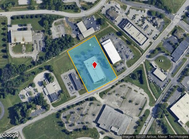
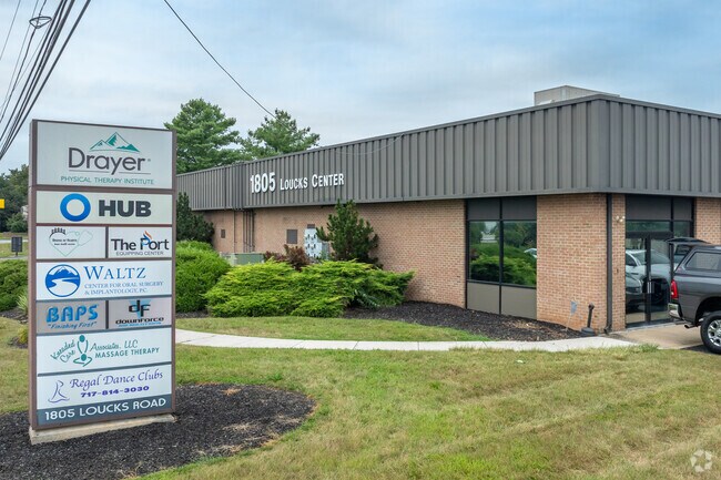
1805 Loucks Rd, York, PA 17408

NEARBY LISTINGS FOR SALE OR LEASE
Property Detail
1805 Loucks Rd
51-000-29-0138.A0-00000
Westgate Final Minor Subdivision Plan Lo
Storebuilding
LOT 138A
X
York
42133C0307F
Pennsylvania
2025
3.17 AC
2025
York County
021410
Philadelphia
27,360 SF
York-Hanover, PA
DEMOGRAPHICS near 1805 Loucks Rd
1 Mile
3 Mile
5 Mile
2024 Total Population
4,851
81,996
142,726
2029 Population
4,939
83,968
146,420
Pop Growth 2024-2029
+ 1.81%
+ 2.40%
+ 2.59%
Average Age
47
39
40
2024 Total Households
2,076
31,866
55,480
HH Growth 2024-2029
+ 1.69%
+ 2.44%
+ 2.63%
Median Household Inc
$57,191
$55,902
$62,419
Avg Household Size
2.20
2.40
2.40
2024 Avg HH Vehicles
2.00
2.00
2.00
Median Home Value
$181,963
$167,825
$175,346
Median Year Built
1984
1959
1963
Nearby Places
Map Layers
Map Styles
 Street
 Aerial
- Restaurants
- Banks
- Shops
- Fitness
- Groceries
PUBLIC TRANSPORTATION
AIRPORT
Harrisburg International
DRIVE
WALK
Distance
Harrisburg International
43 min
30.4 mi
Freight Ports
Port of Baltimore
DRIVE
WALK
Distance
Port of Baltimore
77 min
56.0 mi
SALE & LEASE HISTORY
LISTING DATE
SALE/LEASE

Sep 25, 2016
For Lease
May 14, 2019
For Lease
Nearby Properties
Address
Land Use
TOTAL SIZE
Lot Size
Zoning
Address
Land Use
TOTAL SIZE
Lot Size
Zoning
21 AC
I
Address
Land Use
TOTAL SIZE
Lot Size
Zoning
2,858 SF
46.24 AC
CM
Address
Land Use
TOTAL SIZE
Lot Size
Zoning
754,640 SF
54.36 AC
Address
Land Use
TOTAL SIZE
Lot Size
Zoning
347,456 SF
58.09 AC
RS
Address
Land Use
TOTAL SIZE
Lot Size
Zoning
174,841 SF
27.30 AC
RS
Address
Land Use
TOTAL SIZE
Lot Size
Zoning
14.17 AC
RS
Address
Land Use
TOTAL SIZE
Lot Size
Zoning
44,800 SF
18.73 AC
CM
Address
Land Use
TOTAL SIZE
Lot Size
Zoning
312,000 SF
26.81 AC
RS
Address
Land Use
TOTAL SIZE
Lot Size
Zoning
24,375 SF
977.35 AC
ID
Address
Land Use
TOTAL SIZE
Lot Size
Zoning
471,400 SF
31.22 AC
ID
Address
Land Use
TOTAL SIZE
Lot Size
Zoning
6.44 AC
RS
Address
Land Use
TOTAL SIZE
Lot Size
Zoning
133,416 SF
14.08 AC
RS
Address
Land Use
TOTAL SIZE
Lot Size
Zoning
30,060 SF
11.17 AC
RS
Address
Land Use
TOTAL SIZE
Lot Size
Zoning
68,520 SF
23.56 AC
AG
Address
Land Use
TOTAL SIZE
Lot Size
Zoning
339,876 SF
23.58 AC
ID
Address
Land Use
TOTAL SIZE
Lot Size
Zoning
64,530 SF
24.66 AC
AG
Address
Land Use
TOTAL SIZE
Lot Size
Zoning
85,793 SF
9.71 AC
RS
Address
Land Use
TOTAL SIZE
Lot Size
Zoning
30,530 SF
2.27 AC
RS
Address
Land Use
TOTAL SIZE
Lot Size
Zoning
43,958 SF
3.21 AC
Address
Land Use
TOTAL SIZE
Lot Size
Zoning
6,252 SF
80.38 AC
AG
Address
Land Use
TOTAL SIZE
Lot Size
Zoning
1.86 AC
Address
Land Use
TOTAL SIZE
Lot Size
Zoning
117,168 SF
8.12 AC
CM
Address
Land Use
TOTAL SIZE
Lot Size
Zoning
115,568 SF
16.15 AC
RC
Address
Land Use
TOTAL SIZE
Lot Size
Zoning
72,885 SF
1.66 AC
ID
Address
Land Use
TOTAL SIZE
Lot Size
Zoning
403,218 SF
16.28 AC
ID
Address
Land Use
TOTAL SIZE
Lot Size
Zoning
2.62 AC
RS
Address
Land Use
TOTAL SIZE
Lot Size
Zoning
113,150 SF
4.39 AC
ID
Address
Land Use
TOTAL SIZE
Lot Size
Zoning
11,614 SF
4.21 AC
ID
Address
Land Use
TOTAL SIZE
Lot Size
Zoning
122,007 SF
11.79 AC
Address
Land Use
TOTAL SIZE
Lot Size
Zoning
74,031 SF
20.31 AC
EC
The World's #1 Commercial Real Estate Marketplace
Connect with us
© 2025 CoStar Group
The information above has been obtained from sources believed reliable. While we do not doubt its accuracy we have not verified it and make no guarantee, warranty or representation about it. It is your responsibility to independently confirm its accuracy and completeness. Any projections, opinions, assumptions, or estimates used are for example only and do not represent the current or future performance of the property. The value of this transaction to you depends on tax and other factors which should be evaluated by your tax, financial, and legal advisors. You and your advisors should conduct a careful, independent investigation of the property to determine to your satisfaction the suitability of the property for your needs.