Property Record
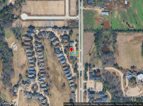
1805 N Westmoreland Rd, Desoto, TX 75115

NEARBY LISTINGS FOR SALE OR LEASE
Property Detail
1805 N Westmoreland Rd
Dallas-Fort Worth-Arlington, TX
The Offices Of Thorntree Ph 1
200791000G0020000
THE OFFICES OF THORNTREE PH 1 BLK G LOT 2 ACS 0.1653 INT201500149373 DD05292015 CO-DC 0791000G00200 5CS0791000G
Officebuilding
Dallas
X
Texas
48139C0055G
2
2024
0.17 AC
2025
Southwest Dallas
016638
Dallas/Ft Worth
1,782 SF
DEMOGRAPHICS near 1805 N Westmoreland Rd
1 Mile
3 Mile
5 Mile
2024 Total Population
4,227
81,503
220,812
2029 Population
4,179
80,378
217,748
Pop Growth 2024-2029
(1.14%)
(1.38%)
(1.39%)
Average Age
43
38
37
2024 Total Households
1,694
29,586
76,160
HH Growth 2024-2029
(1.30%)
(1.62%)
(1.59%)
Median Household Inc
$67,755
$57,441
$59,713
Avg Household Size
2.40
2.70
2.80
2024 Avg HH Vehicles
2.00
2.00
2.00
Median Home Value
$276,642
$229,499
$215,317
Median Year Built
1988
1985
1986
Nearby Places
Map Layers
Map Styles
 Street
 Aerial
- Restaurants
- Banks
- Shops
- Fitness
- Groceries
PUBLIC TRANSPORTATION
AIRPORT
Dallas Love Field
DRIVE
WALK
Distance
Dallas Love Field
30 min
19.5 mi
Dallas-Fort Worth International
DRIVE
WALK
Distance
Dallas-Fort Worth International
39 min
29.0 mi
Freight Ports
Port of Shreveport
DRIVE
WALK
Distance
Port of Shreveport
218 min
201.8 mi
Nearby Properties
Address
Land Use
TOTAL SIZE
Lot Size
Zoning
Address
Land Use
TOTAL SIZE
Lot Size
Zoning
726,662 SF
44.94 AC
Z239
Address
Land Use
TOTAL SIZE
Lot Size
Zoning
1,316,325 SF
54.36 AC
Z111
Address
Land Use
TOTAL SIZE
Lot Size
Zoning
1,126,320 SF
63.41 AC
Z111
Address
Land Use
TOTAL SIZE
Lot Size
Zoning
1,167,500 SF
46.04 AC
Z06
Address
Land Use
TOTAL SIZE
Lot Size
Zoning
951,480 SF
50.63 AC
Z109
Address
Land Use
TOTAL SIZE
Lot Size
Zoning
948,392 SF
50.80 AC
Z109
Address
Land Use
TOTAL SIZE
Lot Size
Zoning
823,000 SF
45.10 AC
Z298
Address
Land Use
TOTAL SIZE
Lot Size
Zoning
662,230 SF
38.49 AC
Z248
Address
Land Use
TOTAL SIZE
Lot Size
Zoning
123,880 SF
16.80 AC
Z236
Address
Land Use
TOTAL SIZE
Lot Size
Zoning
217,510 SF
67.57 AC
Z268
Address
Land Use
TOTAL SIZE
Lot Size
Zoning
507,318 SF
28.40 AC
Z111
Address
Land Use
TOTAL SIZE
Lot Size
Zoning
172,840 SF
49.65 AC
Z164
Address
Land Use
TOTAL SIZE
Lot Size
Zoning
552,200 SF
41.36 AC
Z109
Address
Land Use
TOTAL SIZE
Lot Size
Zoning
489,310 SF
33.91 AC
Z111
Address
Land Use
TOTAL SIZE
Lot Size
Zoning
374,400 SF
6.15 AC
Z150
Address
Land Use
TOTAL SIZE
Lot Size
Zoning
531,254 SF
33.40 AC
Z06
Address
Land Use
TOTAL SIZE
Lot Size
Zoning
453,600 SF
29.54 AC
Z236
Address
Land Use
TOTAL SIZE
Lot Size
Zoning
421,890 SF
23.95 AC
Z111
Address
Land Use
TOTAL SIZE
Lot Size
Zoning
400,000 SF
24.69 AC
Z116
Address
Land Use
TOTAL SIZE
Lot Size
Zoning
344,952 SF
14.39 AC
Z239
Address
Land Use
TOTAL SIZE
Lot Size
Zoning
253,794 SF
10.23 AC
Z201
Address
Land Use
TOTAL SIZE
Lot Size
Zoning
222,576 SF
35.20 AC
Z239
Address
Land Use
TOTAL SIZE
Lot Size
Zoning
418,511 SF
20.38 AC
Z111
Address
Land Use
TOTAL SIZE
Lot Size
Zoning
350,904 SF
18.46 AC
Z111
Address
Land Use
TOTAL SIZE
Lot Size
Zoning
305,727 SF
25.02 AC
Z06
Address
Land Use
TOTAL SIZE
Lot Size
Zoning
119,190 SF
60.25 AC
Z239
Address
Land Use
TOTAL SIZE
Lot Size
Zoning
373,028 SF
19.78 AC
Z116
Address
Land Use
TOTAL SIZE
Lot Size
Zoning
180,659 SF
8.19 AC
Z137
Address
Land Use
TOTAL SIZE
Lot Size
Zoning
220,975 SF
10.52 AC
Z151
Address
Land Use
TOTAL SIZE
Lot Size
Zoning
206,992 SF
14.25 AC
Z188
The World's #1 Commercial Real Estate Marketplace
Connect with us
© 2025 CoStar Group
The information above has been obtained from sources believed reliable. While we do not doubt its accuracy we have not verified it and make no guarantee, warranty or representation about it. It is your responsibility to independently confirm its accuracy and completeness. Any projections, opinions, assumptions, or estimates used are for example only and do not represent the current or future performance of the property. The value of this transaction to you depends on tax and other factors which should be evaluated by your tax, financial, and legal advisors. You and your advisors should conduct a careful, independent investigation of the property to determine to your satisfaction the suitability of the property for your needs.