Property Record
1805 San Gorgonio Ave, Oxnard, CA 93030
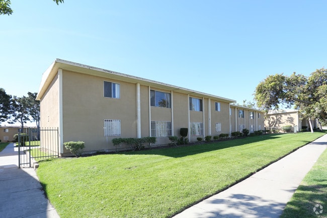


Property Detail
1805 San Gorgonio Ave
216-0-061-065
TRACT: 136301 LOT: 134 REF: 031MR 082
Apartment
Ventura
R1
California
B and X Area of moderate flood hazard, usually the area between the limits of the 100-year and 500-year floods.
134
2024
2.29 AC
2025
Rose Park
004902
Los Angeles
39,672 SF
Oxnard-Thousand Oaks-Ventura, CA
NEARBY LISTINGS FOR SALE OR LEASE
DEMOGRAPHICS near 1805 San Gorgonio Ave
1 mile
3 mile
5 mile
2025 Total Population
21,658
144,350
259,522
2030 Population
21,281
142,345
257,356
Pop Growth 2025-2030
(1.74%)
(1.39%)
(0.83%)
Average Age
36
37
38
2025 Total Households
5,240
36,790
73,406
HH Growth 2025-2030
(1.98%)
(1.53%)
(0.74%)
Median Household Inc
$113,681
$93,918
$96,301
Avg Household Size
3.90
3.70
3.40
2025 Avg HH Vehicles
3.00
2.00
2.00
Median Home Value
$695,223
$685,636
$713,295
Median Year Built
1995
1974
1975
Nearby Places
Map Layers
Map Styles
 Street
 Aerial
Layers
 Traffic
 Biking
Places
Listings with unknown addresses are not visible on the map
- Restaurants
- Banks
- Shops
- Fitness
- Groceries
PUBLIC TRANSPORTATION
COMMUTER RAIL
Oxnard (Ventura County Line - Southern California Regional Rail Authority (Metrolink))
Drive
Walk
Distance
Oxnard (Ventura County Line - Southern California Regional Rail Authority (Metrolink))
4 min
1.8 mi
East Ventura Metrolink Station (Metrolink Ventura County Line - Metrolink Trains)
Drive
Walk
Distance
East Ventura Metrolink Station (Metrolink Ventura County Line - Metrolink Trains)
8 min
5.0 mi
Freight Ports
The Port of Hueneme
Drive
Walk
Distance
The Port of Hueneme
13 min
6.1 mi
Nearby Properties
Address
Land Use
TOTAL SIZE
Lot Size
Zoning
Address
Land Use
TOTAL SIZE
Lot Size
Zoning
135,631 SF
74.32 AC
Address
Land Use
TOTAL SIZE
Lot Size
Zoning
25.09 AC
Address
Land Use
TOTAL SIZE
Lot Size
Zoning
35.90 AC
BRP
Address
Land Use
TOTAL SIZE
Lot Size
Zoning
480,733 SF
14.26 AC
Address
Land Use
TOTAL SIZE
Lot Size
Zoning
31.75 AC
Address
Land Use
TOTAL SIZE
Lot Size
Zoning
505,728 SF
20.81 AC
Address
Land Use
TOTAL SIZE
Lot Size
Zoning
15.09 AC
Address
Land Use
TOTAL SIZE
Lot Size
Zoning
95,637 SF
40.70 AC
Address
Land Use
TOTAL SIZE
Lot Size
Zoning
6.14 AC
Address
Land Use
TOTAL SIZE
Lot Size
Zoning
352,898 SF
16.57 AC
ML
Address
Land Use
TOTAL SIZE
Lot Size
Zoning
3.96 AC
Address
Land Use
TOTAL SIZE
Lot Size
Zoning
11.28 AC
CMPD
Address
Land Use
TOTAL SIZE
Lot Size
Zoning
2.63 AC
Address
Land Use
TOTAL SIZE
Lot Size
Zoning
3.12 AC
Address
Land Use
TOTAL SIZE
Lot Size
Zoning
30,800 SF
32.79 AC
M-1-
Address
Land Use
TOTAL SIZE
Lot Size
Zoning
1,675 SF
18.62 AC
Address
Land Use
TOTAL SIZE
Lot Size
Zoning
110,434 SF
3.81 AC
Address
Land Use
TOTAL SIZE
Lot Size
Zoning
15.59 AC
Address
Land Use
TOTAL SIZE
Lot Size
Zoning
8,398 SF
45.88 AC
M1PD
Address
Land Use
TOTAL SIZE
Lot Size
Zoning
70,392 SF
19.97 AC
4
Address
Land Use
TOTAL SIZE
Lot Size
Zoning
191,035 SF
8.54 AC
R3PD
Address
Land Use
TOTAL SIZE
Lot Size
Zoning
158,736 SF
6.33 AC
Address
Land Use
TOTAL SIZE
Lot Size
Zoning
129,018 SF
5.09 AC
R3PD
Address
Land Use
TOTAL SIZE
Lot Size
Zoning
41,327 SF
7.04 AC
Address
Land Use
TOTAL SIZE
Lot Size
Zoning
133,174 SF
5.94 AC
R3PD
Address
Land Use
TOTAL SIZE
Lot Size
Zoning
770 SF
9.80 AC
M1
Address
Land Use
TOTAL SIZE
Lot Size
Zoning
13,833 SF
13.91 AC
Address
Land Use
TOTAL SIZE
Lot Size
Zoning
138,475 SF
2.77 AC
Address
Land Use
TOTAL SIZE
Lot Size
Zoning
138,475 SF
2.77 AC
Address
Land Use
TOTAL SIZE
Lot Size
Zoning
20,349 SF
9.65 AC
C2
The World's #1 Commercial Real Estate Marketplace
Connect with us
© 2026 CoStar Group
The information above has been obtained from sources believed reliable. While we do not doubt its accuracy we have not verified it and make no guarantee, warranty or representation about it. It is your responsibility to independently confirm its accuracy and completeness. Any projections, opinions, assumptions, or estimates used are for example only and do not represent the current or future performance of the property. The value of this transaction to you depends on tax and other factors which should be evaluated by your tax, financial, and legal advisors. You and your advisors should conduct a careful, independent investigation of the property to determine to your satisfaction the suitability of the property for your needs.