Property Record
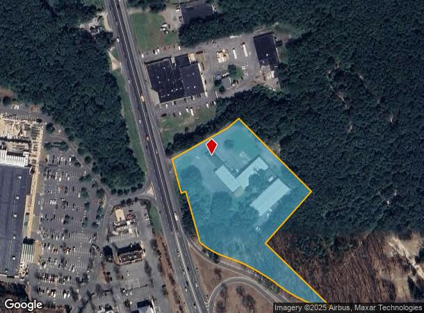
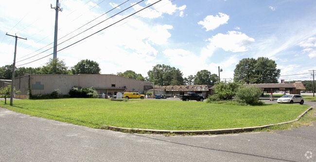
1805 Us Highway 9, Howell, NJ 07731

NEARBY LISTINGS FOR SALE OR LEASE
Property Detail
1805 Us Highway 9
21-00144-0000-00073-01
Monmouth
Telephonefacility
New Jersey
X
73.1
34025C0303F
5.28 AC
2024
Western Monmouth
2025
Northern New Jersey
811200
New York-Jersey City-White Plains, NY-NJ
8,500 SF
DEMOGRAPHICS near 1805 Us Highway 9
1 Mile
3 Mile
5 Mile
2024 Total Population
4,075
32,530
90,269
2029 Population
4,036
32,440
90,979
Pop Growth 2024-2029
(0.96%)
(0.28%)
+ 0.79%
Average Age
40
42
40
2024 Total Households
1,463
11,808
31,150
HH Growth 2024-2029
(1.16%)
(0.65%)
+ 0.34%
Median Household Inc
$77,261
$105,854
$108,456
Avg Household Size
2.70
2.70
2.80
2024 Avg HH Vehicles
2.00
2.00
2.00
Median Home Value
$400,930
$408,406
$411,299
Median Year Built
1987
1984
1983
Nearby Places
Map Layers
Map Styles
 Street
 Aerial
- Restaurants
- Banks
- Shops
- Fitness
- Groceries
Nearby Properties
Address
Land Use
TOTAL SIZE
Lot Size
Zoning
Address
Land Use
TOTAL SIZE
Lot Size
Zoning
15.69 AC
HMUD
Address
Land Use
TOTAL SIZE
Lot Size
Zoning
25.63 AC
HD-1
Address
Land Use
TOTAL SIZE
Lot Size
Zoning
241,399 SF
69.89 AC
R-40
Address
Land Use
TOTAL SIZE
Lot Size
Zoning
14.90 AC
PFE
Address
Land Use
TOTAL SIZE
Lot Size
Zoning
136,800 SF
14.08 AC
ARE1
Address
Land Use
TOTAL SIZE
Lot Size
Zoning
2,674 SF
80 AC
R-E
Address
Land Use
TOTAL SIZE
Lot Size
Zoning
81,657 SF
12.62 AC
B-10
Address
Land Use
TOTAL SIZE
Lot Size
Zoning
120,000 SF
77 AC
ARE2
Address
Land Use
TOTAL SIZE
Lot Size
Zoning
8,694 SF
73.93 AC
R-40
Address
Land Use
TOTAL SIZE
Lot Size
Zoning
76.77 AC
R-E
Address
Land Use
TOTAL SIZE
Lot Size
Zoning
73.44 AC
R-E
Address
Land Use
TOTAL SIZE
Lot Size
Zoning
43.22 AC
ARE2
Address
Land Use
TOTAL SIZE
Lot Size
Zoning
70.60 AC
RE
Address
Land Use
TOTAL SIZE
Lot Size
Zoning
98,731 SF
13.65 AC
HD
Address
Land Use
TOTAL SIZE
Lot Size
Zoning
117,975 SF
21.20 AC
HD-1
Address
Land Use
TOTAL SIZE
Lot Size
Zoning
14.63 AC
HMUD
Address
Land Use
TOTAL SIZE
Lot Size
Zoning
58.80 AC
R-E
Address
Land Use
TOTAL SIZE
Lot Size
Zoning
7,966 SF
44.17 AC
MH
Address
Land Use
TOTAL SIZE
Lot Size
Zoning
51,531 SF
13.30 AC
HD
Address
Land Use
TOTAL SIZE
Lot Size
Zoning
70.12 AC
R-E
Address
Land Use
TOTAL SIZE
Lot Size
Zoning
40.60 AC
MH
Address
Land Use
TOTAL SIZE
Lot Size
Zoning
50.15 AC
R-E
Address
Land Use
TOTAL SIZE
Lot Size
Zoning
94,480 SF
11.11 AC
HD-1
Address
Land Use
TOTAL SIZE
Lot Size
Zoning
49.34 AC
R-80
Address
Land Use
TOTAL SIZE
Lot Size
Zoning
46.70 AC
R-E
Address
Land Use
TOTAL SIZE
Lot Size
Zoning
66,768 SF
10.90 AC
ARE2
Address
Land Use
TOTAL SIZE
Lot Size
Zoning
4,974 SF
36.70 AC
R-80
Address
Land Use
TOTAL SIZE
Lot Size
Zoning
2,104 SF
22.90 AC
MHP
Address
Land Use
TOTAL SIZE
Lot Size
Zoning
52,985 SF
20.92 AC
HD-1
Address
Land Use
TOTAL SIZE
Lot Size
Zoning
2,040 SF
40.11 AC
R-80
The World's #1 Commercial Real Estate Marketplace
Connect with us
© 2025 CoStar Group
The information above has been obtained from sources believed reliable. While we do not doubt its accuracy we have not verified it and make no guarantee, warranty or representation about it. It is your responsibility to independently confirm its accuracy and completeness. Any projections, opinions, assumptions, or estimates used are for example only and do not represent the current or future performance of the property. The value of this transaction to you depends on tax and other factors which should be evaluated by your tax, financial, and legal advisors. You and your advisors should conduct a careful, independent investigation of the property to determine to your satisfaction the suitability of the property for your needs.