Property Record
18050 Ronald Reagan Blvd, Leander, TX 78641

Property Detail
18050 Ronald Reagan Blvd
R032205
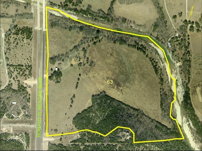
AW0420 MANLOVE, B. SUR., ACRES 36.82
Vacantlandnec
WILLIAMSON
AE The base floodplain where base flood elevations are provided. AE Zones are now used on new format FIRMs instead of A1-A30 Zones.
Texas
2024
36.82 AC
2025
Georgetown
020338
Austin
86,500 SF
Austin-Round Rock-San Marcos, TX
NEARBY LISTINGS FOR SALE OR LEASE
DEMOGRAPHICS near 18050 Ronald Reagan Blvd
1 mile
3 mile
5 mile
2024 Total Population
5,156
35,349
118,664
2029 Population
6,206
42,454
139,819
Pop Growth 2024-2029
+ 20.36%
+ 20.10%
+ 17.83%
Average Age
37
37
37
2024 Total Households
1,779
12,651
40,719
HH Growth 2024-2029
+ 20.80%
+ 20.43%
+ 18.30%
Median Household Inc
$171,173
$148,692
$135,088
Avg Household Size
2.90
2.80
2.90
2024 Avg HH Vehicles
2.00
2.00
2.00
Median Home Value
$599,383
$554,890
$487,683
Median Year Built
2011
2011
2011
Nearby Places
Map Layers
Map Styles
 Street
 Aerial
Transit
 Traffic
 Biking
Places
Listings with unknown addresses are not visible on the map
- Restaurants
- Banks
- Shops
- Fitness
- Groceries
PUBLIC TRANSPORTATION
AIRPORT
Austin-Bergstrom International
Drive
Walk
Distance
Austin-Bergstrom International
53 min
38.9 mi
Robert Gray AAF
Drive
Walk
Distance
Robert Gray AAF
55 min
40.1 mi
Killeen Municipal
Drive
Walk
Distance
Killeen Municipal
58 min
45.9 mi
Nearby Properties
Address
Land Use
TOTAL SIZE
Lot Size
Zoning
Address
Land Use
TOTAL SIZE
Lot Size
Zoning
106,000 SF
72.51 AC
Address
Land Use
TOTAL SIZE
Lot Size
Zoning
1 SF
138.94 AC
Address
Land Use
TOTAL SIZE
Lot Size
Zoning
310,297 SF
15.01 AC
Address
Land Use
TOTAL SIZE
Lot Size
Zoning
246,060 SF
9.30 AC
Address
Land Use
TOTAL SIZE
Lot Size
Zoning
117,076 SF
15.51 AC
Address
Land Use
TOTAL SIZE
Lot Size
Zoning
195,426 SF
12.11 AC
Address
Land Use
TOTAL SIZE
Lot Size
Zoning
249,862 SF
16.14 AC
Address
Land Use
TOTAL SIZE
Lot Size
Zoning
232,172 SF
10.43 AC
Address
Land Use
TOTAL SIZE
Lot Size
Zoning
286,888 SF
20.68 AC
Address
Land Use
TOTAL SIZE
Lot Size
Zoning
247,584 SF
18.45 AC
Address
Land Use
TOTAL SIZE
Lot Size
Zoning
287,118 SF
3.94 AC
Address
Land Use
TOTAL SIZE
Lot Size
Zoning
193,011 SF
8.91 AC
Address
Land Use
TOTAL SIZE
Lot Size
Zoning
109,663 SF
19.54 AC
Address
Land Use
TOTAL SIZE
Lot Size
Zoning
11.98 AC
Address
Land Use
TOTAL SIZE
Lot Size
Zoning
35,223 SF
9.75 AC
Address
Land Use
TOTAL SIZE
Lot Size
Zoning
37,809 SF
6.26 AC
Address
Land Use
TOTAL SIZE
Lot Size
Zoning
163.59 AC
Address
Land Use
TOTAL SIZE
Lot Size
Zoning
185,652 SF
10 AC
Address
Land Use
TOTAL SIZE
Lot Size
Zoning
58,524 SF
16.13 AC
Address
Land Use
TOTAL SIZE
Lot Size
Zoning
60,305 SF
0.87 AC
Address
Land Use
TOTAL SIZE
Lot Size
Zoning
159,400 SF
8.26 AC
Address
Land Use
TOTAL SIZE
Lot Size
Zoning
91,200 SF
3.53 AC
Address
Land Use
TOTAL SIZE
Lot Size
Zoning
1,412 SF
20.17 AC
Address
Land Use
TOTAL SIZE
Lot Size
Zoning
1,952 SF
24.89 AC
Address
Land Use
TOTAL SIZE
Lot Size
Zoning
40.21 AC
Address
Land Use
TOTAL SIZE
Lot Size
Zoning
67,651 SF
2.68 AC
Address
Land Use
TOTAL SIZE
Lot Size
Zoning
107,900 SF
9.87 AC
2-LI
Address
Land Use
TOTAL SIZE
Lot Size
Zoning
111,000 SF
15.27 AC
Address
Land Use
TOTAL SIZE
Lot Size
Zoning
46.56 AC
Address
Land Use
TOTAL SIZE
Lot Size
Zoning
2.49 AC
The World's #1 Commercial Real Estate Marketplace
Connect with us
© 2026 CoStar Group
The information above has been obtained from sources believed reliable. While we do not doubt its accuracy we have not verified it and make no guarantee, warranty or representation about it. It is your responsibility to independently confirm its accuracy and completeness. Any projections, opinions, assumptions, or estimates used are for example only and do not represent the current or future performance of the property. The value of this transaction to you depends on tax and other factors which should be evaluated by your tax, financial, and legal advisors. You and your advisors should conduct a careful, independent investigation of the property to determine to your satisfaction the suitability of the property for your needs.