Property Record
1807 Hammock Rd, Titusville, FL 32796


NEARBY LISTINGS FOR SALE OR LEASE
-
-
View all Titusville listings for sale on LoopNet.com
Property Detail
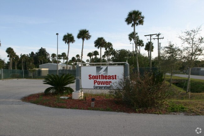
1807 Hammock Rd
21-35-21-00-00508.0-0000.00
PART OF SW 1/4 & PT OF GOVT LOT 3 AS DES IN ORB 220 PG 481 PAR 753 EX RD R/W
Heavyindustrial
Brevard
AE
Florida
12009C0115H
3
2024
13.75 AC
2025
Brevard County
060500
Orlando
40,455 SF
Palm Bay-Melbourne-Titusville, FL
DEMOGRAPHICS near 1807 Hammock Rd
1 Mile
3 Mile
5 Mile
2024 Total Population
817
21,168
45,746
2029 Population
904
23,157
50,307
Pop Growth 2024-2029
+ 10.65%
+ 9.40%
+ 9.97%
Average Age
52
45
44
2024 Total Households
353
8,731
19,343
HH Growth 2024-2029
+ 10.48%
+ 9.23%
+ 9.84%
Median Household Inc
$46,250
$48,429
$50,541
Avg Household Size
2.10
2.30
2.30
2024 Avg HH Vehicles
2.00
2.00
2.00
Median Home Value
$178,333
$196,720
$218,119
Median Year Built
1983
1977
1982
Nearby Places
Map Layers
Map Styles
 Street
 Aerial
- Restaurants
- Banks
- Shops
- Fitness
- Groceries
PUBLIC TRANSPORTATION
AIRPORT
Orlando Sanford International
DRIVE
WALK
Distance
Orlando Sanford International
49 min
32.6 mi
Orlando International
DRIVE
WALK
Distance
Orlando International
58 min
45.5 mi
Freight Ports
Port Canaveral
DRIVE
WALK
Distance
Port Canaveral
44 min
27.9 mi
Nearby Properties
Address
Land Use
TOTAL SIZE
Lot Size
Zoning
Address
Land Use
TOTAL SIZE
Lot Size
Zoning
440,368 SF
60.44 AC
HM
Address
Land Use
TOTAL SIZE
Lot Size
Zoning
18,000 SF
16.54 AC
P
Address
Land Use
TOTAL SIZE
Lot Size
Zoning
172,172 SF
116.12 AC
P
Address
Land Use
TOTAL SIZE
Lot Size
Zoning
267,207 SF
36.82 AC
P
Address
Land Use
TOTAL SIZE
Lot Size
Zoning
3.25 AC
P
Address
Land Use
TOTAL SIZE
Lot Size
Zoning
130,615 SF
16.15 AC
RC
Address
Land Use
TOTAL SIZE
Lot Size
Zoning
187,335 SF
5.92 AC
P
Address
Land Use
TOTAL SIZE
Lot Size
Zoning
87,904 SF
13.16 AC
RU19
Address
Land Use
TOTAL SIZE
Lot Size
Zoning
54,816 SF
10.11 AC
BU-1
Address
Land Use
TOTAL SIZE
Lot Size
Zoning
79,548 SF
4.89 AC
R3
Address
Land Use
TOTAL SIZE
Lot Size
Zoning
113,576 SF
19.98 AC
P
Address
Land Use
TOTAL SIZE
Lot Size
Zoning
163,141 SF
18.58 AC
P
Address
Land Use
TOTAL SIZE
Lot Size
Zoning
2,536 SF
75.81 AC
OR
Address
Land Use
TOTAL SIZE
Lot Size
Zoning
64,036 SF
2.45 AC
R3
Address
Land Use
TOTAL SIZE
Lot Size
Zoning
46.75 AC
GML
Address
Land Use
TOTAL SIZE
Lot Size
Zoning
97,463 SF
19.50 AC
P
Address
Land Use
TOTAL SIZE
Lot Size
Zoning
111,540 SF
6.83 AC
R3
Address
Land Use
TOTAL SIZE
Lot Size
Zoning
68,385 SF
12 AC
P
Address
Land Use
TOTAL SIZE
Lot Size
Zoning
68,376 SF
2.57 AC
R3
Address
Land Use
TOTAL SIZE
Lot Size
Zoning
109,709 SF
5.83 AC
M1
Address
Land Use
TOTAL SIZE
Lot Size
Zoning
87,836 SF
8.89 AC
CC
Address
Land Use
TOTAL SIZE
Lot Size
Zoning
47,960 SF
4.39 AC
R3
Address
Land Use
TOTAL SIZE
Lot Size
Zoning
69,829 SF
4.57 AC
CBD
Address
Land Use
TOTAL SIZE
Lot Size
Zoning
67,723 SF
128.21 AC
P
Address
Land Use
TOTAL SIZE
Lot Size
Zoning
67,874 SF
6.29 AC
R2
Address
Land Use
TOTAL SIZE
Lot Size
Zoning
63,506 SF
18.94 AC
GU
Address
Land Use
TOTAL SIZE
Lot Size
Zoning
47,643 SF
12.90 AC
OP
Address
Land Use
TOTAL SIZE
Lot Size
Zoning
47,186 SF
1.71 AC
R3
Address
Land Use
TOTAL SIZE
Lot Size
Zoning
79,025 SF
10.99 AC
Address
Land Use
TOTAL SIZE
Lot Size
Zoning
24,586 SF
2.23 AC
CC
The World's #1 Commercial Real Estate Marketplace
Connect with us
© 2026 CoStar Group
The information above has been obtained from sources believed reliable. While we do not doubt its accuracy we have not verified it and make no guarantee, warranty or representation about it. It is your responsibility to independently confirm its accuracy and completeness. Any projections, opinions, assumptions, or estimates used are for example only and do not represent the current or future performance of the property. The value of this transaction to you depends on tax and other factors which should be evaluated by your tax, financial, and legal advisors. You and your advisors should conduct a careful, independent investigation of the property to determine to your satisfaction the suitability of the property for your needs.