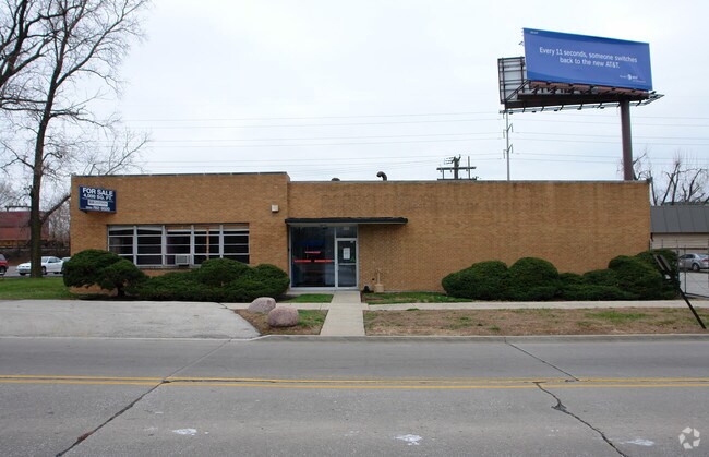
Property Record
1808 Beach St, Broadview, IL 60155


NEARBY LISTINGS FOR SALE OR LEASE
Property Detail
1808 Beach St
15-16-410-014-0000
Shekleton Brothers 25Th Ave
Industrialgeneral
Cook
X
Illinois
17031C0476J
a
2023
0.24 AC
2025
West Cook South
818000
Chicago
3,930 SF
Chicago-Naperville-Elgin, IL-IN
DEMOGRAPHICS near 1808 Beach St
1 Mile
3 Mile
5 Mile
2024 Total Population
20,903
138,837
449,837
2029 Population
20,310
134,200
435,872
Pop Growth 2024-2029
(2.84%)
(3.34%)
(3.10%)
Average Age
41
41
40
2024 Total Households
7,504
49,914
165,742
HH Growth 2024-2029
(3.13%)
(3.62%)
(3.33%)
Median Household Inc
$68,825
$70,869
$80,495
Avg Household Size
2.70
2.70
2.60
2024 Avg HH Vehicles
2.00
2.00
2.00
Median Home Value
$204,349
$243,176
$299,828
Median Year Built
1952
1954
1952
Nearby Places
Map Layers
Map Styles
 Street
 Aerial
- Restaurants
- Banks
- Shops
- Fitness
- Groceries
PUBLIC TRANSPORTATION
COMMUTER RAIL
Melrose Park Station (Union Pacific West Line - Northeast Illinois Regional Commuter Railroad (Metra))
DRIVE
WALK
Distance
Melrose Park Station (Union Pacific West Line - Northeast Illinois Regional Commuter Railroad (Metra))
4 min
2.1 mi
Bellwood Station (Union Pacific West Line - Northeast Illinois Regional Commuter Railroad (Metra))
DRIVE
WALK
Distance
Bellwood Station (Union Pacific West Line - Northeast Illinois Regional Commuter Railroad (Metra))
6 min
2.7 mi
AIRPORT
Chicago Midway International
DRIVE
WALK
Distance
Chicago Midway International
19 min
10.5 mi
Chicago O'Hare International
DRIVE
WALK
Distance
Chicago O'Hare International
20 min
11.1 mi
Freight Ports
Port Milwaukee
DRIVE
WALK
Distance
Port Milwaukee
104 min
83.5 mi
Nearby Properties
Address
Land Use
TOTAL SIZE
Lot Size
Zoning
Address
Land Use
TOTAL SIZE
Lot Size
Zoning
86.63 AC
Address
Land Use
TOTAL SIZE
Lot Size
Zoning
Address
Land Use
TOTAL SIZE
Lot Size
Zoning
516,605 SF
16.29 AC
Address
Land Use
TOTAL SIZE
Lot Size
Zoning
790,000 SF
31.71 AC
Address
Land Use
TOTAL SIZE
Lot Size
Zoning
6.26 AC
Address
Land Use
TOTAL SIZE
Lot Size
Zoning
8.53 AC
Address
Land Use
TOTAL SIZE
Lot Size
Zoning
1,156,393 SF
6.55 AC
Address
Land Use
TOTAL SIZE
Lot Size
Zoning
6.11 AC
Address
Land Use
TOTAL SIZE
Lot Size
Zoning
276,458 SF
16.14 AC
Address
Land Use
TOTAL SIZE
Lot Size
Zoning
7.16 AC
Address
Land Use
TOTAL SIZE
Lot Size
Zoning
8.01 AC
Address
Land Use
TOTAL SIZE
Lot Size
Zoning
389,155 SF
17.69 AC
Address
Land Use
TOTAL SIZE
Lot Size
Zoning
Address
Land Use
TOTAL SIZE
Lot Size
Zoning
51.12 AC
Address
Land Use
TOTAL SIZE
Lot Size
Zoning
137,144 SF
11.77 AC
Address
Land Use
TOTAL SIZE
Lot Size
Zoning
432,777 SF
22.29 AC
Address
Land Use
TOTAL SIZE
Lot Size
Zoning
184,970 SF
11.64 AC
Address
Land Use
TOTAL SIZE
Lot Size
Zoning
479,130 SF
15.80 AC
Address
Land Use
TOTAL SIZE
Lot Size
Zoning
108,276 SF
3.80 AC
Address
Land Use
TOTAL SIZE
Lot Size
Zoning
13.60 AC
Address
Land Use
TOTAL SIZE
Lot Size
Zoning
225,000 SF
5.82 AC
Address
Land Use
TOTAL SIZE
Lot Size
Zoning
139,665 SF
11.63 AC
Address
Land Use
TOTAL SIZE
Lot Size
Zoning
1.65 AC
Address
Land Use
TOTAL SIZE
Lot Size
Zoning
15.14 AC
Address
Land Use
TOTAL SIZE
Lot Size
Zoning
13.20 AC
Address
Land Use
TOTAL SIZE
Lot Size
Zoning
101,146 SF
2.24 AC
Address
Land Use
TOTAL SIZE
Lot Size
Zoning
320,928 SF
13.46 AC
Address
Land Use
TOTAL SIZE
Lot Size
Zoning
193,511 SF
17.89 AC
Address
Land Use
TOTAL SIZE
Lot Size
Zoning
53,800 SF
0.88 AC
Address
Land Use
TOTAL SIZE
Lot Size
Zoning
318,305 SF
12.71 AC
The World's #1 Commercial Real Estate Marketplace
Connect with us
© 2026 CoStar Group
The information above has been obtained from sources believed reliable. While we do not doubt its accuracy we have not verified it and make no guarantee, warranty or representation about it. It is your responsibility to independently confirm its accuracy and completeness. Any projections, opinions, assumptions, or estimates used are for example only and do not represent the current or future performance of the property. The value of this transaction to you depends on tax and other factors which should be evaluated by your tax, financial, and legal advisors. You and your advisors should conduct a careful, independent investigation of the property to determine to your satisfaction the suitability of the property for your needs.