Property Record
181 Cherry Valley Rd, Princeton, NJ 08540


NEARBY LISTINGS FOR SALE OR LEASE
Property Detail
181 Cherry Valley Rd
Lakewood-New Brunswick, NJ
Yorkshire Woods Ph Iib & 03
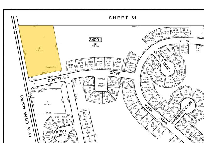
13-34001-0000-00041
ALSO LOT 41-Q LAND CODE 3B
Officebuilding
Somerset
X
New Jersey
34021C0043F
41
2024
2.50 AC
2025
Princeton North
054201
Northern New Jersey
DEMOGRAPHICS near 181 Cherry Valley Rd
1 mile
3 mile
5 mile
2024 Total Population
3,302
32,746
65,227
2029 Population
3,277
32,738
65,298
Pop Growth 2024-2029
(0.76%)
(0.02%)
+ 0.11%
Average Age
43
42
42
2024 Total Households
1,198
12,102
23,491
HH Growth 2024-2029
(0.92%)
(0.14%)
+ 0.14%
Median Household Inc
$202,805
$174,875
$170,622
Avg Household Size
2.70
2.60
2.60
2024 Avg HH Vehicles
2.00
2.00
2.00
Median Home Value
$740,319
$772,635
$744,702
Median Year Built
1990
1981
1984
Nearby Places
Map Layers
Map Styles
 Street
 Aerial
Transit
 Traffic
 Biking
Places
Listings with unknown addresses are not visible on the map
- Restaurants
- Banks
- Shops
- Fitness
- Groceries
PUBLIC TRANSPORTATION
COMMUTER RAIL
Princeton (Princeton Branch - NJ Transit Commuter Rail (NJ Transit))
Drive
Walk
Distance
Princeton (Princeton Branch - NJ Transit Commuter Rail (NJ Transit))
10 min
4.0 mi
Princeton Junction (Northeast Corridor Line - NJ Transit Commuter Rail (NJ Transit), Princeton Branch - NJ Transit Commuter Rail (NJ Transit))
Drive
Walk
Distance
Princeton Junction (Northeast Corridor Line - NJ Transit Commuter Rail (NJ Transit), Princeton Branch - NJ Transit Commuter Rail (NJ Transit))
16 min
6.6 mi
AIRPORT
Trenton Mercer
Drive
Walk
Distance
Trenton Mercer
29 min
13.7 mi
Newark Liberty International
Drive
Walk
Distance
Newark Liberty International
63 min
41.9 mi
Freight Ports
New York Container Terminal
Drive
Walk
Distance
New York Container Terminal
58 min
37.0 mi
Nearby Properties
Address
Land Use
TOTAL SIZE
Lot Size
Zoning
Address
Land Use
TOTAL SIZE
Lot Size
Zoning
75.25 AC
Address
Land Use
TOTAL SIZE
Lot Size
Zoning
8.97 AC
HMC
Address
Land Use
TOTAL SIZE
Lot Size
Zoning
115,000 SF
7.98 AC
OR2
Address
Land Use
TOTAL SIZE
Lot Size
Zoning
405,811 SF
4.14 AC
Address
Land Use
TOTAL SIZE
Lot Size
Zoning
216,000 SF
22.79 AC
SC
Address
Land Use
TOTAL SIZE
Lot Size
Zoning
Address
Land Use
TOTAL SIZE
Lot Size
Zoning
2.49 AC
E3
Address
Land Use
TOTAL SIZE
Lot Size
Zoning
2.29 AC
Address
Land Use
TOTAL SIZE
Lot Size
Zoning
151,475 SF
2.12 AC
E1
Address
Land Use
TOTAL SIZE
Lot Size
Zoning
21.79 AC
R3
Address
Land Use
TOTAL SIZE
Lot Size
Zoning
52,000 SF
0.62 AC
CBCP
Address
Land Use
TOTAL SIZE
Lot Size
Zoning
167,546 SF
3.08 AC
Address
Land Use
TOTAL SIZE
Lot Size
Zoning
36.45 AC
E4
Address
Land Use
TOTAL SIZE
Lot Size
Zoning
0.26 AC
OR2
Address
Land Use
TOTAL SIZE
Lot Size
Zoning
108,653 SF
1.93 AC
E1
Address
Land Use
TOTAL SIZE
Lot Size
Zoning
4.44 AC
Address
Land Use
TOTAL SIZE
Lot Size
Zoning
72,000 SF
0.09 AC
CB
Address
Land Use
TOTAL SIZE
Lot Size
Zoning
152,220 SF
2.21 AC
Address
Land Use
TOTAL SIZE
Lot Size
Zoning
86,765 SF
2.07 AC
E2
Address
Land Use
TOTAL SIZE
Lot Size
Zoning
30 AC
E4
Address
Land Use
TOTAL SIZE
Lot Size
Zoning
480 SF
5.23 AC
Address
Land Use
TOTAL SIZE
Lot Size
Zoning
23,067 SF
4.46 AC
Address
Land Use
TOTAL SIZE
Lot Size
Zoning
6.96 AC
Address
Land Use
TOTAL SIZE
Lot Size
Zoning
149,709 SF
2.36 AC
Address
Land Use
TOTAL SIZE
Lot Size
Zoning
72,988 SF
1.51 AC
Address
Land Use
TOTAL SIZE
Lot Size
Zoning
4.39 AC
Address
Land Use
TOTAL SIZE
Lot Size
Zoning
27.04 AC
R1
Address
Land Use
TOTAL SIZE
Lot Size
Zoning
35.71 AC
OR1
Address
Land Use
TOTAL SIZE
Lot Size
Zoning
88,479 SF
2.42 AC
Address
Land Use
TOTAL SIZE
Lot Size
Zoning
10 AC
OR1
The World's #1 Commercial Real Estate Marketplace
Connect with us
© 2026 CoStar Group
The information above has been obtained from sources believed reliable. While we do not doubt its accuracy we have not verified it and make no guarantee, warranty or representation about it. It is your responsibility to independently confirm its accuracy and completeness. Any projections, opinions, assumptions, or estimates used are for example only and do not represent the current or future performance of the property. The value of this transaction to you depends on tax and other factors which should be evaluated by your tax, financial, and legal advisors. You and your advisors should conduct a careful, independent investigation of the property to determine to your satisfaction the suitability of the property for your needs.