Property Record
181 Countess Rd Ne, Huntsville, AL 35810
NEARBY LISTINGS FOR SALE OR LEASE
-
-
View all Huntsville listings for sale on LoopNet.com
Property Detail
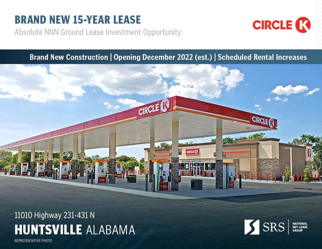
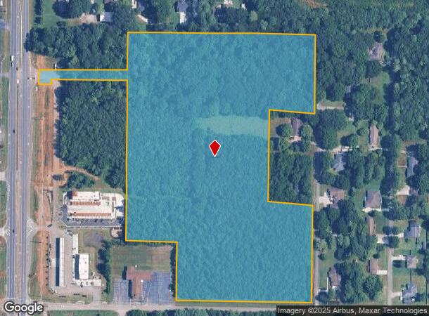
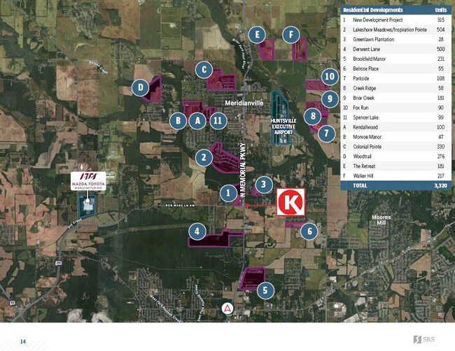
181 Countess Rd Ne
Huntsville, AL
Northern Hills Subdivision
08-09-30-0-002-002.000
LOT 1A NORTHERN HILLS SUB PH 2 PB# 2022-411
Residentialacreage
Madison
X
Alabama
01089C0179F
1a
2025
21 AC
2025
North Madison County
010705
Huntsville
1,288 SF
DEMOGRAPHICS near 181 Countess Rd Ne
1 Mile
3 Mile
5 Mile
2024 Total Population
1,354
17,321
51,407
2029 Population
1,489
19,288
56,994
Pop Growth 2024-2029
+ 9.97%
+ 11.36%
+ 10.87%
Average Age
40
40
39
2024 Total Households
529
6,412
18,605
HH Growth 2024-2029
+ 10.40%
+ 12.21%
+ 11.99%
Median Household Inc
$74,624
$77,315
$67,996
Avg Household Size
2.50
2.50
2.50
2024 Avg HH Vehicles
2.00
2.00
2.00
Median Home Value
$215,341
$220,598
$203,799
Median Year Built
1997
1997
1990
Nearby Places
Map Layers
Map Styles
 Street
 Aerial
- Restaurants
- Banks
- Shops
- Fitness
- Groceries
PUBLIC TRANSPORTATION
AIRPORT
Huntsville International-Carl T Jones Field
DRIVE
WALK
Distance
Huntsville International-Carl T Jones Field
30 min
20.9 mi
Freight Ports
Port of Mobile
DRIVE
WALK
Distance
Port of Mobile
397 min
362.1 mi
SALE & LEASE HISTORY
LISTING DATE
SALE/LEASE

Oct 24, 2022
For Sale
Nearby Properties
Address
Land Use
TOTAL SIZE
Lot Size
Zoning
Address
Land Use
TOTAL SIZE
Lot Size
Zoning
57,106 SF
47 AC
Address
Land Use
TOTAL SIZE
Lot Size
Zoning
69,640 SF
44 SF
Address
Land Use
TOTAL SIZE
Lot Size
Zoning
21,990 SF
11 AC
Address
Land Use
TOTAL SIZE
Lot Size
Zoning
20.80 AC
Address
Land Use
TOTAL SIZE
Lot Size
Zoning
30,000 SF
Address
Land Use
TOTAL SIZE
Lot Size
Zoning
3,293 SF
3 AC
Address
Land Use
TOTAL SIZE
Lot Size
Zoning
4,980 SF
3.90 AC
Address
Land Use
TOTAL SIZE
Lot Size
Zoning
12,600 SF
6.60 AC
Address
Land Use
TOTAL SIZE
Lot Size
Zoning
3,450 SF
4.48 AC
Address
Land Use
TOTAL SIZE
Lot Size
Zoning
55,319 SF
6.16 AC
Address
Land Use
TOTAL SIZE
Lot Size
Zoning
2,012 SF
47 AC
Address
Land Use
TOTAL SIZE
Lot Size
Zoning
16,281 SF
11.64 AC
Address
Land Use
TOTAL SIZE
Lot Size
Zoning
4,894 SF
4.98 AC
Address
Land Use
TOTAL SIZE
Lot Size
Zoning
2,910 SF
6.83 AC
Address
Land Use
TOTAL SIZE
Lot Size
Zoning
22,800 SF
4.26 AC
Address
Land Use
TOTAL SIZE
Lot Size
Zoning
6,000 SF
44 AC
Address
Land Use
TOTAL SIZE
Lot Size
Zoning
12,299 SF
23 AC
Address
Land Use
TOTAL SIZE
Lot Size
Zoning
1,686 SF
3.70 AC
Address
Land Use
TOTAL SIZE
Lot Size
Zoning
30,000 SF
19 AC
Address
Land Use
TOTAL SIZE
Lot Size
Zoning
47 AC
Address
Land Use
TOTAL SIZE
Lot Size
Zoning
21,412 SF
9.10 AC
Address
Land Use
TOTAL SIZE
Lot Size
Zoning
29,758 SF
8.35 AC
Address
Land Use
TOTAL SIZE
Lot Size
Zoning
5,480 SF
4.59 AC
Address
Land Use
TOTAL SIZE
Lot Size
Zoning
11,599 SF
4.46 AC
Address
Land Use
TOTAL SIZE
Lot Size
Zoning
6,800 SF
3.30 AC
Address
Land Use
TOTAL SIZE
Lot Size
Zoning
11,951 SF
21 AC
Address
Land Use
TOTAL SIZE
Lot Size
Zoning
Address
Land Use
TOTAL SIZE
Lot Size
Zoning
9,142 SF
2.51 AC
Address
Land Use
TOTAL SIZE
Lot Size
Zoning
7,500 SF
9.89 AC
The World's #1 Commercial Real Estate Marketplace
Connect with us
© 2025 CoStar Group
The information above has been obtained from sources believed reliable. While we do not doubt its accuracy we have not verified it and make no guarantee, warranty or representation about it. It is your responsibility to independently confirm its accuracy and completeness. Any projections, opinions, assumptions, or estimates used are for example only and do not represent the current or future performance of the property. The value of this transaction to you depends on tax and other factors which should be evaluated by your tax, financial, and legal advisors. You and your advisors should conduct a careful, independent investigation of the property to determine to your satisfaction the suitability of the property for your needs.