Property Record
181 Library Rd, Jacksonville, FL 32225


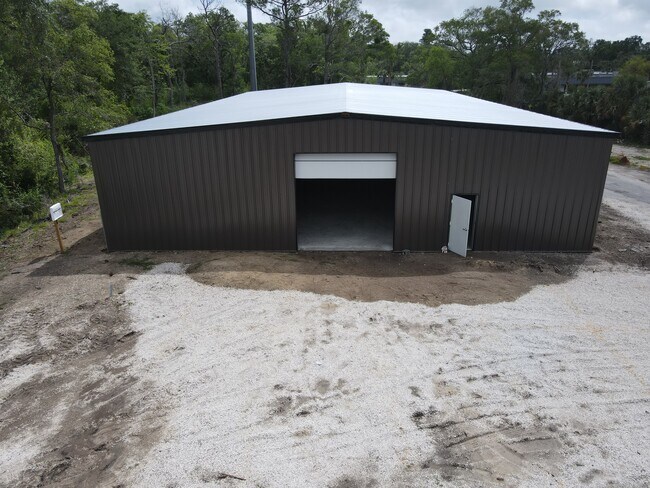

Property Detail
181 Library Rd
162883-2120
18-2S-28E 1.457 PT LOT 16 RECD O/R 21204-1114
Autorepair
Duval
CCG-2
Florida
B and X Area of moderate flood hazard, usually the area between the limits of the 100-year and 500-year floods.
16
2025
1.46 AC
2026
Arlington
014604
Jacksonville (Florida)
10,476 SF
Jacksonville, FL
NEARBY LISTINGS FOR SALE OR LEASE
DEMOGRAPHICS near 181 Library Rd
1 mile
3 mile
5 mile
2025 Total Population
9,167
88,197
222,629
2030 Population
9,808
93,134
234,247
Pop Growth 2025-2030
+ 6.99%
+ 5.60%
+ 5.22%
Average Age
37
38
38
2025 Total Households
4,053
34,652
88,587
HH Growth 2025-2030
+ 7.38%
+ 5.88%
+ 5.52%
Median Household Inc
$45,947
$61,440
$70,700
Avg Household Size
2.20
2.50
2.40
2025 Avg HH Vehicles
1.00
2.00
2.00
Median Home Value
$224,102
$264,472
$309,919
Median Year Built
1983
1984
1987
Nearby Places
Map Layers
Map Styles
 Street
 Aerial
Layers
 Traffic
 Biking
Places
Listings with unknown addresses are not visible on the map
- Restaurants
- Banks
- Shops
- Fitness
- Groceries
PUBLIC TRANSPORTATION
AIRPORT
Jacksonville International
Drive
Walk
Distance
Jacksonville International
28 min
18.2 mi
Freight Ports
Jacksonville Port
Drive
Walk
Distance
Jacksonville Port
16 min
8.7 mi
SALE & LEASE HISTORY
LISTING DATE
SALE/LEASE

Sep 27, 2024
For Lease
Jun 25, 2020
For Sale
Jun 25, 2020
For Sale
Jun 02, 2023
For Sale
Nearby Properties
Address
Land Use
TOTAL SIZE
Lot Size
Zoning
Address
Land Use
TOTAL SIZE
Lot Size
Zoning
565,202 SF
33.92 AC
RMD-D
Address
Land Use
TOTAL SIZE
Lot Size
Zoning
361,268 SF
15.27 AC
PUD
Address
Land Use
TOTAL SIZE
Lot Size
Zoning
327,165 SF
25 AC
RMD-D
Address
Land Use
TOTAL SIZE
Lot Size
Zoning
557,032 SF
40.06 AC
PUD
Address
Land Use
TOTAL SIZE
Lot Size
Zoning
277,959 SF
14.39 AC
PUD
Address
Land Use
TOTAL SIZE
Lot Size
Zoning
471,372 SF
1,067.68 AC
PUD
Address
Land Use
TOTAL SIZE
Lot Size
Zoning
308,517 SF
19.55 AC
PUD
Address
Land Use
TOTAL SIZE
Lot Size
Zoning
266,120 SF
14.60 AC
PUD
Address
Land Use
TOTAL SIZE
Lot Size
Zoning
430,668 SF
27.20 AC
RMD-D
Address
Land Use
TOTAL SIZE
Lot Size
Zoning
323,318 SF
19.24 AC
PUD
Address
Land Use
TOTAL SIZE
Lot Size
Zoning
321,335 SF
19.83 AC
RMD-D
Address
Land Use
TOTAL SIZE
Lot Size
Zoning
302,406 SF
20.54 AC
RMD-D
Address
Land Use
TOTAL SIZE
Lot Size
Zoning
300,360 SF
14.44 AC
RMD-C
Address
Land Use
TOTAL SIZE
Lot Size
Zoning
232,520 SF
12.37 AC
RMD-D
Address
Land Use
TOTAL SIZE
Lot Size
Zoning
184,563 SF
125.66 AC
PBF-1
Address
Land Use
TOTAL SIZE
Lot Size
Zoning
210,913 SF
10.32 AC
PUD
Address
Land Use
TOTAL SIZE
Lot Size
Zoning
210,829 SF
11.84 AC
RMD-D
Address
Land Use
TOTAL SIZE
Lot Size
Zoning
184,221 SF
12.05 AC
PUD
Address
Land Use
TOTAL SIZE
Lot Size
Zoning
154,382 SF
8.67 AC
RMD-D
Address
Land Use
TOTAL SIZE
Lot Size
Zoning
166,588 SF
10.40 AC
RMD-D
Address
Land Use
TOTAL SIZE
Lot Size
Zoning
196,639 SF
17.44 AC
RMD-C
Address
Land Use
TOTAL SIZE
Lot Size
Zoning
214,460 SF
19.77 AC
RMD-C
Address
Land Use
TOTAL SIZE
Lot Size
Zoning
164,330 SF
9.04 AC
PUD
Address
Land Use
TOTAL SIZE
Lot Size
Zoning
267,103 SF
17.31 AC
RMD-C
Address
Land Use
TOTAL SIZE
Lot Size
Zoning
125,088 SF
6.62 AC
RMD-D
Address
Land Use
TOTAL SIZE
Lot Size
Zoning
245,531 SF
17.37 AC
CCG-1
Address
Land Use
TOTAL SIZE
Lot Size
Zoning
80,308 SF
12.07 AC
PUD
Address
Land Use
TOTAL SIZE
Lot Size
Zoning
122,854 SF
12.25 AC
PUD
Address
Land Use
TOTAL SIZE
Lot Size
Zoning
180,180 SF
11.06 AC
CRO
Address
Land Use
TOTAL SIZE
Lot Size
Zoning
171,731 SF
17.56 AC
RMD-D
The World's #1 Commercial Real Estate Marketplace
Connect with us
© 2026 CoStar Group
The information above has been obtained from sources believed reliable. While we do not doubt its accuracy we have not verified it and make no guarantee, warranty or representation about it. It is your responsibility to independently confirm its accuracy and completeness. Any projections, opinions, assumptions, or estimates used are for example only and do not represent the current or future performance of the property. The value of this transaction to you depends on tax and other factors which should be evaluated by your tax, financial, and legal advisors. You and your advisors should conduct a careful, independent investigation of the property to determine to your satisfaction the suitability of the property for your needs.