Property Record
S Stoddard Ave, San Bernardino, CA 92408
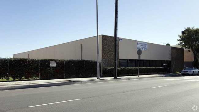

This Property Is For Sale
Property Detail
S Stoddard Ave
Riverside-San Bernardino-Ontario, CA
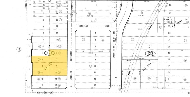
THE PEPPERS LOTS 15 AND 16 BLK A
0136-121-13
SAN BERNARDINO
Vacantlandnec
California
B and X Area of moderate flood hazard, usually the area between the limits of the 100-year and 500-year floods.
15,16
2025
0.31 AC
2025
San Bernardino
007202
Inland Empire (California)
NEARBY LISTINGS FOR SALE OR LEASE
DEMOGRAPHICS near S Stoddard Ave
1 mile
3 mile
5 mile
2025 Total Population
9,082
132,997
371,003
2030 Population
9,224
134,247
375,486
Pop Growth 2025-2030
+ 1.56%
+ 0.94%
+ 1.21%
Average Age
37
35
35
2025 Total Households
3,089
36,531
107,052
HH Growth 2025-2030
+ 2.27%
+ 1.05%
+ 1.32%
Median Household Inc
$33,460
$58,150
$66,883
Avg Household Size
2.80
3.50
3.30
2025 Avg HH Vehicles
1.00
2.00
2.00
Median Home Value
$329,864
$372,473
$421,414
Median Year Built
1973
1963
1970
Nearby Places
Map Layers
Map Styles
 Street
 Aerial
Layers
 Traffic
 Biking
Places
Listings with unknown addresses are not visible on the map
- Restaurants
- Banks
- Shops
- Fitness
- Groceries
PUBLIC TRANSPORTATION
COMMUTER RAIL
San Bernardino - Downtown Metrolink Station (Metrolink Inland Empire-Orange County Line - Metrolink Trains, Metrolink San Bernardino Line - Metrolink Trains)
Drive
Walk
Distance
San Bernardino - Downtown Metrolink Station (Metrolink Inland Empire-Orange County Line - Metrolink Trains, Metrolink San Bernardino Line - Metrolink Trains)
2 min
9 min
0.5 mi
San Bernardino (Inland Empire-Orange County Line - Southern California Regional Rail Authority (Metrolink), San Bernardino Line - Southern California Regional Rail Authority (Metrolink))
Drive
Walk
Distance
San Bernardino (Inland Empire-Orange County Line - Southern California Regional Rail Authority (Metrolink), San Bernardino Line - Southern California Regional Rail Authority (Metrolink))
3 min
1.4 mi
AIRPORT
Ontario International
Drive
Walk
Distance
Ontario International
28 min
20.0 mi
Freight Ports
Port of Long Beach
Drive
Walk
Distance
Port of Long Beach
84 min
66.3 mi
Nearby Properties
Address
Land Use
TOTAL SIZE
Lot Size
Zoning
Address
Land Use
TOTAL SIZE
Lot Size
Zoning
2,134,798 SF
153.92 AC
Address
Land Use
TOTAL SIZE
Lot Size
Zoning
778,653 SF
19.31 AC
Address
Land Use
TOTAL SIZE
Lot Size
Zoning
457,253 SF
20.14 AC
Address
Land Use
TOTAL SIZE
Lot Size
Zoning
497,664 SF
56.39 AC
Address
Land Use
TOTAL SIZE
Lot Size
Zoning
1,032,072 SF
61.74 AC
Address
Land Use
TOTAL SIZE
Lot Size
Zoning
330,420 SF
15.31 AC
Address
Land Use
TOTAL SIZE
Lot Size
Zoning
1,081,199 SF
49.77 AC
Address
Land Use
TOTAL SIZE
Lot Size
Zoning
300,188 SF
11.98 AC
Address
Land Use
TOTAL SIZE
Lot Size
Zoning
379,299 SF
19.97 AC
Address
Land Use
TOTAL SIZE
Lot Size
Zoning
1,139,976 SF
49.56 AC
Address
Land Use
TOTAL SIZE
Lot Size
Zoning
758,180 SF
31.86 AC
Address
Land Use
TOTAL SIZE
Lot Size
Zoning
391,468 SF
16.73 AC
Address
Land Use
TOTAL SIZE
Lot Size
Zoning
1,205,400 SF
58.05 AC
Address
Land Use
TOTAL SIZE
Lot Size
Zoning
210,418 SF
12.09 AC
Address
Land Use
TOTAL SIZE
Lot Size
Zoning
951,686 SF
47.90 AC
Address
Land Use
TOTAL SIZE
Lot Size
Zoning
913,716 SF
20 AC
Address
Land Use
TOTAL SIZE
Lot Size
Zoning
474,680 SF
17.95 AC
Address
Land Use
TOTAL SIZE
Lot Size
Zoning
851,880 SF
42.20 AC
Address
Land Use
TOTAL SIZE
Lot Size
Zoning
404,725 SF
19.29 AC
Address
Land Use
TOTAL SIZE
Lot Size
Zoning
472,962 SF
23.28 AC
Address
Land Use
TOTAL SIZE
Lot Size
Zoning
178,926 SF
9.12 AC
IC
Address
Land Use
TOTAL SIZE
Lot Size
Zoning
549,796 SF
13.61 AC
Address
Land Use
TOTAL SIZE
Lot Size
Zoning
344,757 SF
14.89 AC
Address
Land Use
TOTAL SIZE
Lot Size
Zoning
335,000 SF
8.44 AC
Address
Land Use
TOTAL SIZE
Lot Size
Zoning
151,859 SF
7.23 AC
Address
Land Use
TOTAL SIZE
Lot Size
Zoning
415,405 SF
18.43 AC
IC
Address
Land Use
TOTAL SIZE
Lot Size
Zoning
592,710 SF
28.89 AC
Address
Land Use
TOTAL SIZE
Lot Size
Zoning
318,940 SF
14.26 AC
Address
Land Use
TOTAL SIZE
Lot Size
Zoning
154,639 SF
6.87 AC
Address
Land Use
TOTAL SIZE
Lot Size
Zoning
599,690 SF
17.08 AC
IC
The World's #1 Commercial Real Estate Marketplace
Connect with us
© 2026 CoStar Group
The information above has been obtained from sources believed reliable. While we do not doubt its accuracy we have not verified it and make no guarantee, warranty or representation about it. It is your responsibility to independently confirm its accuracy and completeness. Any projections, opinions, assumptions, or estimates used are for example only and do not represent the current or future performance of the property. The value of this transaction to you depends on tax and other factors which should be evaluated by your tax, financial, and legal advisors. You and your advisors should conduct a careful, independent investigation of the property to determine to your satisfaction the suitability of the property for your needs.