Property Record
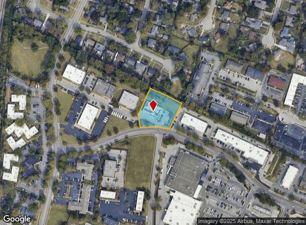
181 W Lowry Ln, Lexington, KY 40503
NEARBY LISTINGS FOR SALE OR LEASE
Property Detail
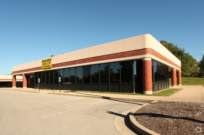
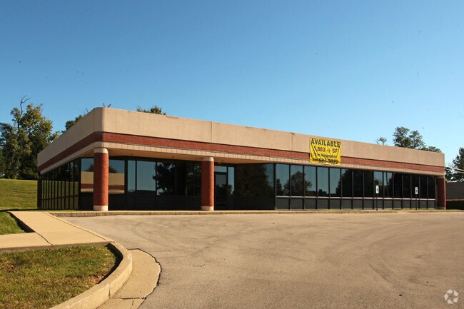
181 W Lowry Ln
Lexington-Fayette, KY
Regency Development
10034130
H-243 REGENCY DEVELOPMENT UNIT 2 LOT 5; BOOK: 3214 PAGE: 42
Officebuilding
Fayette
X
Kentucky
2100670119E
5
2025
0.99 AC
2025
West Lexington/Fayette
002800
Lexington/Fayette
5,861 SF
DEMOGRAPHICS near 181 W Lowry Ln
1 Mile
3 Mile
5 Mile
2024 Total Population
9,760
124,430
242,096
2029 Population
9,698
124,080
241,968
Pop Growth 2024-2029
(0.64%)
(0.28%)
(0.05%)
Average Age
41
38
38
2024 Total Households
4,460
53,795
103,915
HH Growth 2024-2029
(0.74%)
(0.28%)
(0.06%)
Median Household Inc
$68,339
$57,213
$57,745
Avg Household Size
2.20
2.10
2.20
2024 Avg HH Vehicles
2.00
2.00
2.00
Median Home Value
$259,342
$265,733
$256,260
Median Year Built
1959
1976
1979
Nearby Places
Map Layers
Map Styles
 Street
 Aerial
- Restaurants
- Banks
- Shops
- Fitness
- Groceries
PUBLIC TRANSPORTATION
AIRPORT
Blue Grass
DRIVE
WALK
Distance
Blue Grass
17 min
9.0 mi
SALE & LEASE HISTORY
LISTING DATE
SALE/LEASE

Nov 02, 2018
For Lease
Nearby Properties
Address
Land Use
TOTAL SIZE
Lot Size
Zoning
Address
Land Use
TOTAL SIZE
Lot Size
Zoning
3,896 SF
0.49 AC
B-4
Address
Land Use
TOTAL SIZE
Lot Size
Zoning
635,961 SF
23.52 AC
P-1
Address
Land Use
TOTAL SIZE
Lot Size
Zoning
510,633 SF
15.10 AC
P-1
Address
Land Use
TOTAL SIZE
Lot Size
Zoning
372,139 SF
4.82 AC
R-4
Address
Land Use
TOTAL SIZE
Lot Size
Zoning
82.77 AC
R-4
Address
Land Use
TOTAL SIZE
Lot Size
Zoning
Address
Land Use
TOTAL SIZE
Lot Size
Zoning
87 SF
R-4
Address
Land Use
TOTAL SIZE
Lot Size
Zoning
Address
Land Use
TOTAL SIZE
Lot Size
Zoning
582.34 AC
A-U
Address
Land Use
TOTAL SIZE
Lot Size
Zoning
76,441 SF
63.86 AC
A-U
Address
Land Use
TOTAL SIZE
Lot Size
Zoning
319,500 SF
0.25 AC
P-1
Address
Land Use
TOTAL SIZE
Lot Size
Zoning
318,370 SF
17.79 AC
B-6P
Address
Land Use
TOTAL SIZE
Lot Size
Zoning
301,644 SF
38.07 AC
R-1C
Address
Land Use
TOTAL SIZE
Lot Size
Zoning
292,730 SF
3.18 AC
R-1C
Address
Land Use
TOTAL SIZE
Lot Size
Zoning
394,590 SF
14.76 AC
R-4
Address
Land Use
TOTAL SIZE
Lot Size
Zoning
4,299 SF
18.43 AC
R-4
Address
Land Use
TOTAL SIZE
Lot Size
Zoning
8,001 SF
32.59 AC
MU-3
Address
Land Use
TOTAL SIZE
Lot Size
Zoning
144,866 SF
14.83 AC
B-6P
Address
Land Use
TOTAL SIZE
Lot Size
Zoning
238,393 SF
9.83 AC
B-6P
Address
Land Use
TOTAL SIZE
Lot Size
Zoning
156,270 SF
11.18 AC
R-1C
Address
Land Use
TOTAL SIZE
Lot Size
Zoning
29,480 SF
4.60 AC
MU-3
Address
Land Use
TOTAL SIZE
Lot Size
Zoning
134,783 SF
1.36 AC
B-1
Address
Land Use
TOTAL SIZE
Lot Size
Zoning
8,078 SF
10.61 AC
R-5
Address
Land Use
TOTAL SIZE
Lot Size
Zoning
26,672 SF
1.24 AC
B-1
Address
Land Use
TOTAL SIZE
Lot Size
Zoning
384,037 SF
9.52 AC
P-1
Address
Land Use
TOTAL SIZE
Lot Size
Zoning
2,545 SF
14 AC
R-4
Address
Land Use
TOTAL SIZE
Lot Size
Zoning
25,920 SF
23.71 AC
R-2
Address
Land Use
TOTAL SIZE
Lot Size
Zoning
22.10 AC
R-3
Address
Land Use
TOTAL SIZE
Lot Size
Zoning
8,880 SF
7.39 AC
R-4
Address
Land Use
TOTAL SIZE
Lot Size
Zoning
41,040 SF
14.77 AC
R-4
The World's #1 Commercial Real Estate Marketplace
Connect with us
© 2025 CoStar Group
The information above has been obtained from sources believed reliable. While we do not doubt its accuracy we have not verified it and make no guarantee, warranty or representation about it. It is your responsibility to independently confirm its accuracy and completeness. Any projections, opinions, assumptions, or estimates used are for example only and do not represent the current or future performance of the property. The value of this transaction to you depends on tax and other factors which should be evaluated by your tax, financial, and legal advisors. You and your advisors should conduct a careful, independent investigation of the property to determine to your satisfaction the suitability of the property for your needs.