Property Record
1810 Clover Rd, Mishawaka, IN 46545


NEARBY LISTINGS FOR SALE OR LEASE
Property Detail
1810 Clover Rd
South Bend-Mishawaka, IN-MI
Citizens Home Co Mckinley Hy Plat
71-09-11-176-001.000-022
400 N&S X 601.85 E&W BEG 300 FT S OF SW COR LOT 87 CITIZENS HOME CO MCKINLEY HY PLAT SEC 11 37 3E
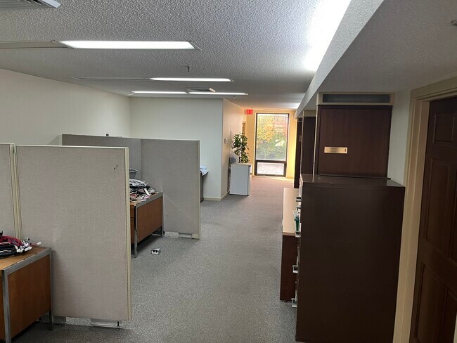
Warehouse
St Joseph
X
Indiana
18141C0217E
87
2023
5.52 AC
2024
Mishawaka
011503
South Bend/Mishawaka
59,480 SF
DEMOGRAPHICS near 1810 Clover Rd
1 Mile
3 Mile
5 Mile
2024 Total Population
4,181
59,525
141,296
2029 Population
4,143
59,181
141,000
Pop Growth 2024-2029
(0.91%)
(0.58%)
(0.21%)
Average Age
40
39
38
2024 Total Households
1,807
26,224
56,772
HH Growth 2024-2029
(1.00%)
(0.52%)
(0.15%)
Median Household Inc
$58,585
$53,140
$59,417
Avg Household Size
2.30
2.20
2.30
2024 Avg HH Vehicles
2.00
2.00
2.00
Median Home Value
$147,515
$143,874
$162,878
Median Year Built
1958
1969
1970
Nearby Places
Map Layers
Map Styles
 Street
 Aerial
- Restaurants
- Banks
- Shops
- Fitness
- Groceries
PUBLIC TRANSPORTATION
COMMUTER RAIL
DRIVE
WALK
Distance
17 min
7.5 mi
South Bend Airport Station (South Shore Line - Northern Indiana Commuter Transportation District (South Shore Line))
DRIVE
WALK
Distance
South Bend Airport Station (South Shore Line - Northern Indiana Commuter Transportation District (South Shore Line))
23 min
9.3 mi
AIRPORT
South Bend International
DRIVE
WALK
Distance
South Bend International
28 min
11.5 mi
Nearby Properties
Address
Land Use
TOTAL SIZE
Lot Size
Zoning
Address
Land Use
TOTAL SIZE
Lot Size
Zoning
560,184 SF
0.01 AC
Address
Land Use
TOTAL SIZE
Lot Size
Zoning
529,154 SF
131 SF
Address
Land Use
TOTAL SIZE
Lot Size
Zoning
397,501 SF
3.50 AC
Address
Land Use
TOTAL SIZE
Lot Size
Zoning
262,392 SF
Address
Land Use
TOTAL SIZE
Lot Size
Zoning
66,297 SF
131 SF
Address
Land Use
TOTAL SIZE
Lot Size
Zoning
2,584,820 SF
32.18 AC
Address
Land Use
TOTAL SIZE
Lot Size
Zoning
770,407 SF
0.01 AC
Address
Land Use
TOTAL SIZE
Lot Size
Zoning
220,913 SF
29.14 AC
Address
Land Use
TOTAL SIZE
Lot Size
Zoning
327,618 SF
39.65 AC
Address
Land Use
TOTAL SIZE
Lot Size
Zoning
65,986 SF
174 SF
Address
Land Use
TOTAL SIZE
Lot Size
Zoning
107,258 SF
1.61 AC
Address
Land Use
TOTAL SIZE
Lot Size
Zoning
124,260 SF
44 SF
Address
Land Use
TOTAL SIZE
Lot Size
Zoning
2,368,321 SF
32.52 AC
Address
Land Use
TOTAL SIZE
Lot Size
Zoning
112,424 SF
5 AC
Address
Land Use
TOTAL SIZE
Lot Size
Zoning
360,056 SF
19.59 AC
Address
Land Use
TOTAL SIZE
Lot Size
Zoning
92,030 SF
44 SF
Address
Land Use
TOTAL SIZE
Lot Size
Zoning
86,310 SF
87 SF
Address
Land Use
TOTAL SIZE
Lot Size
Zoning
218,000 SF
24.57 AC
Address
Land Use
TOTAL SIZE
Lot Size
Zoning
3,692,640 SF
0.01 AC
Address
Land Use
TOTAL SIZE
Lot Size
Zoning
216,257 SF
37.13 AC
Address
Land Use
TOTAL SIZE
Lot Size
Zoning
172,995 SF
14.44 AC
Address
Land Use
TOTAL SIZE
Lot Size
Zoning
54,226 SF
44 SF
Address
Land Use
TOTAL SIZE
Lot Size
Zoning
35,687 SF
44 SF
Address
Land Use
TOTAL SIZE
Lot Size
Zoning
142,671 SF
11.73 AC
Address
Land Use
TOTAL SIZE
Lot Size
Zoning
100,191 SF
11.72 AC
Address
Land Use
TOTAL SIZE
Lot Size
Zoning
123,382 SF
18.94 AC
Address
Land Use
TOTAL SIZE
Lot Size
Zoning
153,130 SF
44 SF
Address
Land Use
TOTAL SIZE
Lot Size
Zoning
58,737 SF
44 SF
Address
Land Use
TOTAL SIZE
Lot Size
Zoning
386,403 SF
23.89 AC
Address
Land Use
TOTAL SIZE
Lot Size
Zoning
49,444 SF
44 SF
The World's #1 Commercial Real Estate Marketplace
Connect with us
© 2026 CoStar Group
The information above has been obtained from sources believed reliable. While we do not doubt its accuracy we have not verified it and make no guarantee, warranty or representation about it. It is your responsibility to independently confirm its accuracy and completeness. Any projections, opinions, assumptions, or estimates used are for example only and do not represent the current or future performance of the property. The value of this transaction to you depends on tax and other factors which should be evaluated by your tax, financial, and legal advisors. You and your advisors should conduct a careful, independent investigation of the property to determine to your satisfaction the suitability of the property for your needs.