Property Record
1810 Eldorado Springs Hts, Colorado Springs, CO 80906


NEARBY LISTINGS FOR SALE OR LEASE
Property Detail
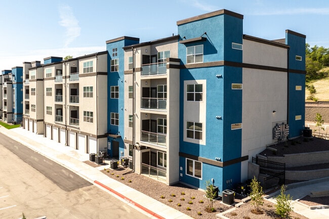
1810 Eldorado Springs Hts
Colorado Springs, CO
Independence Place At Cheyenne Mountain
64333-01-051
LOT 1 INDEPENDENCE PLACE AT CHEYENNE MOUNTAIN FIL NO 1A
Multifamilydwelling
El Paso
X
Colorado
08041C0741G
1
2024
13.70 AC
2025
Stratmoor Hills
003303
Colorado Springs
292,939 SF
DEMOGRAPHICS near 1810 Eldorado Springs Hts
1 Mile
3 Mile
5 Mile
2024 Total Population
6,344
91,083
212,961
2029 Population
6,565
95,375
222,745
Pop Growth 2024-2029
+ 3.48%
+ 4.71%
+ 4.59%
Average Age
39
36
36
2024 Total Households
2,698
34,837
81,898
HH Growth 2024-2029
+ 3.56%
+ 5.05%
+ 4.95%
Median Household Inc
$67,611
$58,886
$59,793
Avg Household Size
2.30
2.40
2.40
2024 Avg HH Vehicles
2.00
2.00
2.00
Median Home Value
$331,746
$324,773
$331,706
Median Year Built
1983
1981
1979
Nearby Places
Map Layers
Map Styles
 Street
 Aerial
- Restaurants
- Banks
- Shops
- Fitness
- Groceries
PUBLIC TRANSPORTATION
AIRPORT
City of Colorado Springs Municipal
DRIVE
WALK
Distance
City of Colorado Springs Municipal
22 min
9.8 mi
Freight Ports
Tulsa Port Of Catoosa
DRIVE
WALK
Distance
Tulsa Port Of Catoosa
748 min
696.5 mi
Nearby Properties
Address
Land Use
TOTAL SIZE
Lot Size
Zoning
Address
Land Use
TOTAL SIZE
Lot Size
Zoning
309,046 SF
28.95 AC
PF SS
Address
Land Use
TOTAL SIZE
Lot Size
Zoning
215,464 SF
11.59 AC
R-5
Address
Land Use
TOTAL SIZE
Lot Size
Zoning
152,977 SF
39.50 AC
MX-M MX-M/
Address
Land Use
TOTAL SIZE
Lot Size
Zoning
200,642 SF
6.65 AC
MX-M HR AO
Address
Land Use
TOTAL SIZE
Lot Size
Zoning
233,194 SF
30 AC
R-1 6 AO S
Address
Land Use
TOTAL SIZE
Lot Size
Zoning
168,835 SF
33 AC
PF SS
Address
Land Use
TOTAL SIZE
Lot Size
Zoning
215,377 SF
11.24 AC
R-5/CR
Address
Land Use
TOTAL SIZE
Lot Size
Zoning
109,739 SF
18.61 AC
BP/CR CU
Address
Land Use
TOTAL SIZE
Lot Size
Zoning
123,644 SF
74.14 AC
GI PF SS
Address
Land Use
TOTAL SIZE
Lot Size
Zoning
113,594 SF
1.65 AC
R-5 HR
Address
Land Use
TOTAL SIZE
Lot Size
Zoning
71,438 SF
9.81 AC
R-5/CR
Address
Land Use
TOTAL SIZE
Lot Size
Zoning
65,400 SF
13.65 AC
PF CU
Address
Land Use
TOTAL SIZE
Lot Size
Zoning
98,638 SF
7.22 AC
MX-M AO
Address
Land Use
TOTAL SIZE
Lot Size
Zoning
23,535 SF
15.91 AC
BP/CR AO
Address
Land Use
TOTAL SIZE
Lot Size
Zoning
99,829 SF
15.39 AC
R-E CU UV
Address
Land Use
TOTAL SIZE
Lot Size
Zoning
69,078 SF
0.03 AC
Address
Land Use
TOTAL SIZE
Lot Size
Zoning
107,146 SF
16.72 AC
R-1 6 CU
Address
Land Use
TOTAL SIZE
Lot Size
Zoning
58,598 SF
0.96 AC
PDZ UV
Address
Land Use
TOTAL SIZE
Lot Size
Zoning
124,107 SF
104.60 AC
MX-N CU
Address
Land Use
TOTAL SIZE
Lot Size
Zoning
166,182 SF
26.35 AC
BP/CR
Address
Land Use
TOTAL SIZE
Lot Size
Zoning
24,293 SF
10.61 AC
C5
Address
Land Use
TOTAL SIZE
Lot Size
Zoning
76,047 SF
5.74 AC
PF
Address
Land Use
TOTAL SIZE
Lot Size
Zoning
46,190 SF
4.02 AC
PDZ
Address
Land Use
TOTAL SIZE
Lot Size
Zoning
38,365 SF
3.37 AC
MX-M
Address
Land Use
TOTAL SIZE
Lot Size
Zoning
105,617 SF
10.10 AC
PBC
Address
Land Use
TOTAL SIZE
Lot Size
Zoning
107,610 SF
5.69 AC
R-E
Address
Land Use
TOTAL SIZE
Lot Size
Zoning
261,184 SF
17.39 AC
MX-M CU
Address
Land Use
TOTAL SIZE
Lot Size
Zoning
118,700 SF
22.90 AC
R-1 6 AO
Address
Land Use
TOTAL SIZE
Lot Size
Zoning
28,769 SF
3.92 AC
MX-M
Address
Land Use
TOTAL SIZE
Lot Size
Zoning
39,750 SF
1.94 AC
R-5 CU
The World's #1 Commercial Real Estate Marketplace
Connect with us
© 2026 CoStar Group
The information above has been obtained from sources believed reliable. While we do not doubt its accuracy we have not verified it and make no guarantee, warranty or representation about it. It is your responsibility to independently confirm its accuracy and completeness. Any projections, opinions, assumptions, or estimates used are for example only and do not represent the current or future performance of the property. The value of this transaction to you depends on tax and other factors which should be evaluated by your tax, financial, and legal advisors. You and your advisors should conduct a careful, independent investigation of the property to determine to your satisfaction the suitability of the property for your needs.