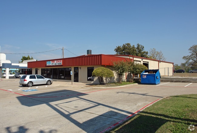
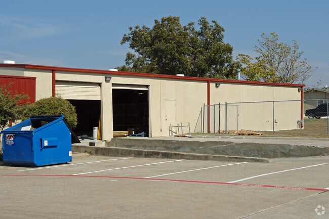
Property Record
1810 N I-35E E, Lancaster, TX 75134

Property Detail
1810 N I-35E E
36001500000030100
BECKLEY ACRES PT LOT 4 ACS 0.563 209X116 VOL95066/5245 DD040595 CO-DALLAS 0015000000301 23600150000
Officebuilding
DALLAS
Z39
Texas
B and X Area of moderate flood hazard, usually the area between the limits of the 100-year and 500-year floods.
4
2024
0.56 AC
2025
SE Dallas/I-45
016704
Dallas/Ft Worth
6,720 SF
Dallas-Fort Worth-Arlington, TX
NEARBY LISTINGS FOR SALE OR LEASE
DEMOGRAPHICS near 1810 N I-35E E
1 mile
3 mile
5 mile
2025 Total Population
8,832
71,915
177,572
2030 Population
8,950
73,798
182,900
Pop Growth 2025-2030
+ 1.34%
+ 2.62%
+ 3.00%
Average Age
39
38
38
2025 Total Households
3,424
24,882
61,460
HH Growth 2025-2030
+ 1.29%
+ 2.54%
+ 2.91%
Median Household Inc
$50,955
$67,032
$66,143
Avg Household Size
2.50
2.80
2.80
2025 Avg HH Vehicles
2.00
2.00
2.00
Median Home Value
$248,966
$267,686
$270,414
Median Year Built
1985
1990
1988
Nearby Places
Map Layers
Map Styles
 Street
 Aerial
Transit
 Traffic
 Biking
Places
Listings with unknown addresses are not visible on the map
- Restaurants
- Banks
- Shops
- Fitness
- Groceries
PUBLIC TRANSPORTATION
AIRPORT
Dallas Love Field
Drive
Walk
Distance
Dallas Love Field
26 min
18.2 mi
Dallas-Fort Worth International
Drive
Walk
Distance
Dallas-Fort Worth International
40 min
32.3 mi
Nearby Properties
Address
Land Use
TOTAL SIZE
Lot Size
Zoning
Address
Land Use
TOTAL SIZE
Lot Size
Zoning
1,283,264 SF
78.52 AC
Z04
Address
Land Use
TOTAL SIZE
Lot Size
Zoning
1,316,325 SF
54.36 AC
Z111
Address
Land Use
TOTAL SIZE
Lot Size
Zoning
1,200,000 SF
60.01 AC
Z125
Address
Land Use
TOTAL SIZE
Lot Size
Zoning
1,167,500 SF
46.04 AC
Z06
Address
Land Use
TOTAL SIZE
Lot Size
Zoning
1,015,340 SF
55.63 AC
Z239
Address
Land Use
TOTAL SIZE
Lot Size
Zoning
951,480 SF
50.63 AC
Z109
Address
Land Use
TOTAL SIZE
Lot Size
Zoning
948,392 SF
50.80 AC
Z109
Address
Land Use
TOTAL SIZE
Lot Size
Zoning
900,000 SF
50.76 AC
Z04
Address
Land Use
TOTAL SIZE
Lot Size
Zoning
872,640 SF
46.97 AC
Z125
Address
Land Use
TOTAL SIZE
Lot Size
Zoning
823,000 SF
45.10 AC
Z298
Address
Land Use
TOTAL SIZE
Lot Size
Zoning
713,000 SF
52.25 AC
Z125
Address
Land Use
TOTAL SIZE
Lot Size
Zoning
660,400 SF
35.93 AC
Z125
Address
Land Use
TOTAL SIZE
Lot Size
Zoning
659,523 SF
35.33 AC
Z04
Address
Land Use
TOTAL SIZE
Lot Size
Zoning
595,148 SF
34.96 AC
Z39
Address
Land Use
TOTAL SIZE
Lot Size
Zoning
123,880 SF
16.80 AC
Z236
Address
Land Use
TOTAL SIZE
Lot Size
Zoning
610,806 SF
33.66 AC
Z125
Address
Land Use
TOTAL SIZE
Lot Size
Zoning
610,806 SF
34.20 AC
Z125
Address
Land Use
TOTAL SIZE
Lot Size
Zoning
590,200 SF
31.83 AC
Z04
Address
Land Use
TOTAL SIZE
Lot Size
Zoning
507,318 SF
28.40 AC
Z111
Address
Land Use
TOTAL SIZE
Lot Size
Zoning
552,200 SF
41.36 AC
Z109
Address
Land Use
TOTAL SIZE
Lot Size
Zoning
610,669 SF
41.65 AC
Z125
Address
Land Use
TOTAL SIZE
Lot Size
Zoning
489,310 SF
33.91 AC
Z111
Address
Land Use
TOTAL SIZE
Lot Size
Zoning
531,254 SF
33.40 AC
Z06
Address
Land Use
TOTAL SIZE
Lot Size
Zoning
227,423 SF
13.86 AC
Z236
Address
Land Use
TOTAL SIZE
Lot Size
Zoning
469,000 SF
28.81 AC
Z125
Address
Land Use
TOTAL SIZE
Lot Size
Zoning
281,669 SF
16.02 AC
Z312
Address
Land Use
TOTAL SIZE
Lot Size
Zoning
453,600 SF
29.54 AC
Z236
Address
Land Use
TOTAL SIZE
Lot Size
Zoning
160,003 SF
29.67 AC
Z350
Address
Land Use
TOTAL SIZE
Lot Size
Zoning
419,328 SF
23.30 AC
Z04
Address
Land Use
TOTAL SIZE
Lot Size
Zoning
421,890 SF
23.95 AC
Z111
The World's #1 Commercial Real Estate Marketplace
Connect with us
© 2026 CoStar Group
The information above has been obtained from sources believed reliable. While we do not doubt its accuracy we have not verified it and make no guarantee, warranty or representation about it. It is your responsibility to independently confirm its accuracy and completeness. Any projections, opinions, assumptions, or estimates used are for example only and do not represent the current or future performance of the property. The value of this transaction to you depends on tax and other factors which should be evaluated by your tax, financial, and legal advisors. You and your advisors should conduct a careful, independent investigation of the property to determine to your satisfaction the suitability of the property for your needs.