Property Record
18100 N Scottsdale Rd, Phoenix, AZ 85054

NEARBY LISTINGS FOR SALE OR LEASE
Property Detail
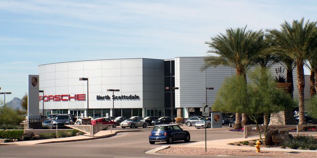
18100 N Scottsdale Rd
Phoenix-Mesa-Scottsdale, AZ
PCL LY IN SE4 NE4 SEC 34 DAF COM E4 COR SD SEC 34 TH W 75F TO POB TH W 1343.10F TH N 44D 56M W 60.47F TH N 1195.04F TH N 45D 3M E 60.52F TH E 643.23F TH S 88D 39M E 155.59F TH E 185.70F TO CUR WI RAD 298.50F TH ALG CUR 77.29F TO CUR WI RAD 301.50F TH
215-09-015G
Maricopa
Vehiclerentalsvehiclesales
Arizona
2025
40.11 AC
2025
North Scottsdale
615201
Phoenix
368,657 SF
DEMOGRAPHICS near 18100 N Scottsdale Rd
1 Mile
3 Mile
5 Mile
2024 Total Population
9,231
70,021
196,131
2029 Population
10,345
77,406
214,174
Pop Growth 2024-2029
+ 12.07%
+ 10.55%
+ 9.20%
Average Age
39
43
43
2024 Total Households
4,996
31,886
85,412
HH Growth 2024-2029
+ 12.27%
+ 10.98%
+ 9.53%
Median Household Inc
$97,518
$113,409
$109,413
Avg Household Size
1.80
2.10
2.20
2024 Avg HH Vehicles
1.00
2.00
2.00
Median Home Value
$607,991
$688,228
$632,676
Median Year Built
2007
1997
1993
Nearby Places
Map Layers
Map Styles
 Street
 Aerial
- Restaurants
- Banks
- Shops
- Fitness
- Groceries
PUBLIC TRANSPORTATION
AIRPORT
Phoenix Sky Harbor International
DRIVE
WALK
Distance
Phoenix Sky Harbor International
33 min
24.5 mi
Phoenix-Mesa Gateway
DRIVE
WALK
Distance
Phoenix-Mesa Gateway
53 min
39.5 mi
Freight Ports
Port of San Diego
DRIVE
WALK
Distance
Port of San Diego
421 min
376.8 mi
Nearby Properties
Address
Land Use
TOTAL SIZE
Lot Size
Zoning
Address
Land Use
TOTAL SIZE
Lot Size
Zoning
1,504,047 SF
40.43 AC
I-P
Address
Land Use
TOTAL SIZE
Lot Size
Zoning
13.01 AC
Address
Land Use
TOTAL SIZE
Lot Size
Zoning
35.76 AC
R1-18
Address
Land Use
TOTAL SIZE
Lot Size
Zoning
14.58 AC
Address
Land Use
TOTAL SIZE
Lot Size
Zoning
1,293,284 SF
14.50 AC
C-R
Address
Land Use
TOTAL SIZE
Lot Size
Zoning
1,479,005 SF
12.55 AC
PC
Address
Land Use
TOTAL SIZE
Lot Size
Zoning
Address
Land Use
TOTAL SIZE
Lot Size
Zoning
3.15 AC
I-P
Address
Land Use
TOTAL SIZE
Lot Size
Zoning
667,688 SF
277.21 AC
Address
Land Use
TOTAL SIZE
Lot Size
Zoning
694,644 SF
34.41 AC
C-C
Address
Land Use
TOTAL SIZE
Lot Size
Zoning
670,926 SF
20.92 AC
I-P
Address
Land Use
TOTAL SIZE
Lot Size
Zoning
229,856 SF
7.71 AC
C-T
Address
Land Use
TOTAL SIZE
Lot Size
Zoning
794,304 SF
14.59 AC
WTP
Address
Land Use
TOTAL SIZE
Lot Size
Zoning
762,044 SF
16.66 AC
I1
Address
Land Use
TOTAL SIZE
Lot Size
Zoning
7,803 SF
2.31 AC
I-P
Address
Land Use
TOTAL SIZE
Lot Size
Zoning
514,088 SF
6.70 AC
PAD
Address
Land Use
TOTAL SIZE
Lot Size
Zoning
734,840 SF
33.12 AC
M-H
Address
Land Use
TOTAL SIZE
Lot Size
Zoning
428,891 SF
6.48 AC
PAD
Address
Land Use
TOTAL SIZE
Lot Size
Zoning
707,542 SF
28.49 AC
R-3A
Address
Land Use
TOTAL SIZE
Lot Size
Zoning
421,002 SF
23.48 AC
Address
Land Use
TOTAL SIZE
Lot Size
Zoning
487,786 SF
18.42 AC
S1
Address
Land Use
TOTAL SIZE
Lot Size
Zoning
884,258 SF
30.63 AC
PCD
Address
Land Use
TOTAL SIZE
Lot Size
Zoning
90.73 AC
O-S
Address
Land Use
TOTAL SIZE
Lot Size
Zoning
497,704 SF
6.77 AC
Address
Land Use
TOTAL SIZE
Lot Size
Zoning
337,668 SF
8.14 AC
PAD
Address
Land Use
TOTAL SIZE
Lot Size
Zoning
539,135 SF
15.11 AC
R3A
Address
Land Use
TOTAL SIZE
Lot Size
Zoning
417,831 SF
2.68 AC
C-R
Address
Land Use
TOTAL SIZE
Lot Size
Zoning
542,795 SF
5.56 AC
PCP
Address
Land Use
TOTAL SIZE
Lot Size
Zoning
530,588 SF
20.58 AC
C-C
The World's #1 Commercial Real Estate Marketplace
Connect with us
© 2026 CoStar Group
The information above has been obtained from sources believed reliable. While we do not doubt its accuracy we have not verified it and make no guarantee, warranty or representation about it. It is your responsibility to independently confirm its accuracy and completeness. Any projections, opinions, assumptions, or estimates used are for example only and do not represent the current or future performance of the property. The value of this transaction to you depends on tax and other factors which should be evaluated by your tax, financial, and legal advisors. You and your advisors should conduct a careful, independent investigation of the property to determine to your satisfaction the suitability of the property for your needs.