Property Record
18111 Prince Philip Dr, Olney, MD 20832


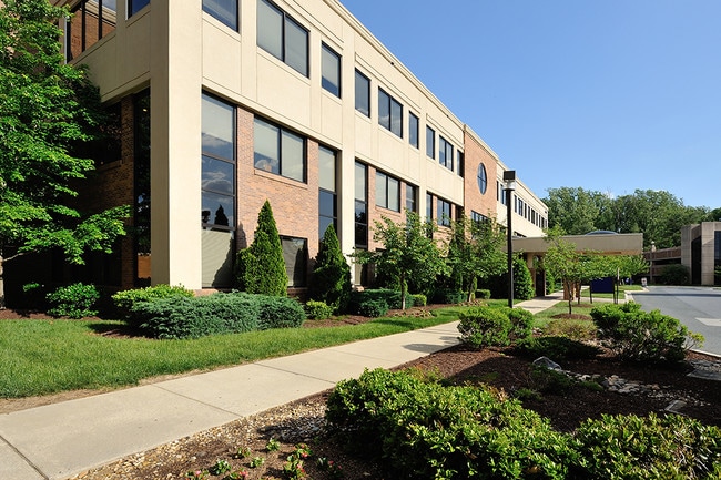
Property Detail
18111 Prince Philip Dr
08-02167798
PL8872PT PAR A MONTG GNRL HOSPTL INC LEASE
Hospitalpublic
Montgomery
RE2
Maryland
AE The base floodplain where base flood elevations are provided. AE Zones are now used on new format FIRMs instead of A1-A30 Zones.
a
2025
5.45 AC
2025
Outlying Montgmery Cnty E
701315
Washington, DC
90,759 SF
Washington-Arlington-Alexandria, DC-VA-MD-WV
NEARBY LISTINGS FOR SALE OR LEASE
DEMOGRAPHICS near 18111 Prince Philip Dr
1 mile
3 mile
5 mile
2025 Total Population
11,597
41,659
107,944
2030 Population
11,831
42,713
110,753
Pop Growth 2025-2030
+ 2.02%
+ 2.53%
+ 2.60%
Average Age
42
43
45
2025 Total Households
4,146
14,092
39,269
HH Growth 2025-2030
+ 1.91%
+ 2.42%
+ 2.62%
Median Household Inc
$156,105
$175,899
$134,096
Avg Household Size
2.70
2.90
2.70
2025 Avg HH Vehicles
2.00
2.00
2.00
Median Home Value
$604,284
$705,100
$643,771
Median Year Built
1986
1985
1982
Nearby Places
Map Layers
Map Styles
 Street
 Aerial
Layers
 Traffic
 Biking
Places
Listings with unknown addresses are not visible on the map
- Restaurants
- Banks
- Shops
- Fitness
- Groceries
PUBLIC TRANSPORTATION
COMMUTER RAIL
Rockville (BRUNSWICK - WASHINGTON - Maryland Area Regional Commuter Trains (The MARC), Brunswick Line - Maryland Area Regional Commuter Trains (The MARC))
Drive
Walk
Distance
Rockville (BRUNSWICK - WASHINGTON - Maryland Area Regional Commuter Trains (The MARC), Brunswick Line - Maryland Area Regional Commuter Trains (The MARC))
16 min
8.2 mi
AIRPORT
Ronald Reagan Washington Ntl
Drive
Walk
Distance
Ronald Reagan Washington Ntl
46 min
25.1 mi
Baltimore/Washington International Thurgood Marshall
Drive
Walk
Distance
Baltimore/Washington International Thurgood Marshall
44 min
28.3 mi
Washington Dulles International
Drive
Walk
Distance
Washington Dulles International
61 min
35.8 mi
Freight Ports
Port of Baltimore
Drive
Walk
Distance
Port of Baltimore
48 min
31.1 mi
SALE & LEASE HISTORY
LISTING DATE
SALE/LEASE

Sep 24, 2016
For Lease
Mar 06, 2020
For Lease
Jan 10, 2017
For Lease
Apr 17, 2025
For Lease
Nearby Properties
Address
Land Use
TOTAL SIZE
Lot Size
Zoning
Address
Land Use
TOTAL SIZE
Lot Size
Zoning
233,735 SF
21.74 AC
RE2
Address
Land Use
TOTAL SIZE
Lot Size
Zoning
202,044 SF
17.69 AC
CRT2.
Address
Land Use
TOTAL SIZE
Lot Size
Zoning
235,762 SF
139.24 AC
RE2
Address
Land Use
TOTAL SIZE
Lot Size
Zoning
289,712 SF
19.79 AC
RNC
Address
Land Use
TOTAL SIZE
Lot Size
Zoning
135,878 SF
17.11 AC
RNC
Address
Land Use
TOTAL SIZE
Lot Size
Zoning
165,842 SF
16.90 AC
RE2
Address
Land Use
TOTAL SIZE
Lot Size
Zoning
209,897 SF
48.45 AC
RC
Address
Land Use
TOTAL SIZE
Lot Size
Zoning
96,941 SF
10.87 AC
CRT2.
Address
Land Use
TOTAL SIZE
Lot Size
Zoning
140,080 SF
6.48 AC
PD9
Address
Land Use
TOTAL SIZE
Lot Size
Zoning
136,736 SF
37.37 AC
RNC
Address
Land Use
TOTAL SIZE
Lot Size
Zoning
61,578 SF
4.80 AC
RE2
Address
Land Use
TOTAL SIZE
Lot Size
Zoning
115,000 SF
15.85 AC
RE2
Address
Land Use
TOTAL SIZE
Lot Size
Zoning
110,210 SF
3.92 AC
CRT2.
Address
Land Use
TOTAL SIZE
Lot Size
Zoning
124,099 SF
10.95 AC
RE2
Address
Land Use
TOTAL SIZE
Lot Size
Zoning
58,437 SF
3.55 AC
CRT2.
Address
Land Use
TOTAL SIZE
Lot Size
Zoning
78,271 SF
57.63 AC
RC
Address
Land Use
TOTAL SIZE
Lot Size
Zoning
28,072 SF
2.28 AC
NR0.7
Address
Land Use
TOTAL SIZE
Lot Size
Zoning
34,658 SF
2.99 AC
CRT2.
Address
Land Use
TOTAL SIZE
Lot Size
Zoning
65,000 SF
19.80 AC
RE1
Address
Land Use
TOTAL SIZE
Lot Size
Zoning
53,664 SF
17.63 AC
R90
Address
Land Use
TOTAL SIZE
Lot Size
Zoning
68,190 SF
3.29 AC
CRT2.
Address
Land Use
TOTAL SIZE
Lot Size
Zoning
51,824 SF
10.49 AC
PCC
Address
Land Use
TOTAL SIZE
Lot Size
Zoning
30,221 SF
3.47 AC
R200
Address
Land Use
TOTAL SIZE
Lot Size
Zoning
47,870 SF
7.80 AC
R200
Address
Land Use
TOTAL SIZE
Lot Size
Zoning
56,300 SF
10.24 AC
R200
Address
Land Use
TOTAL SIZE
Lot Size
Zoning
63,992 SF
37.97 AC
RC
Address
Land Use
TOTAL SIZE
Lot Size
Zoning
55,972 SF
49.25 AC
Address
Land Use
TOTAL SIZE
Lot Size
Zoning
57,793 SF
10.85 AC
RE2
Address
Land Use
TOTAL SIZE
Lot Size
Zoning
78,736 SF
35.96 AC
RE2
The World's #1 Commercial Real Estate Marketplace
Connect with us
© 2026 CoStar Group
The information above has been obtained from sources believed reliable. While we do not doubt its accuracy we have not verified it and make no guarantee, warranty or representation about it. It is your responsibility to independently confirm its accuracy and completeness. Any projections, opinions, assumptions, or estimates used are for example only and do not represent the current or future performance of the property. The value of this transaction to you depends on tax and other factors which should be evaluated by your tax, financial, and legal advisors. You and your advisors should conduct a careful, independent investigation of the property to determine to your satisfaction the suitability of the property for your needs.