Property Record
1812 S Empire Rd, Salt Lake City, UT 84104
NEARBY LISTINGS FOR SALE OR LEASE
Property Detail
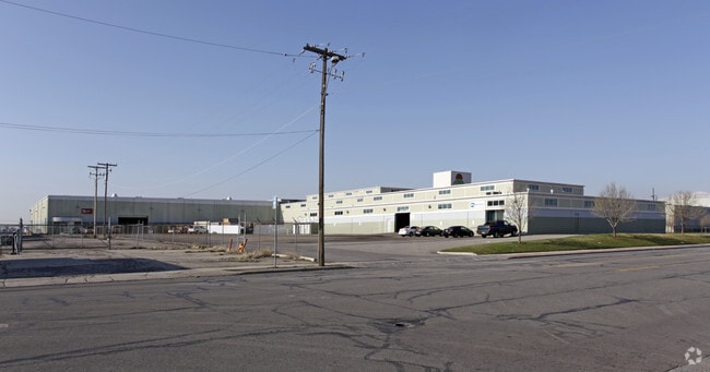
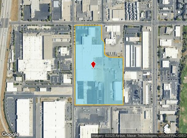
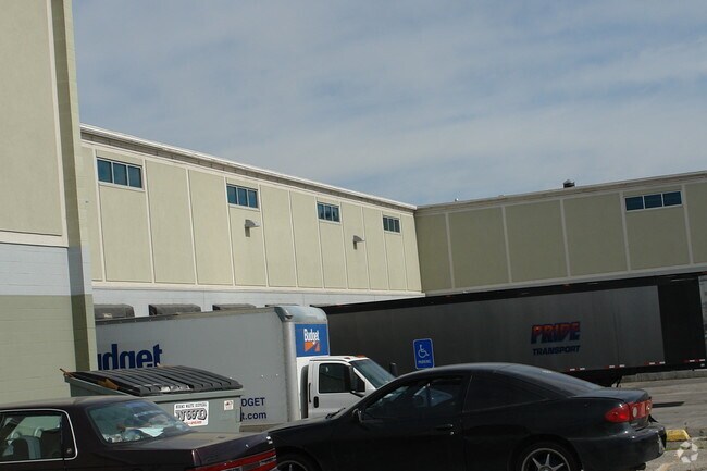
1812 S Empire Rd
15-15-326-013-0000
Radius Curve
Warehouse
BEG N 0^0308 W 25 FT & N 89^5652 E 25 FT FR MNT; SD MNT BEING S 89^4530 W 1599.39 FT & N 0^0308 W 1051.8 FT FT S1/4 COR SEC 15, T 1S, R 1W, SLM; N 89^5652 E 936.08 FT; N 0^0308 W 917.48 FT; S 89^5652 W 254.55 FT; N 68^ W 66.59FT; NWLY ALG A 74.45 FT
X
Salt Lake
49035C0280E
Utah
2024
27.54 AC
2025
California Avenue
114500
Salt Lake City
503,240 SF
Salt Lake City, UT
DEMOGRAPHICS near 1812 S Empire Rd
1 Mile
3 Mile
5 Mile
2024 Total Population
5,030
71,683
318,827
2029 Population
5,019
72,306
323,752
Pop Growth 2024-2029
(0.22%)
+ 0.87%
+ 1.54%
Average Age
34
34
36
2024 Total Households
1,444
24,538
125,986
HH Growth 2024-2029
(0.35%)
+ 1.19%
+ 1.93%
Median Household Inc
$62,269
$53,998
$60,766
Avg Household Size
3.20
2.70
2.40
2024 Avg HH Vehicles
2.00
2.00
2.00
Median Home Value
$268,817
$285,739
$369,260
Median Year Built
1976
1981
1977
Nearby Places
- Restaurants
- Banks
- Shops
- Fitness
- Groceries
PUBLIC TRANSPORTATION
COMMUTER RAIL
North Temple Station (FrontRunner - Utah Transit Authority (UTA))
DRIVE
WALK
Distance
North Temple Station (FrontRunner - Utah Transit Authority (UTA))
12 min
5.2 mi
Warm Springs Relief Point (FrontRunner - Utah Transit Authority (UTA))
DRIVE
WALK
Distance
Warm Springs Relief Point (FrontRunner - Utah Transit Authority (UTA))
13 min
6.4 mi
AIRPORT
Salt Lake City International
DRIVE
WALK
Distance
Salt Lake City International
12 min
6.1 mi
Freight Ports
Port of Stockton
DRIVE
WALK
Distance
Port of Stockton
712 min
693.8 mi
Nearby Properties
Address
Land Use
TOTAL SIZE
Lot Size
Zoning
Address
Land Use
TOTAL SIZE
Lot Size
Zoning
1,330,058 SF
5.02 AC
D2
Address
Land Use
TOTAL SIZE
Lot Size
Zoning
488,509 SF
36.03 AC
FLEX
Address
Land Use
TOTAL SIZE
Lot Size
Zoning
163,932 SF
14.65 AC
PL
Address
Land Use
TOTAL SIZE
Lot Size
Zoning
208,868 SF
20.41 AC
I
Address
Land Use
TOTAL SIZE
Lot Size
Zoning
252,420 SF
15.26 AC
TSA-MU
Address
Land Use
TOTAL SIZE
Lot Size
Zoning
673,062 SF
15.84 AC
RM
Address
Land Use
TOTAL SIZE
Lot Size
Zoning
185,436 SF
25.23 AC
RM
Address
Land Use
TOTAL SIZE
Lot Size
Zoning
146,652 SF
16.63 AC
RMF-45
Address
Land Use
TOTAL SIZE
Lot Size
Zoning
95,854 SF
15.42 AC
CC
Address
Land Use
TOTAL SIZE
Lot Size
Zoning
322,076 SF
16.32 AC
PL
Address
Land Use
TOTAL SIZE
Lot Size
Zoning
76,096 SF
17.30 AC
RM
Address
Land Use
TOTAL SIZE
Lot Size
Zoning
171,839 SF
17.80 AC
CG
Address
Land Use
TOTAL SIZE
Lot Size
Zoning
77,693 SF
2.99 AC
TSA-MU
Address
Land Use
TOTAL SIZE
Lot Size
Zoning
1,932 SF
33.44 AC
TSAMUC
Address
Land Use
TOTAL SIZE
Lot Size
Zoning
401,887 SF
3.51 AC
RM
Address
Land Use
TOTAL SIZE
Lot Size
Zoning
29.13 AC
C-2
Address
Land Use
TOTAL SIZE
Lot Size
Zoning
426,280 SF
19.84 AC
M1
Address
Land Use
TOTAL SIZE
Lot Size
Zoning
116,268 SF
8.07 AC
RMF-45
Address
Land Use
TOTAL SIZE
Lot Size
Zoning
65,127 SF
5.17 AC
TSA-MU
Address
Land Use
TOTAL SIZE
Lot Size
Zoning
89,239 SF
14.78 AC
RM
Address
Land Use
TOTAL SIZE
Lot Size
Zoning
137,209 SF
38.90 AC
FLEX
Address
Land Use
TOTAL SIZE
Lot Size
Zoning
436,875 SF
26.95 AC
M-1
Address
Land Use
TOTAL SIZE
Lot Size
Zoning
431,400 SF
23.99 AC
IP-M-1
Address
Land Use
TOTAL SIZE
Lot Size
Zoning
381,105 SF
2.88 AC
CC
Address
Land Use
TOTAL SIZE
Lot Size
Zoning
750,887 SF
28 AC
M1
Address
Land Use
TOTAL SIZE
Lot Size
Zoning
213,286 SF
3.67 AC
CG
Address
Land Use
TOTAL SIZE
Lot Size
Zoning
304,366 SF
2.71 AC
M
Address
Land Use
TOTAL SIZE
Lot Size
Zoning
180,383 SF
4.77 AC
MXD
Address
Land Use
TOTAL SIZE
Lot Size
Zoning
393,809 SF
2.86 AC
CC
Address
Land Use
TOTAL SIZE
Lot Size
Zoning
29,654 SF
9.98 AC
RMF-45
The World's #1 Commercial Real Estate Marketplace
Connect with us
© 2025 CoStar Group
The information above has been obtained from sources believed reliable. While we do not doubt its accuracy we have not verified it and make no guarantee, warranty or representation about it. It is your responsibility to independently confirm its accuracy and completeness. Any projections, opinions, assumptions, or estimates used are for example only and do not represent the current or future performance of the property. The value of this transaction to you depends on tax and other factors which should be evaluated by your tax, financial, and legal advisors. You and your advisors should conduct a careful, independent investigation of the property to determine to your satisfaction the suitability of the property for your needs.