Property Record
1812 W Baseline Rd, Phoenix, AZ 85041
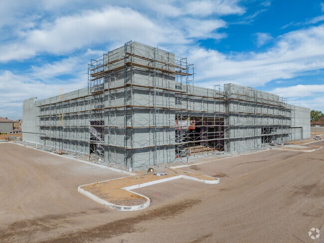

Property Detail
1812 W Baseline Rd
Phoenix-Mesa-Chandler, AZ
NINETEEN COMMONS MCR 1632-25
105-97-797
MARICOPA
Gymhealthspa
Arizona
2025
b
2025
3.99 AC
116614
South Mountain
42,468 SF
Phoenix
NEARBY LISTINGS FOR SALE OR LEASE
DEMOGRAPHICS near 1812 W Baseline Rd
1 mile
3 mile
5 mile
2025 Total Population
15,069
102,849
198,057
2030 Population
15,651
107,724
207,524
Pop Growth 2025-2030
+ 3.86%
+ 4.74%
+ 4.78%
Average Age
35
35
35
2025 Total Households
4,331
29,778
58,579
HH Growth 2025-2030
+ 3.90%
+ 4.81%
+ 4.85%
Median Household Inc
$73,858
$74,901
$74,617
Avg Household Size
3.40
3.30
3.20
2025 Avg HH Vehicles
2.00
2.00
2.00
Median Home Value
$387,978
$387,501
$400,525
Median Year Built
2003
2000
2000
Nearby Places
Map Layers
Map Styles
 Street
 Aerial
Layers
 Traffic
 Biking
Places
Listings with unknown addresses are not visible on the map
- Restaurants
- Banks
- Shops
- Fitness
- Groceries
PUBLIC TRANSPORTATION
AIRPORT
Phoenix Sky Harbor International
Drive
Walk
Distance
Phoenix Sky Harbor International
20 min
10.3 mi
Phoenix-Mesa Gateway
Drive
Walk
Distance
Phoenix-Mesa Gateway
46 min
30.8 mi
Freight Ports
Port of San Diego
Drive
Walk
Distance
Port of San Diego
403 min
359.0 mi
Nearby Properties
Address
Land Use
TOTAL SIZE
Lot Size
Zoning
Address
Land Use
TOTAL SIZE
Lot Size
Zoning
182,984 SF
146.12 AC
I-1
Address
Land Use
TOTAL SIZE
Lot Size
Zoning
47,597 SF
22.74 AC
R-43
Address
Land Use
TOTAL SIZE
Lot Size
Zoning
367,953 SF
38.18 AC
R-43AG
Address
Land Use
TOTAL SIZE
Lot Size
Zoning
10 SF
644.14 AC
R-35
Address
Land Use
TOTAL SIZE
Lot Size
Zoning
369,723 SF
19.41 AC
R3
Address
Land Use
TOTAL SIZE
Lot Size
Zoning
398,815 SF
12.72 AC
C2
Address
Land Use
TOTAL SIZE
Lot Size
Zoning
6.55 AC
C-G
Address
Land Use
TOTAL SIZE
Lot Size
Zoning
70,951 SF
336.40 AC
R-43AG
Address
Land Use
TOTAL SIZE
Lot Size
Zoning
205,550 SF
27.37 AC
R-6
Address
Land Use
TOTAL SIZE
Lot Size
Zoning
70,152 SF
180.34 AC
RE35
Address
Land Use
TOTAL SIZE
Lot Size
Zoning
180,057 SF
40 AC
I-2
Address
Land Use
TOTAL SIZE
Lot Size
Zoning
91,949 SF
19.14 AC
R-43
Address
Land Use
TOTAL SIZE
Lot Size
Zoning
416,645 SF
18.80 AC
M-H
Address
Land Use
TOTAL SIZE
Lot Size
Zoning
219,555 SF
21.25 AC
C2
Address
Land Use
TOTAL SIZE
Lot Size
Zoning
91,063 SF
12 AC
R-43AG
Address
Land Use
TOTAL SIZE
Lot Size
Zoning
186,437 SF
17.85 AC
PAD-HD
Address
Land Use
TOTAL SIZE
Lot Size
Zoning
103,111 SF
12.13 AC
R-43
Address
Land Use
TOTAL SIZE
Lot Size
Zoning
139,410 SF
14.41 AC
C-C
Address
Land Use
TOTAL SIZE
Lot Size
Zoning
118,842 SF
5.10 AC
R3
Address
Land Use
TOTAL SIZE
Lot Size
Zoning
92,917 SF
14.54 AC
Address
Land Use
TOTAL SIZE
Lot Size
Zoning
8,880 SF
1.99 AC
I-2
Address
Land Use
TOTAL SIZE
Lot Size
Zoning
58,603 SF
12.15 AC
R-43AG
Address
Land Use
TOTAL SIZE
Lot Size
Zoning
90,706 SF
9.02 AC
A1
Address
Land Use
TOTAL SIZE
Lot Size
Zoning
64,031 SF
14.68 AC
R-43AG
Address
Land Use
TOTAL SIZE
Lot Size
Zoning
63,002 SF
11.61 AC
R-6
Address
Land Use
TOTAL SIZE
Lot Size
Zoning
78,576 SF
8.69 AC
R-10
Address
Land Use
TOTAL SIZE
Lot Size
Zoning
8,029 SF
2.19 AC
R-4
Address
Land Use
TOTAL SIZE
Lot Size
Zoning
55,528 SF
9.66 AC
M-H
Address
Land Use
TOTAL SIZE
Lot Size
Zoning
55,493 SF
8.01 AC
R-6
Address
Land Use
TOTAL SIZE
Lot Size
Zoning
75,877 SF
7.91 AC
R-43AG
The World's #1 Commercial Real Estate Marketplace
Connect with us
© 2026 CoStar Group
The information above has been obtained from sources believed reliable. While we do not doubt its accuracy we have not verified it and make no guarantee, warranty or representation about it. It is your responsibility to independently confirm its accuracy and completeness. Any projections, opinions, assumptions, or estimates used are for example only and do not represent the current or future performance of the property. The value of this transaction to you depends on tax and other factors which should be evaluated by your tax, financial, and legal advisors. You and your advisors should conduct a careful, independent investigation of the property to determine to your satisfaction the suitability of the property for your needs.