Property Record
1813 Manatee Ave W, Bradenton, FL 34205
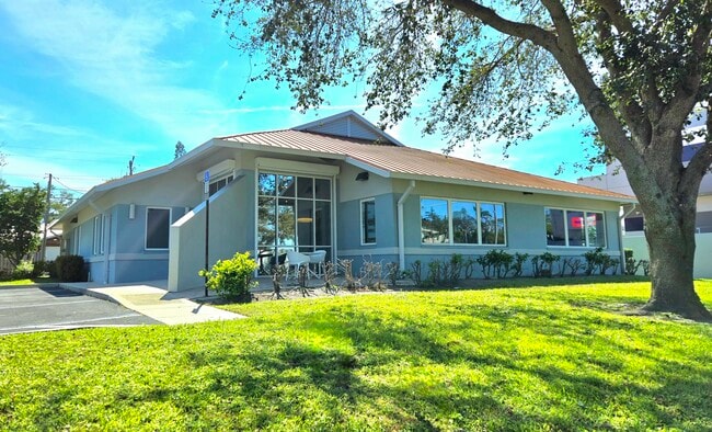


Property Detail
1813 Manatee Ave W
34100-0000-8
LOTS 3, 4, AND 5, OAKLAWN SUB, LESS R/W DESC IN DB 383 P 41 PI#34100.0000/8
Officebuilding
Manatee
BR_UV
Florida
B and X Area of moderate flood hazard, usually the area between the limits of the 100-year and 500-year floods.
3
2024
0.47 AC
2025
Manatee
000601
Tampa/St Petersburg
4,143 SF
North Port-Bradenton-Sarasota, FL
NEARBY LISTINGS FOR SALE OR LEASE
DEMOGRAPHICS near 1813 Manatee Ave W
1 mile
3 mile
5 mile
2025 Total Population
11,910
100,995
211,544
2030 Population
13,341
112,825
236,379
Pop Growth 2025-2030
+ 12.02%
+ 11.71%
+ 11.74%
Average Age
45
44
45
2025 Total Households
5,325
41,666
89,323
HH Growth 2025-2030
+ 12.66%
+ 12.14%
+ 12.15%
Median Household Inc
$55,222
$57,310
$60,031
Avg Household Size
2.10
2.30
2.30
2025 Avg HH Vehicles
2.00
2.00
2.00
Median Home Value
$304,372
$266,581
$288,796
Median Year Built
1963
1976
1981
Nearby Places
Map Layers
Map Styles
 Street
 Aerial
Transit
 Traffic
 Biking
Places
Listings with unknown addresses are not visible on the map
- Restaurants
- Banks
- Shops
- Fitness
- Groceries
PUBLIC TRANSPORTATION
AIRPORT
Sarasota/Bradenton International
Drive
Walk
Distance
Sarasota/Bradenton International
16 min
7.7 mi
St Pete-Clearwater International
Drive
Walk
Distance
St Pete-Clearwater International
55 min
36.8 mi
Tampa International
Drive
Walk
Distance
Tampa International
61 min
44.7 mi
SALE & LEASE HISTORY
LISTING DATE
SALE/LEASE

May 31, 2018
For Sale
Feb 26, 2025
For Sale
Nearby Properties
Address
Land Use
TOTAL SIZE
Lot Size
Zoning
Address
Land Use
TOTAL SIZE
Lot Size
Zoning
595,475 SF
16.90 AC
BR_T5
Address
Land Use
TOTAL SIZE
Lot Size
Zoning
349,711 SF
49.51 AC
BR_SD1
Address
Land Use
TOTAL SIZE
Lot Size
Zoning
508,298 SF
18.71 AC
P
Address
Land Use
TOTAL SIZE
Lot Size
Zoning
405,843 SF
9.09 AC
BR_T5
Address
Land Use
TOTAL SIZE
Lot Size
Zoning
277,678 SF
7.80 AC
BR_T4-O, B
Address
Land Use
TOTAL SIZE
Lot Size
Zoning
279,545 SF
19.41 AC
BR_R-1
Address
Land Use
TOTAL SIZE
Lot Size
Zoning
427,250 SF
38.18 AC
A-1 SUBURB
Address
Land Use
TOTAL SIZE
Lot Size
Zoning
98,722 SF
10.24 AC
PL_P
Address
Land Use
TOTAL SIZE
Lot Size
Zoning
432,078 SF
1.64 AC
BR_T6
Address
Land Use
TOTAL SIZE
Lot Size
Zoning
169,485 SF
7.87 AC
PD-MU
Address
Land Use
TOTAL SIZE
Lot Size
Zoning
318,507 SF
10.47 AC
BR_T4R,BR_
Address
Land Use
TOTAL SIZE
Lot Size
Zoning
2,401,721 SF
142.14 AC
PD-UI
Address
Land Use
TOTAL SIZE
Lot Size
Zoning
247,280 SF
17.72 AC
PD-R
Address
Land Use
TOTAL SIZE
Lot Size
Zoning
257,072 SF
10.07 AC
BR_T5
Address
Land Use
TOTAL SIZE
Lot Size
Zoning
214,906 SF
20.71 AC
BR_R-1
Address
Land Use
TOTAL SIZE
Lot Size
Zoning
397,863 SF
21.60 AC
GC GENERA
Address
Land Use
TOTAL SIZE
Lot Size
Zoning
541,781 SF
3.48 AC
BR_T5
Address
Land Use
TOTAL SIZE
Lot Size
Zoning
885,776 SF
46.22 AC
LM LIGHT M
Address
Land Use
TOTAL SIZE
Lot Size
Zoning
318,680 SF
1.31 AC
BR_FBC,BR_
Address
Land Use
TOTAL SIZE
Lot Size
Zoning
499,823 SF
39.50 AC
PL_P
Address
Land Use
TOTAL SIZE
Lot Size
Zoning
247,592 SF
13.39 AC
GC,RMF-6
Address
Land Use
TOTAL SIZE
Lot Size
Zoning
198,036 SF
8.32 AC
GC GENERA
Address
Land Use
TOTAL SIZE
Lot Size
Zoning
163,868 SF
12.60 AC
BR_R-3
Address
Land Use
TOTAL SIZE
Lot Size
Zoning
185,617 SF
13.68 AC
BR_R-2
Address
Land Use
TOTAL SIZE
Lot Size
Zoning
166,810 SF
3.16 AC
BR_T4-O
Address
Land Use
TOTAL SIZE
Lot Size
Zoning
276,469 SF
10.90 AC
PD-MU
Address
Land Use
TOTAL SIZE
Lot Size
Zoning
485,150 SF
56.44 AC
HC,GC
Address
Land Use
TOTAL SIZE
Lot Size
Zoning
163,582 SF
8.61 AC
PL_P
Address
Land Use
TOTAL SIZE
Lot Size
Zoning
106,355 SF
120.66 AC
BR_PDP
Address
Land Use
TOTAL SIZE
Lot Size
Zoning
196,346 SF
33.03 AC
BR_R-1
The World's #1 Commercial Real Estate Marketplace
Connect with us
© 2026 CoStar Group
The information above has been obtained from sources believed reliable. While we do not doubt its accuracy we have not verified it and make no guarantee, warranty or representation about it. It is your responsibility to independently confirm its accuracy and completeness. Any projections, opinions, assumptions, or estimates used are for example only and do not represent the current or future performance of the property. The value of this transaction to you depends on tax and other factors which should be evaluated by your tax, financial, and legal advisors. You and your advisors should conduct a careful, independent investigation of the property to determine to your satisfaction the suitability of the property for your needs.