Property Record
18130 Us Highway 27, Clermont, FL 34715

NEARBY LISTINGS FOR SALE OR LEASE
-
-
View all Clermont listings for sale on LoopNet.com
Property Detail
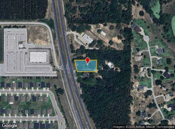
18130 Us Highway 27
36-21-25-0004-000-03300
FROM THE SOUTHEAST CORNER OF SECTION 36 TOWNSHIP 21 SOUTH RANGE 25 EAST RUN NORTH ALONG THE EAST LINE 982 FEET WEST TO THE EAST RIGHT OF WAY OF US HIGHWAY 27 THENCE RUN SOUTHEASTERLY ALONG SAID RIGHT OF WAY 90 FEET FOR THE POINT OF BEGINNING RUN EAST
Retailwithmorethanonenonretailuse
Lake
X
Florida
12069C0560E
33
2024
0.78 AC
2026
Lake County
031309
Orlando
804 SF
Orlando-Kissimmee-Sanford, FL
DEMOGRAPHICS near 18130 Us Highway 27
1 Mile
3 Mile
5 Mile
2024 Total Population
2,086
25,093
63,115
2029 Population
2,426
29,873
74,208
Pop Growth 2024-2029
+ 16.30%
+ 19.05%
+ 17.58%
Average Age
41
41
41
2024 Total Households
744
8,574
22,735
HH Growth 2024-2029
+ 16.13%
+ 18.84%
+ 17.31%
Median Household Inc
$84,339
$89,680
$81,206
Avg Household Size
2.80
2.80
2.70
2024 Avg HH Vehicles
2.00
2.00
2.00
Median Home Value
$286,128
$332,071
$321,143
Median Year Built
2001
2009
2004
Nearby Places
Map Layers
Map Styles
 Street
 Aerial
- Restaurants
- Banks
- Shops
- Fitness
- Groceries
PUBLIC TRANSPORTATION
AIRPORT
Orlando International
DRIVE
WALK
Distance
Orlando International
48 min
35.7 mi
Freight Ports
Port of Tampa Bay
DRIVE
WALK
Distance
Port of Tampa Bay
105 min
79.2 mi
SALE & LEASE HISTORY
LISTING DATE
SALE/LEASE

May 26, 2020
For Sale
Nearby Properties
Address
Land Use
TOTAL SIZE
Lot Size
Zoning
Address
Land Use
TOTAL SIZE
Lot Size
Zoning
337,218 SF
16.38 AC
Address
Land Use
TOTAL SIZE
Lot Size
Zoning
199.94 AC
PUDR
Address
Land Use
TOTAL SIZE
Lot Size
Zoning
43,769 SF
287.86 AC
C1
Address
Land Use
TOTAL SIZE
Lot Size
Zoning
83.86 AC
Address
Land Use
TOTAL SIZE
Lot Size
Zoning
128,174 SF
9.88 AC
B1
Address
Land Use
TOTAL SIZE
Lot Size
Zoning
80,546 SF
6.75 AC
B1
Address
Land Use
TOTAL SIZE
Lot Size
Zoning
62,415 SF
10.19 AC
Address
Land Use
TOTAL SIZE
Lot Size
Zoning
123,387 SF
47.51 AC
R3
Address
Land Use
TOTAL SIZE
Lot Size
Zoning
2,000 SF
19.45 AC
Address
Land Use
TOTAL SIZE
Lot Size
Zoning
40,798 SF
7.51 AC
P
Address
Land Use
TOTAL SIZE
Lot Size
Zoning
30.07 AC
Address
Land Use
TOTAL SIZE
Lot Size
Zoning
2,000 SF
17.63 AC
P
Address
Land Use
TOTAL SIZE
Lot Size
Zoning
31,018 SF
2.88 AC
B1
Address
Land Use
TOTAL SIZE
Lot Size
Zoning
51,272 SF
4.91 AC
C2
Address
Land Use
TOTAL SIZE
Lot Size
Zoning
36,768 SF
3.59 AC
P
Address
Land Use
TOTAL SIZE
Lot Size
Zoning
23,504 SF
11.97 AC
CFD
Address
Land Use
TOTAL SIZE
Lot Size
Zoning
14,729 SF
1.95 AC
B1
Address
Land Use
TOTAL SIZE
Lot Size
Zoning
40.73 AC
R1
Address
Land Use
TOTAL SIZE
Lot Size
Zoning
57,187 SF
170.79 AC
HM
Address
Land Use
TOTAL SIZE
Lot Size
Zoning
21,935 SF
2.03 AC
I1
Address
Land Use
TOTAL SIZE
Lot Size
Zoning
5,245 SF
8.28 AC
R1
Address
Land Use
TOTAL SIZE
Lot Size
Zoning
13,014 SF
2.09 AC
B1
Address
Land Use
TOTAL SIZE
Lot Size
Zoning
11,364 SF
2.05 AC
B1
Address
Land Use
TOTAL SIZE
Lot Size
Zoning
6,256 SF
1.50 AC
Address
Land Use
TOTAL SIZE
Lot Size
Zoning
27,040 SF
17.78 AC
C2
Address
Land Use
TOTAL SIZE
Lot Size
Zoning
16.70 AC
B1
Address
Land Use
TOTAL SIZE
Lot Size
Zoning
35.80 AC
A
Address
Land Use
TOTAL SIZE
Lot Size
Zoning
5,517 SF
2.12 AC
B1
Address
Land Use
TOTAL SIZE
Lot Size
Zoning
5,000 SF
1.54 AC
Address
Land Use
TOTAL SIZE
Lot Size
Zoning
24,436 SF
117.83 AC
A
The World's #1 Commercial Real Estate Marketplace
Connect with us
© 2025 CoStar Group
The information above has been obtained from sources believed reliable. While we do not doubt its accuracy we have not verified it and make no guarantee, warranty or representation about it. It is your responsibility to independently confirm its accuracy and completeness. Any projections, opinions, assumptions, or estimates used are for example only and do not represent the current or future performance of the property. The value of this transaction to you depends on tax and other factors which should be evaluated by your tax, financial, and legal advisors. You and your advisors should conduct a careful, independent investigation of the property to determine to your satisfaction the suitability of the property for your needs.