Property Record
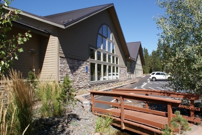
18135 Cottonwood Rd, Bend, OR 97707


Property Detail
18135 Cottonwood Rd
197279
REPLAT OF TRACT C DEER PARK I LOT PT 1
Resorthotel
DESCHUTES
SUCN
Oregon
B and X Area of moderate flood hazard, usually the area between the limits of the 100-year and 500-year floods.
1
2025
3.75 AC
2025
Deschutes County
000403
Portland
15,062 SF
Bend, OR
NEARBY LISTINGS FOR SALE OR LEASE
DEMOGRAPHICS near 18135 Cottonwood Rd
1 mile
3 mile
5 mile
2025 Total Population
3,070
6,686
10,497
2030 Population
3,613
7,861
12,027
Pop Growth 2025-2030
+ 17.69%
+ 17.57%
+ 14.58%
Average Age
61
61
56
2025 Total Households
1,552
3,375
5,011
HH Growth 2025-2030
+ 17.65%
+ 17.57%
+ 14.93%
Median Household Inc
$123,598
$125,189
$119,948
Avg Household Size
2.00
2.00
2.10
2025 Avg HH Vehicles
2.00
2.00
2.00
Median Home Value
$823,270
$828,051
$798,666
Median Year Built
1989
1990
1992
Nearby Places
Map Layers
Map Styles
 Street
 Aerial
Layers
 Traffic
 Biking
Places
Listings with unknown addresses are not visible on the map
- Restaurants
- Banks
- Shops
- Fitness
- Groceries
PUBLIC TRANSPORTATION
AIRPORT
Roberts Field
Drive
Walk
Distance
Roberts Field
48 min
31.8 mi
SALE & LEASE HISTORY
LISTING DATE
SALE/LEASE

Jun 25, 2024
For Sale
Jun 06, 2018
For Sale
Feb 08, 2021
For Sale
Aug 16, 2023
For Sale
Nearby Properties
Address
Land Use
TOTAL SIZE
Lot Size
Zoning
Address
Land Use
TOTAL SIZE
Lot Size
Zoning
94,873 SF
14.14 AC
SUC
Address
Land Use
TOTAL SIZE
Lot Size
Zoning
94,873 SF
14.14 AC
SUC
Address
Land Use
TOTAL SIZE
Lot Size
Zoning
38,472 SF
10.14 AC
SUCG
Address
Land Use
TOTAL SIZE
Lot Size
Zoning
8,082 SF
17.35 AC
SUR
Address
Land Use
TOTAL SIZE
Lot Size
Zoning
22,316 SF
5.65 AC
SUU
Address
Land Use
TOTAL SIZE
Lot Size
Zoning
5.65 AC
Address
Land Use
TOTAL SIZE
Lot Size
Zoning
42,150 SF
7.37 AC
SUR
Address
Land Use
TOTAL SIZE
Lot Size
Zoning
1,789 SF
9.19 AC
SUR
Address
Land Use
TOTAL SIZE
Lot Size
Zoning
22,764 SF
9.19 AC
SUR
Address
Land Use
TOTAL SIZE
Lot Size
Zoning
8,880 SF
15.28 AC
SUCN
Address
Land Use
TOTAL SIZE
Lot Size
Zoning
8,920 SF
100.29 AC
SUA
Address
Land Use
TOTAL SIZE
Lot Size
Zoning
16,994 SF
100.29 AC
SUA
Address
Land Use
TOTAL SIZE
Lot Size
Zoning
680 SF
100.29 AC
SUA
Address
Land Use
TOTAL SIZE
Lot Size
Zoning
34,535 SF
0.91 AC
SUCR
Address
Land Use
TOTAL SIZE
Lot Size
Zoning
6.08 AC
SUCR
Address
Land Use
TOTAL SIZE
Lot Size
Zoning
9,315 SF
0.42 AC
SURS
Address
Land Use
TOTAL SIZE
Lot Size
Zoning
6,341 SF
0.75 AC
F2
Address
Land Use
TOTAL SIZE
Lot Size
Zoning
5,507 SF
1.09 AC
F2
Address
Land Use
TOTAL SIZE
Lot Size
Zoning
21,439 SF
2.85 AC
SUR
Address
Land Use
TOTAL SIZE
Lot Size
Zoning
13,089 SF
3.03 AC
SUC
Address
Land Use
TOTAL SIZE
Lot Size
Zoning
6,214 SF
0.68 AC
F2
Address
Land Use
TOTAL SIZE
Lot Size
Zoning
46,964 SF
1.54 AC
SUBP
Address
Land Use
TOTAL SIZE
Lot Size
Zoning
6,172 SF
0.90 AC
F2
Address
Land Use
TOTAL SIZE
Lot Size
Zoning
10,212 SF
2.09 AC
SUBP
Address
Land Use
TOTAL SIZE
Lot Size
Zoning
27,200 SF
1.58 AC
SUBP
Address
Land Use
TOTAL SIZE
Lot Size
Zoning
6,402 SF
1.17 AC
SURS
Address
Land Use
TOTAL SIZE
Lot Size
Zoning
5,748 SF
0.35 AC
F2
Address
Land Use
TOTAL SIZE
Lot Size
Zoning
4,698 SF
0.35 AC
F2
Address
Land Use
TOTAL SIZE
Lot Size
Zoning
5,741 SF
0.79 AC
SURS
The World's #1 Commercial Real Estate Marketplace
Connect with us
© 2026 CoStar Group
The information above has been obtained from sources believed reliable. While we do not doubt its accuracy we have not verified it and make no guarantee, warranty or representation about it. It is your responsibility to independently confirm its accuracy and completeness. Any projections, opinions, assumptions, or estimates used are for example only and do not represent the current or future performance of the property. The value of this transaction to you depends on tax and other factors which should be evaluated by your tax, financial, and legal advisors. You and your advisors should conduct a careful, independent investigation of the property to determine to your satisfaction the suitability of the property for your needs.