Property Record
1815 Schafer St, Bismarck, ND 58501


Property Detail
1815 Schafer St
1425-001-050
HORIZON VIEW ADDITION LOT 2 & N10' OF S42' OF W60' OF LOT 2 BLK 1 PRAIRIE HILLS 5TH AND THAT PART OF LOT 2 TH LIES S LINE THL
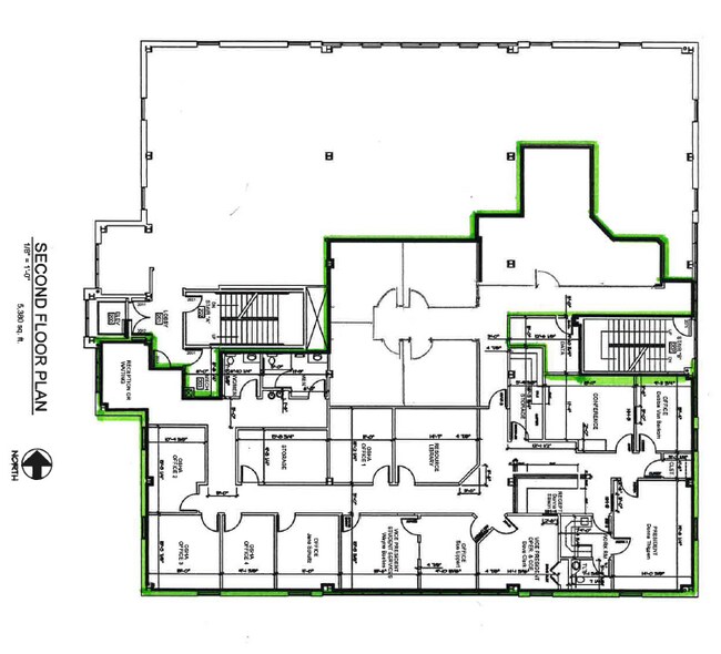
Officebuilding
Burleigh
CG
North Dakota
B and X Area of moderate flood hazard, usually the area between the limits of the 100-year and 500-year floods.
2
2025
1.83 AC
2025
Riverfront
010500
Other Market Areas
30,015 SF
Bismarck, ND
NEARBY LISTINGS FOR SALE OR LEASE
DEMOGRAPHICS near 1815 Schafer St
1 mile
3 mile
5 mile
2025 Total Population
5,764
59,505
103,328
2030 Population
5,922
61,271
106,373
Pop Growth 2025-2030
+ 2.74%
+ 2.97%
+ 2.95%
Average Age
39
41
41
2025 Total Households
2,352
26,284
43,985
HH Growth 2025-2030
+ 2.81%
+ 3.34%
+ 3.22%
Median Household Inc
$89,668
$75,975
$82,493
Avg Household Size
2.20
2.20
2.20
2025 Avg HH Vehicles
2.00
2.00
2.00
Median Home Value
$309,902
$286,049
$285,775
Median Year Built
1980
1979
1984
Nearby Places
Map Layers
Map Styles
 Street
 Aerial
Layers
 Traffic
 Biking
Places
Listings with unknown addresses are not visible on the map
- Restaurants
- Banks
- Shops
- Fitness
- Groceries
PUBLIC TRANSPORTATION
AIRPORT
Bismarck Municipal
Drive
Walk
Distance
Bismarck Municipal
22 min
9.3 mi
Freight Ports
Port Milwaukee
Drive
Walk
Distance
Port Milwaukee
823 min
765.7 mi
SALE & LEASE HISTORY
LISTING DATE
SALE/LEASE

Sep 25, 2016
For Lease
Apr 22, 2021
For Lease
Nearby Properties
Address
Land Use
TOTAL SIZE
Lot Size
Zoning
Address
Land Use
TOTAL SIZE
Lot Size
Zoning
45.23 AC
CG
Address
Land Use
TOTAL SIZE
Lot Size
Zoning
13.47 AC
PUD
Address
Land Use
TOTAL SIZE
Lot Size
Zoning
93,860 SF
1.44 AC
HM
Address
Land Use
TOTAL SIZE
Lot Size
Zoning
70,182 SF
3.83 AC
PUD
Address
Land Use
TOTAL SIZE
Lot Size
Zoning
7.67 AC
CG
Address
Land Use
TOTAL SIZE
Lot Size
Zoning
16.12 AC
CG
Address
Land Use
TOTAL SIZE
Lot Size
Zoning
81,092 SF
4.17 AC
HM
Address
Land Use
TOTAL SIZE
Lot Size
Zoning
38,467 SF
13.89 AC
CG
Address
Land Use
TOTAL SIZE
Lot Size
Zoning
68,211 SF
10 AC
RT
Address
Land Use
TOTAL SIZE
Lot Size
Zoning
31,202 SF
9.05 AC
RM30
Address
Land Use
TOTAL SIZE
Lot Size
Zoning
38,275 SF
10.53 AC
RM30
Address
Land Use
TOTAL SIZE
Lot Size
Zoning
11.48 AC
CG
Address
Land Use
TOTAL SIZE
Lot Size
Zoning
65,001 SF
9.88 AC
RT
Address
Land Use
TOTAL SIZE
Lot Size
Zoning
10.84 AC
CG
Address
Land Use
TOTAL SIZE
Lot Size
Zoning
13.98 AC
CG
Address
Land Use
TOTAL SIZE
Lot Size
Zoning
8.64 AC
ETZ
Address
Land Use
TOTAL SIZE
Lot Size
Zoning
77,694 SF
8.66 AC
RT
Address
Land Use
TOTAL SIZE
Lot Size
Zoning
7,560 SF
4.39 AC
PUD
Address
Land Use
TOTAL SIZE
Lot Size
Zoning
62,652 SF
2.34 AC
HM
Address
Land Use
TOTAL SIZE
Lot Size
Zoning
74,564 SF
6.67 AC
RT
Address
Land Use
TOTAL SIZE
Lot Size
Zoning
10.14 AC
CG
Address
Land Use
TOTAL SIZE
Lot Size
Zoning
57,580 SF
8.85 AC
CG
Address
Land Use
TOTAL SIZE
Lot Size
Zoning
25.59 AC
CG
Address
Land Use
TOTAL SIZE
Lot Size
Zoning
3.90 AC
RM30
Address
Land Use
TOTAL SIZE
Lot Size
Zoning
30,852 SF
2.04 AC
CG
Address
Land Use
TOTAL SIZE
Lot Size
Zoning
6.86 AC
CG
Address
Land Use
TOTAL SIZE
Lot Size
Zoning
10.58 AC
CG
Address
Land Use
TOTAL SIZE
Lot Size
Zoning
15,656 SF
8.98 AC
RM30
Address
Land Use
TOTAL SIZE
Lot Size
Zoning
98,908 SF
2.33 AC
MA
Address
Land Use
TOTAL SIZE
Lot Size
Zoning
14.65 AC
CG
The World's #1 Commercial Real Estate Marketplace
Connect with us
© 2026 CoStar Group
The information above has been obtained from sources believed reliable. While we do not doubt its accuracy we have not verified it and make no guarantee, warranty or representation about it. It is your responsibility to independently confirm its accuracy and completeness. Any projections, opinions, assumptions, or estimates used are for example only and do not represent the current or future performance of the property. The value of this transaction to you depends on tax and other factors which should be evaluated by your tax, financial, and legal advisors. You and your advisors should conduct a careful, independent investigation of the property to determine to your satisfaction the suitability of the property for your needs.