Property Record
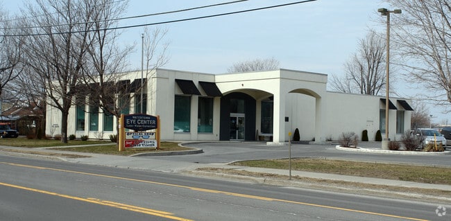
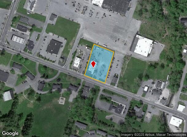
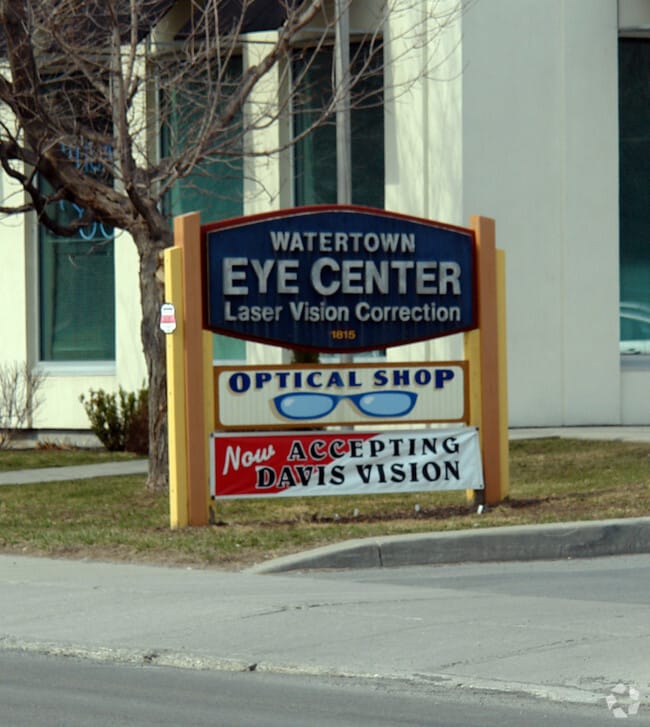
1815 State St, Watertown, NY 13601
NEARBY LISTINGS FOR SALE OR LEASE
Property Detail
1815 State St
221800-005-000-0021-103-000-0000
200X300 521103
Professionalbldglegalinsurancerealestateetc
Jefferson
ARE
New York
36045C0734G
103.000
2025
1.38 AC
2024
Jefferson County
061200
Syracuse
7,200 SF
Watertown-Fort Drum, NY
DEMOGRAPHICS near 1815 State St
1 Mile
3 Mile
5 Mile
2024 Total Population
5,715
27,344
35,750
2029 Population
5,625
26,944
35,158
Pop Growth 2024-2029
(1.57%)
(1.46%)
(1.66%)
Average Age
34
38
38
2024 Total Households
2,235
11,746
15,150
HH Growth 2024-2029
(1.88%)
(1.74%)
(1.93%)
Median Household Inc
$55,906
$51,504
$54,388
Avg Household Size
2.40
2.10
2.20
2024 Avg HH Vehicles
1.00
1.00
1.00
Median Home Value
$147,584
$151,943
$162,495
Median Year Built
1951
1949
1955
Nearby Places
Map Layers
Map Styles
 Street
 Aerial
- Restaurants
- Banks
- Shops
- Fitness
- Groceries
Nearby Properties
Address
Land Use
TOTAL SIZE
Lot Size
Zoning
Address
Land Use
TOTAL SIZE
Lot Size
Zoning
242,869 SF
8.06 AC
PC
Address
Land Use
TOTAL SIZE
Lot Size
Zoning
Address
Land Use
TOTAL SIZE
Lot Size
Zoning
160,819 SF
8.70 AC
PC
Address
Land Use
TOTAL SIZE
Lot Size
Zoning
158,186 SF
3.36 AC
PC
Address
Land Use
TOTAL SIZE
Lot Size
Zoning
381,570 SF
3.30 AC
DC
Address
Land Use
TOTAL SIZE
Lot Size
Zoning
215,473 SF
82.50 AC
PC
Address
Land Use
TOTAL SIZE
Lot Size
Zoning
746,745 SF
72.40 AC
C
Address
Land Use
TOTAL SIZE
Lot Size
Zoning
115,362 SF
12.39 AC
INDUST
Address
Land Use
TOTAL SIZE
Lot Size
Zoning
79,220 SF
0.47 AC
DC
Address
Land Use
TOTAL SIZE
Lot Size
Zoning
69,672 SF
20.95 AC
PC
Address
Land Use
TOTAL SIZE
Lot Size
Zoning
74,565 SF
2.50 AC
DC
Address
Land Use
TOTAL SIZE
Lot Size
Zoning
176,409 SF
1.99 AC
PC
Address
Land Use
TOTAL SIZE
Lot Size
Zoning
0.33 AC
DC
Address
Land Use
TOTAL SIZE
Lot Size
Zoning
4,744 SF
31.15 AC
SPLIT
Address
Land Use
TOTAL SIZE
Lot Size
Zoning
48,818 SF
3.25 AC
PC
Address
Land Use
TOTAL SIZE
Lot Size
Zoning
59,771 SF
9.68 AC
PARK
Address
Land Use
TOTAL SIZE
Lot Size
Zoning
10,559 SF
1.11 AC
99
Address
Land Use
TOTAL SIZE
Lot Size
Zoning
134,480 SF
21.36 AC
99
Address
Land Use
TOTAL SIZE
Lot Size
Zoning
87,912 SF
88.80 AC
C
Address
Land Use
TOTAL SIZE
Lot Size
Zoning
1,200 SF
13.71 AC
PARK
Address
Land Use
TOTAL SIZE
Lot Size
Zoning
111,529 SF
31.30 AC
INDUST
Address
Land Use
TOTAL SIZE
Lot Size
Zoning
21,552 SF
3.10 AC
DC
Address
Land Use
TOTAL SIZE
Lot Size
Zoning
7,500 SF
31.71 AC
PARK
Address
Land Use
TOTAL SIZE
Lot Size
Zoning
32,200 SF
1.11 AC
DC
Address
Land Use
TOTAL SIZE
Lot Size
Zoning
88,021 SF
2.70 AC
UMU
Address
Land Use
TOTAL SIZE
Lot Size
Zoning
11,575 SF
2.22 AC
DC
Address
Land Use
TOTAL SIZE
Lot Size
Zoning
3,308 SF
25.55 AC
PC
Address
Land Use
TOTAL SIZE
Lot Size
Zoning
97,920 SF
23.22 AC
PC
Address
Land Use
TOTAL SIZE
Lot Size
Zoning
83,372 SF
4.28 AC
PC
Address
Land Use
TOTAL SIZE
Lot Size
Zoning
61,142 SF
1.31 AC
DC
The World's #1 Commercial Real Estate Marketplace
Connect with us
© 2026 CoStar Group
The information above has been obtained from sources believed reliable. While we do not doubt its accuracy we have not verified it and make no guarantee, warranty or representation about it. It is your responsibility to independently confirm its accuracy and completeness. Any projections, opinions, assumptions, or estimates used are for example only and do not represent the current or future performance of the property. The value of this transaction to you depends on tax and other factors which should be evaluated by your tax, financial, and legal advisors. You and your advisors should conduct a careful, independent investigation of the property to determine to your satisfaction the suitability of the property for your needs.