Property Record
1815 W 8Th Ave, Mesa, AZ 85202

NEARBY LISTINGS FOR SALE OR LEASE
Property Detail
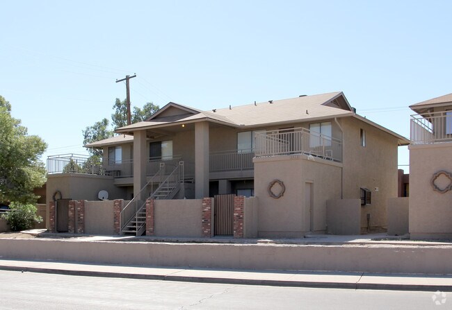
1815 W 8Th Ave
134-30-004E
PT SW4 NW4 DAF BEG W4 COR SD SEC TH E 1067.74F ALG MID-SEC LN TO PT SLY R/W LN ALG CUR CONC NW 48.79F N 56DE 25F TPOB CONT N 56DE ALG SLY R/W LN 63.82F BEG CUR RAD 274.95F CONC SE ALG SLY CUR 101.89F S 69.10F W 25F S 30F W 91.81F CONC NE ALG CUR 24.7
Quadruplex
Maricopa
X
Arizona
04013C2265M
0.28 AC
2025
Central Mesa
2025
Phoenix
422103
Phoenix-Mesa-Chandler, AZ
3,780 SF
DEMOGRAPHICS near 1815 W 8Th Ave
1 Mile
3 Mile
5 Mile
2024 Total Population
26,785
165,199
396,441
2029 Population
29,099
178,407
427,647
Pop Growth 2024-2029
+ 8.64%
+ 8.00%
+ 7.87%
Average Age
36
36
36
2024 Total Households
11,438
67,284
155,835
HH Growth 2024-2029
+ 8.83%
+ 8.16%
+ 8.12%
Median Household Inc
$46,120
$56,199
$61,560
Avg Household Size
2.20
2.40
2.40
2024 Avg HH Vehicles
1.00
2.00
2.00
Median Home Value
$266,075
$322,759
$337,634
Median Year Built
1980
1979
1981
Nearby Places
Map Layers
Map Styles
 Street
 Aerial
- Restaurants
- Banks
- Shops
- Fitness
- Groceries
PUBLIC TRANSPORTATION
AIRPORT
Phoenix Sky Harbor International
DRIVE
WALK
Distance
Phoenix Sky Harbor International
17 min
10.4 mi
Phoenix-Mesa Gateway
DRIVE
WALK
Distance
Phoenix-Mesa Gateway
29 min
19.0 mi
Nearby Properties
Address
Land Use
TOTAL SIZE
Lot Size
Zoning
Address
Land Use
TOTAL SIZE
Lot Size
Zoning
439,211 SF
77.92 AC
C-G
Address
Land Use
TOTAL SIZE
Lot Size
Zoning
918,576 SF
22.96 AC
C-N
Address
Land Use
TOTAL SIZE
Lot Size
Zoning
1,418,890 SF
39 AC
PF
Address
Land Use
TOTAL SIZE
Lot Size
Zoning
805,814 SF
115.19 AC
C-G
Address
Land Use
TOTAL SIZE
Lot Size
Zoning
8.79 AC
PF
Address
Land Use
TOTAL SIZE
Lot Size
Zoning
197,454 SF
18.97 AC
PF
Address
Land Use
TOTAL SIZE
Lot Size
Zoning
401,437 SF
17.70 AC
C-R
Address
Land Use
TOTAL SIZE
Lot Size
Zoning
377,442 SF
0.21 AC
C-DT
Address
Land Use
TOTAL SIZE
Lot Size
Zoning
937,488 SF
40.63 AC
R-4
Address
Land Use
TOTAL SIZE
Lot Size
Zoning
564,649 SF
7.19 AC
RCC
Address
Land Use
TOTAL SIZE
Lot Size
Zoning
739,944 SF
40.02 AC
MFM
Address
Land Use
TOTAL SIZE
Lot Size
Zoning
448,308 SF
6.30 AC
GID
Address
Land Use
TOTAL SIZE
Lot Size
Zoning
267,023 SF
19.58 AC
PEP
Address
Land Use
TOTAL SIZE
Lot Size
Zoning
15,050 SF
1.42 AC
C-G
Address
Land Use
TOTAL SIZE
Lot Size
Zoning
459,103 SF
13.27 AC
MU4
Address
Land Use
TOTAL SIZE
Lot Size
Zoning
562,356 SF
6.70 AC
MU4
Address
Land Use
TOTAL SIZE
Lot Size
Zoning
782,618 SF
6.70 AC
PAD
Address
Land Use
TOTAL SIZE
Lot Size
Zoning
485,625 SF
45.99 AC
PF
Address
Land Use
TOTAL SIZE
Lot Size
Zoning
32,619 SF
2.40 AC
C-G
Address
Land Use
TOTAL SIZE
Lot Size
Zoning
435,896 SF
3.40 AC
PCC2
Address
Land Use
TOTAL SIZE
Lot Size
Zoning
501,927 SF
8.13 AC
GC
Address
Land Use
TOTAL SIZE
Lot Size
Zoning
13,336 SF
1.98 AC
I-2
Address
Land Use
TOTAL SIZE
Lot Size
Zoning
411,683 SF
15.53 AC
RM3
Address
Land Use
TOTAL SIZE
Lot Size
Zoning
357,952 SF
33.73 AC
LI
Address
Land Use
TOTAL SIZE
Lot Size
Zoning
418,678 SF
18.63 AC
C-G
Address
Land Use
TOTAL SIZE
Lot Size
Zoning
407,570 SF
6.22 AC
PEP
Address
Land Use
TOTAL SIZE
Lot Size
Zoning
23,030 SF
0.99 AC
M-H
Address
Land Use
TOTAL SIZE
Lot Size
Zoning
454,015 SF
10.03 AC
DB1
Address
Land Use
TOTAL SIZE
Lot Size
Zoning
572,119 SF
22.45 AC
PF
Address
Land Use
TOTAL SIZE
Lot Size
Zoning
291,833 SF
36.86 AC
R-6
The World's #1 Commercial Real Estate Marketplace
Connect with us
© 2026 CoStar Group
The information above has been obtained from sources believed reliable. While we do not doubt its accuracy we have not verified it and make no guarantee, warranty or representation about it. It is your responsibility to independently confirm its accuracy and completeness. Any projections, opinions, assumptions, or estimates used are for example only and do not represent the current or future performance of the property. The value of this transaction to you depends on tax and other factors which should be evaluated by your tax, financial, and legal advisors. You and your advisors should conduct a careful, independent investigation of the property to determine to your satisfaction the suitability of the property for your needs.