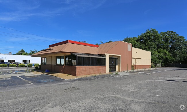
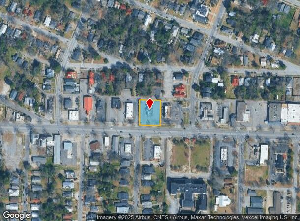
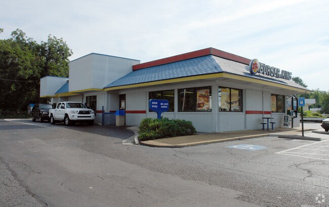
Property Record
1815 Walton Way, Augusta, GA 30904
NEARBY LISTINGS FOR SALE OR LEASE
Property Detail
1815 Walton Way
0354460000
1815 WALTON WAY
Commercialacreage
Richmond
X
Georgia
13245C0130H
0.51 AC
2025
Downtown Augusta
2025
Augusta/Richmond County
000300
Augusta-Richmond County, GA-SC
2,846 SF
DEMOGRAPHICS near 1815 Walton Way
1 Mile
3 Mile
5 Mile
2024 Total Population
10,267
56,144
123,970
2029 Population
10,461
57,277
125,412
Pop Growth 2024-2029
+ 1.89%
+ 2.02%
+ 1.16%
Average Age
40
40
39
2024 Total Households
4,645
25,619
54,986
HH Growth 2024-2029
+ 1.85%
+ 2.08%
+ 1.09%
Median Household Inc
$30,673
$39,687
$44,836
Avg Household Size
2.00
2.10
2.20
2024 Avg HH Vehicles
1.00
1.00
2.00
Median Home Value
$150,475
$175,939
$159,922
Median Year Built
1949
1960
1969
Nearby Places
Map Layers
Map Styles
 Street
 Aerial
- Restaurants
- Banks
- Shops
- Fitness
- Groceries
PUBLIC TRANSPORTATION
AIRPORT
Augusta Regional at Bush Field
DRIVE
WALK
Distance
Augusta Regional at Bush Field
18 min
9.8 mi
Freight Ports
Georgia Ports - Savannah
DRIVE
WALK
Distance
Georgia Ports - Savannah
1 min
105.6 mi
SALE & LEASE HISTORY
LISTING DATE
SALE/LEASE

Aug 10, 2017
For Sale
Nearby Properties
Address
Land Use
TOTAL SIZE
Lot Size
Zoning
Address
Land Use
TOTAL SIZE
Lot Size
Zoning
954,084 SF
18.30 AC
B-2
Address
Land Use
TOTAL SIZE
Lot Size
Zoning
8,993 SF
351.84 AC
R-1_B-2
Address
Land Use
TOTAL SIZE
Lot Size
Zoning
52,025 SF
6.46 AC
Address
Land Use
TOTAL SIZE
Lot Size
Zoning
627,990 SF
20 AC
P-1
Address
Land Use
TOTAL SIZE
Lot Size
Zoning
1,100 SF
97.38 AC
R-1A
Address
Land Use
TOTAL SIZE
Lot Size
Zoning
197,726 SF
2.93 AC
B-2
Address
Land Use
TOTAL SIZE
Lot Size
Zoning
169,662 SF
3.09 AC
B-2
Address
Land Use
TOTAL SIZE
Lot Size
Zoning
202,994 SF
19.25 AC
P-1
Address
Land Use
TOTAL SIZE
Lot Size
Zoning
179,743 SF
9.52 AC
007
Address
Land Use
TOTAL SIZE
Lot Size
Zoning
102,429 SF
7.31 AC
PUD
Address
Land Use
TOTAL SIZE
Lot Size
Zoning
255,834 SF
5.56 AC
B-1
Address
Land Use
TOTAL SIZE
Lot Size
Zoning
102,748 SF
22.60 AC
R-3B
Address
Land Use
TOTAL SIZE
Lot Size
Zoning
179,779 SF
5.91 AC
B-2
Address
Land Use
TOTAL SIZE
Lot Size
Zoning
1,000 SF
4.45 AC
Address
Land Use
TOTAL SIZE
Lot Size
Zoning
267,960 SF
2.13 AC
B-2
Address
Land Use
TOTAL SIZE
Lot Size
Zoning
61,769 SF
12.06 AC
B-2
Address
Land Use
TOTAL SIZE
Lot Size
Zoning
152,352 SF
1.51 AC
Address
Land Use
TOTAL SIZE
Lot Size
Zoning
137,062 SF
4.45 AC
B-2
Address
Land Use
TOTAL SIZE
Lot Size
Zoning
127,728 SF
1.34 AC
B-2
Address
Land Use
TOTAL SIZE
Lot Size
Zoning
109,076 SF
4.23 AC
R-3C
Address
Land Use
TOTAL SIZE
Lot Size
Zoning
106,500 SF
1.41 AC
Address
Land Use
TOTAL SIZE
Lot Size
Zoning
25,504 SF
9.87 AC
B-2
Address
Land Use
TOTAL SIZE
Lot Size
Zoning
21,615 SF
207.78 AC
R-1
Address
Land Use
TOTAL SIZE
Lot Size
Zoning
225,546 SF
1.28 AC
B-2
Address
Land Use
TOTAL SIZE
Lot Size
Zoning
6,424 SF
15.16 AC
R-3C
Address
Land Use
TOTAL SIZE
Lot Size
Zoning
90,447 SF
1.28 AC
B-1
Address
Land Use
TOTAL SIZE
Lot Size
Zoning
431,971 SF
21.07 AC
007
Address
Land Use
TOTAL SIZE
Lot Size
Zoning
17,954 SF
6.61 AC
LI
Address
Land Use
TOTAL SIZE
Lot Size
Zoning
94,850 SF
0.90 AC
B-2
Address
Land Use
TOTAL SIZE
Lot Size
Zoning
4,507 SF
56.06 AC
HI
The World's #1 Commercial Real Estate Marketplace
Connect with us
© 2025 CoStar Group
The information above has been obtained from sources believed reliable. While we do not doubt its accuracy we have not verified it and make no guarantee, warranty or representation about it. It is your responsibility to independently confirm its accuracy and completeness. Any projections, opinions, assumptions, or estimates used are for example only and do not represent the current or future performance of the property. The value of this transaction to you depends on tax and other factors which should be evaluated by your tax, financial, and legal advisors. You and your advisors should conduct a careful, independent investigation of the property to determine to your satisfaction the suitability of the property for your needs.