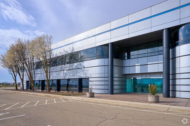
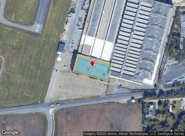
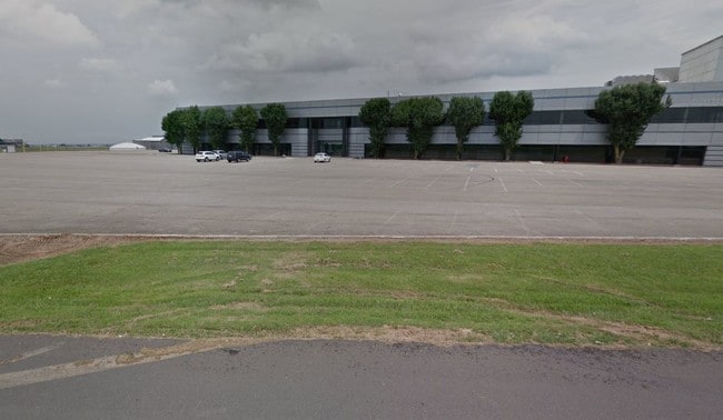
Property Record
18150 Showalter Rd, Hagerstown, MD 21742
NEARBY LISTINGS FOR SALE OR LEASE
Property Detail
18150 Showalter Rd
Hagerstown-Martinsburg, MD-WV
First Flight Air Park Condominium
27-038158
UNIT 1 1.3763 ACRES SHOWALTER ROAD
Officecondo
Washington
X
Maryland
24043C0128D
un 1
2024
1.37 AC
2025
Washington County
011202
Washington, DC
119,900 SF
DEMOGRAPHICS near 18150 Showalter Rd
1 Mile
3 Mile
5 Mile
2024 Total Population
3,068
20,637
65,514
2029 Population
3,061
20,739
66,325
Pop Growth 2024-2029
(0.23%)
+ 0.49%
+ 1.24%
Average Age
39
41
40
2024 Total Households
1,171
8,079
25,863
HH Growth 2024-2029
(0.26%)
+ 0.58%
+ 1.28%
Median Household Inc
$67,062
$77,535
$55,431
Avg Household Size
2.60
2.50
2.40
2024 Avg HH Vehicles
2.00
2.00
2.00
Median Home Value
$239,756
$277,777
$221,492
Median Year Built
1982
1982
1969
Nearby Places
Map Layers
Map Styles
 Street
 Aerial
- Restaurants
- Banks
- Shops
- Fitness
- Groceries
PUBLIC TRANSPORTATION
AIRPORT
Hagerstown Regional/Richard A Henson Field
DRIVE
WALK
Distance
Hagerstown Regional/Richard A Henson Field
1 min
0.2 mi
Freight Ports
Port of Baltimore
DRIVE
WALK
Distance
Port of Baltimore
101 min
81.6 mi
SALE & LEASE HISTORY
LISTING DATE
SALE/LEASE

Sep 26, 2019
For Lease
May 11, 2021
For Sale
Jul 20, 2023
For Sale
Nearby Properties
Address
Land Use
TOTAL SIZE
Lot Size
Zoning
Address
Land Use
TOTAL SIZE
Lot Size
Zoning
1,190,700 SF
83.26 AC
HI
Address
Land Use
TOTAL SIZE
Lot Size
Zoning
23,941 SF
401.89 AC
U
Address
Land Use
TOTAL SIZE
Lot Size
Zoning
801,000 SF
86.86 AC
HI
Address
Land Use
TOTAL SIZE
Lot Size
Zoning
36,685 SF
281.72 AC
IG
Address
Land Use
TOTAL SIZE
Lot Size
Zoning
151,660 SF
56.24 AC
RMOD
Address
Land Use
TOTAL SIZE
Lot Size
Zoning
127,315 SF
26.65 AC
RMOD
Address
Land Use
TOTAL SIZE
Lot Size
Zoning
6,778 SF
8.24 AC
RH
Address
Land Use
TOTAL SIZE
Lot Size
Zoning
91,586 SF
28.49 AC
U
Address
Land Use
TOTAL SIZE
Lot Size
Zoning
5,090 SF
25.27 AC
RMOD
Address
Land Use
TOTAL SIZE
Lot Size
Zoning
150,000 SF
22.73 AC
HI
Address
Land Use
TOTAL SIZE
Lot Size
Zoning
764,619 SF
31.10 AC
IG
Address
Land Use
TOTAL SIZE
Lot Size
Zoning
35,402 SF
10.18 AC
BG
Address
Land Use
TOTAL SIZE
Lot Size
Zoning
84,796 SF
8.81 AC
PB
Address
Land Use
TOTAL SIZE
Lot Size
Zoning
78,042 SF
11 AC
RB-E
Address
Land Use
TOTAL SIZE
Lot Size
Zoning
51,773 SF
11.96 AC
HI
Address
Land Use
TOTAL SIZE
Lot Size
Zoning
36,000 SF
12.07 AC
RM
Address
Land Use
TOTAL SIZE
Lot Size
Zoning
188,784 SF
79.06 AC
AP
Address
Land Use
TOTAL SIZE
Lot Size
Zoning
351,104 SF
55.68 AC
AP
Address
Land Use
TOTAL SIZE
Lot Size
Zoning
6,300 SF
35.92 AC
RT
Address
Land Use
TOTAL SIZE
Lot Size
Zoning
102,782 SF
12.92 AC
RMOD
Address
Land Use
TOTAL SIZE
Lot Size
Zoning
12,908 SF
12.94 AC
HI
Address
Land Use
TOTAL SIZE
Lot Size
Zoning
287,625 SF
19.69 AC
IG
Address
Land Use
TOTAL SIZE
Lot Size
Zoning
20,312 SF
17.59 AC
U
Address
Land Use
TOTAL SIZE
Lot Size
Zoning
21,483 SF
3.51 AC
HI
Address
Land Use
TOTAL SIZE
Lot Size
Zoning
12.19 AC
RH
Address
Land Use
TOTAL SIZE
Lot Size
Zoning
34,110 SF
8.03 AC
HI
Address
Land Use
TOTAL SIZE
Lot Size
Zoning
135,184 SF
61.18 AC
HI
Address
Land Use
TOTAL SIZE
Lot Size
Zoning
43,600 SF
3.71 AC
HI
Address
Land Use
TOTAL SIZE
Lot Size
Zoning
6,077 SF
8.82 AC
U
Address
Land Use
TOTAL SIZE
Lot Size
Zoning
47,923 SF
10.25 AC
RS
The World's #1 Commercial Real Estate Marketplace
Connect with us
© 2026 CoStar Group
The information above has been obtained from sources believed reliable. While we do not doubt its accuracy we have not verified it and make no guarantee, warranty or representation about it. It is your responsibility to independently confirm its accuracy and completeness. Any projections, opinions, assumptions, or estimates used are for example only and do not represent the current or future performance of the property. The value of this transaction to you depends on tax and other factors which should be evaluated by your tax, financial, and legal advisors. You and your advisors should conduct a careful, independent investigation of the property to determine to your satisfaction the suitability of the property for your needs.