Property Record
18155 Lyons Valley Rd, Jamul, CA 91935
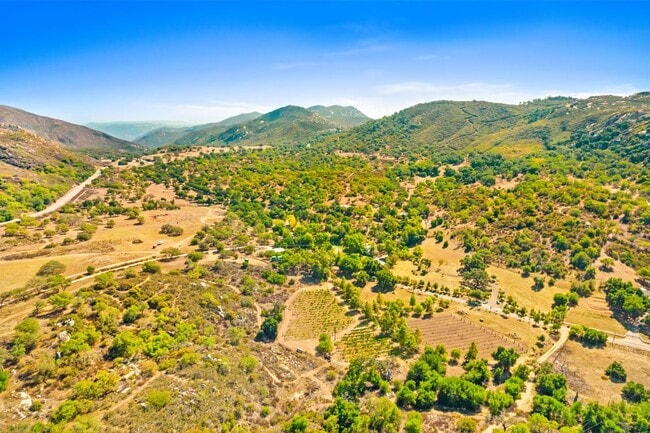


Property Detail
18155 Lyons Valley Rd
599-140-07
SEC 10-17-2E NE 1/4 E 1/2 OF
Agriculturalland
SAN DIEGO
A72
California
D Areas with possible but undetermined flood hazards.
80 AC
2024
Outlying SD County S
2025
San Diego
021302
San Diego-Chula Vista-Carlsbad, CA
NEARBY LISTINGS FOR SALE OR LEASE
-
-
View all Jamul listings for sale on LoopNet.com
DEMOGRAPHICS near 18155 Lyons Valley Rd
1 mile
3 mile
5 mile
2025 Total Population
240
2,049
5,179
2030 Population
238
2,038
5,152
Pop Growth 2025-2030
(0.83%)
(0.54%)
(0.52%)
Average Age
44
43
43
2025 Total Households
84
588
1,324
HH Growth 2025-2030
0.00%
(0.68%)
(0.76%)
Median Household Inc
$132,500
$134,936
$136,956
Avg Household Size
2.80
2.80
2.90
2025 Avg HH Vehicles
3.00
3.00
3.00
Median Home Value
$762,820
$756,317
$789,695
Median Year Built
1984
1983
1983
Nearby Places
Map Layers
Map Styles
 Street
 Aerial
Transit
 Traffic
 Biking
Places
Listings with unknown addresses are not visible on the map
- Restaurants
- Banks
- Shops
- Fitness
- Groceries
PUBLIC TRANSPORTATION
AIRPORT
San Diego International
Drive
Walk
Distance
San Diego International
45 min
31.5 mi
Freight Ports
Port of San Diego
Drive
Walk
Distance
Port of San Diego
43 min
28.8 mi
SALE & LEASE HISTORY
LISTING DATE
SALE/LEASE

Oct 17, 2021
For Sale
Nearby Properties
Address
Land Use
TOTAL SIZE
Lot Size
Zoning
Address
Land Use
TOTAL SIZE
Lot Size
Zoning
6,363 SF
13.53 AC
A72
Address
Land Use
TOTAL SIZE
Lot Size
Zoning
121.34 AC
A72
Address
Land Use
TOTAL SIZE
Lot Size
Zoning
6,117 SF
76.91 AC
A72
Address
Land Use
TOTAL SIZE
Lot Size
Zoning
4,112 SF
4.67 AC
A72
Address
Land Use
TOTAL SIZE
Lot Size
Zoning
80 AC
A72
Address
Land Use
TOTAL SIZE
Lot Size
Zoning
74.86 AC
A72
Address
Land Use
TOTAL SIZE
Lot Size
Zoning
72.41 AC
A72
Address
Land Use
TOTAL SIZE
Lot Size
Zoning
4,602 SF
14.06 AC
A72
Address
Land Use
TOTAL SIZE
Lot Size
Zoning
4,641 SF
40 AC
A72
Address
Land Use
TOTAL SIZE
Lot Size
Zoning
3,344 SF
11.34 AC
A72
Address
Land Use
TOTAL SIZE
Lot Size
Zoning
3,987 SF
13.05 AC
A72
Address
Land Use
TOTAL SIZE
Lot Size
Zoning
2,602 SF
10.52 AC
A72
Address
Land Use
TOTAL SIZE
Lot Size
Zoning
5,125 SF
10.42 AC
A72
Address
Land Use
TOTAL SIZE
Lot Size
Zoning
1,880 SF
7.14 AC
A72
Address
Land Use
TOTAL SIZE
Lot Size
Zoning
4,969 SF
10.98 AC
A72
Address
Land Use
TOTAL SIZE
Lot Size
Zoning
2,337 SF
19.55 AC
A72
Address
Land Use
TOTAL SIZE
Lot Size
Zoning
3.06 AC
A72
Address
Land Use
TOTAL SIZE
Lot Size
Zoning
353.37 AC
A72
Address
Land Use
TOTAL SIZE
Lot Size
Zoning
2,915 SF
2.67 AC
A72
Address
Land Use
TOTAL SIZE
Lot Size
Zoning
4,490 SF
36.11 AC
A72
Address
Land Use
TOTAL SIZE
Lot Size
Zoning
4,360 SF
16.35 AC
A72
Address
Land Use
TOTAL SIZE
Lot Size
Zoning
233.15 AC
S80
Address
Land Use
TOTAL SIZE
Lot Size
Zoning
3,916 SF
38.87 AC
A72
Address
Land Use
TOTAL SIZE
Lot Size
Zoning
225.78 AC
A72
Address
Land Use
TOTAL SIZE
Lot Size
Zoning
2,294 SF
10.96 AC
A72
Address
Land Use
TOTAL SIZE
Lot Size
Zoning
2,230 SF
2.24 AC
A72
Address
Land Use
TOTAL SIZE
Lot Size
Zoning
158.18 AC
A72
Address
Land Use
TOTAL SIZE
Lot Size
Zoning
20 AC
A72
Address
Land Use
TOTAL SIZE
Lot Size
Zoning
9.53 AC
A72
The World's #1 Commercial Real Estate Marketplace
Connect with us
© 2026 CoStar Group
The information above has been obtained from sources believed reliable. While we do not doubt its accuracy we have not verified it and make no guarantee, warranty or representation about it. It is your responsibility to independently confirm its accuracy and completeness. Any projections, opinions, assumptions, or estimates used are for example only and do not represent the current or future performance of the property. The value of this transaction to you depends on tax and other factors which should be evaluated by your tax, financial, and legal advisors. You and your advisors should conduct a careful, independent investigation of the property to determine to your satisfaction the suitability of the property for your needs.