Property Record
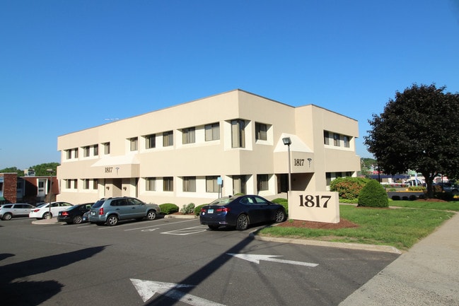
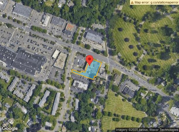
1817 Black Rock Tpke, Fairfield, CT 06825


This Property Is For Sale
NEARBY LISTINGS FOR SALE OR LEASE
Property Detail
1817 Black Rock Tpke
Commercialbuilding
Fairfield
X
Connecticut
09001C0436G
0.67 AC
2025
Fairfield
2025
Westchester/So Connecticut
061000
Bridgeport-Stamford-Norwalk, CT
14,668 SF
FAIR-000076-000000-000245
DEMOGRAPHICS near 1817 Black Rock Tpke
1 Mile
3 Mile
5 Mile
2024 Total Population
13,847
131,393
234,833
2029 Population
13,892
131,620
235,446
Pop Growth 2024-2029
+ 0.32%
+ 0.17%
+ 0.26%
Average Age
41
38
38
2024 Total Households
5,205
46,425
83,209
HH Growth 2024-2029
+ 0.33%
+ 0.10%
+ 0.22%
Median Household Inc
$106,768
$68,506
$68,726
Avg Household Size
2.60
2.60
2.60
2024 Avg HH Vehicles
2.00
2.00
2.00
Median Home Value
$492,985
$396,720
$376,527
Median Year Built
1959
1955
1955
Nearby Places
- Restaurants
- Banks
- Shops
- Fitness
- Groceries
PUBLIC TRANSPORTATION
COMMUTER RAIL
DRIVE
WALK
Distance
5 min
2.0 mi
Fairfield Station (New Haven Line - Metro-North Commuter Railroad Company (Metro-North))
DRIVE
WALK
Distance
Fairfield Station (New Haven Line - Metro-North Commuter Railroad Company (Metro-North))
7 min
3.7 mi
AIRPORT
Tweed/New Haven
DRIVE
WALK
Distance
Tweed/New Haven
43 min
26.8 mi
Westchester County
DRIVE
WALK
Distance
Westchester County
48 min
33.0 mi
Long Island MacArthur
DRIVE
WALK
Distance
Long Island MacArthur
115 min
37.8 mi
Nearby Properties
Address
Land Use
TOTAL SIZE
Lot Size
Zoning
Address
Land Use
TOTAL SIZE
Lot Size
Zoning
Address
Land Use
TOTAL SIZE
Lot Size
Zoning
23.95 AC
RB
Address
Land Use
TOTAL SIZE
Lot Size
Zoning
356,837 SF
8.87 AC
RA
Address
Land Use
TOTAL SIZE
Lot Size
Zoning
111 AC
RA
Address
Land Use
TOTAL SIZE
Lot Size
Zoning
120,955 SF
9.37 AC
RA
Address
Land Use
TOTAL SIZE
Lot Size
Zoning
335,633 SF
39.70 AC
R3
Address
Land Use
TOTAL SIZE
Lot Size
Zoning
19.43 AC
A
Address
Land Use
TOTAL SIZE
Lot Size
Zoning
1,183 SF
2.33 AC
DID
Address
Land Use
TOTAL SIZE
Lot Size
Zoning
213,826 SF
18.30 AC
A
Address
Land Use
TOTAL SIZE
Lot Size
Zoning
146,351 SF
8.86 AC
Address
Land Use
TOTAL SIZE
Lot Size
Zoning
10.66 AC
ORR
Address
Land Use
TOTAL SIZE
Lot Size
Zoning
10.28 AC
DID
Address
Land Use
TOTAL SIZE
Lot Size
Zoning
260,992 SF
4.19 AC
ILI
Address
Land Use
TOTAL SIZE
Lot Size
Zoning
43,489 SF
21.09 AC
AAA
Address
Land Use
TOTAL SIZE
Lot Size
Zoning
493,114 SF
2.20 AC
DCB
Address
Land Use
TOTAL SIZE
Lot Size
Zoning
144,086 SF
3.12 AC
DRD
Address
Land Use
TOTAL SIZE
Lot Size
Zoning
22.43 AC
R3
Address
Land Use
TOTAL SIZE
Lot Size
Zoning
115,006 SF
2.51 AC
DCD
Address
Land Use
TOTAL SIZE
Lot Size
Zoning
12.47 AC
AA
Address
Land Use
TOTAL SIZE
Lot Size
Zoning
216,972 SF
2.53 AC
DCB
Address
Land Use
TOTAL SIZE
Lot Size
Zoning
14.90 AC
RC
Address
Land Use
TOTAL SIZE
Lot Size
Zoning
5.31 AC
RC
Address
Land Use
TOTAL SIZE
Lot Size
Zoning
16.73 AC
DCD
Address
Land Use
TOTAL SIZE
Lot Size
Zoning
79,739 SF
1.53 AC
PDD
Address
Land Use
TOTAL SIZE
Lot Size
Zoning
7.52 AC
RC
Address
Land Use
TOTAL SIZE
Lot Size
Zoning
2.40 AC
DCB
Address
Land Use
TOTAL SIZE
Lot Size
Zoning
14.18 AC
RC
Address
Land Use
TOTAL SIZE
Lot Size
Zoning
2 AC
DCB
Address
Land Use
TOTAL SIZE
Lot Size
Zoning
101,558 SF
7.74 AC
ORN
Address
Land Use
TOTAL SIZE
Lot Size
Zoning
6.43 AC
DCD
The World's #1 Commercial Real Estate Marketplace
Connect with us
© 2025 CoStar Group
The information above has been obtained from sources believed reliable. While we do not doubt its accuracy we have not verified it and make no guarantee, warranty or representation about it. It is your responsibility to independently confirm its accuracy and completeness. Any projections, opinions, assumptions, or estimates used are for example only and do not represent the current or future performance of the property. The value of this transaction to you depends on tax and other factors which should be evaluated by your tax, financial, and legal advisors. You and your advisors should conduct a careful, independent investigation of the property to determine to your satisfaction the suitability of the property for your needs.