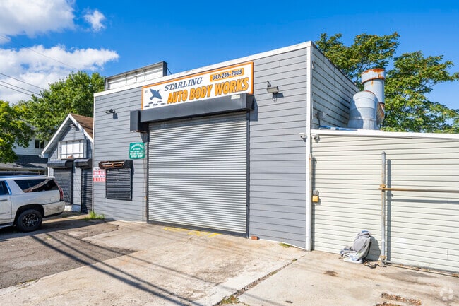
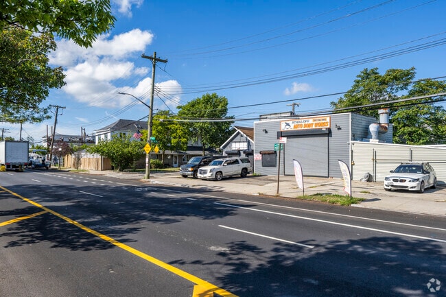
Property Record
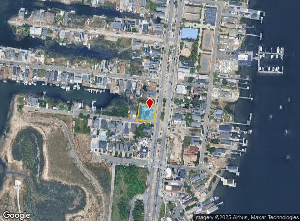
1817 Cross Bay Blvd, Broad Channel, NY 11693
NEARBY LISTINGS FOR SALE OR LEASE
Property Detail
1817 Cross Bay Blvd
15323-0057
Queens
Autorepair
New York
AE
57
3604970377F
0.23 AC
2024
South Queens
2025
Long Island (New York)
107201
New York-Jersey City-White Plains, NY-NJ
1,673 SF
DEMOGRAPHICS near 1817 Cross Bay Blvd
1 Mile
3 Mile
5 Mile
2024 Total Population
7,323
66,244
238,794
2029 Population
6,942
62,234
223,147
Pop Growth 2024-2029
(5.20%)
(6.05%)
(6.55%)
Average Age
39
41
41
2024 Total Households
2,702
24,281
84,766
HH Growth 2024-2029
(5.59%)
(6.14%)
(6.69%)
Median Household Inc
$50,248
$59,876
$63,151
Avg Household Size
2.60
2.50
2.60
2024 Avg HH Vehicles
1.00
1.00
1.00
Median Home Value
$548,672
$616,128
$672,879
Median Year Built
1958
1966
1963
Nearby Places
Map Layers
Map Styles
 Street
 Aerial
- Restaurants
- Banks
- Shops
- Fitness
- Groceries
PUBLIC TRANSPORTATION
TRANSIT/SUBWAY
Broad Channel (A - New York MTA Subway (The Subway), Rockaway Park Shuttle - New York MTA Subway (The Subway))
DRIVE
WALK
Distance
Broad Channel (A - New York MTA Subway (The Subway), Rockaway Park Shuttle - New York MTA Subway (The Subway))
3 min
14 min
0.7 mi
COMMUTER RAIL
Far Rockaway Station (Far Rockaway Branch - Long Island Rail Road)
DRIVE
WALK
Distance
Far Rockaway Station (Far Rockaway Branch - Long Island Rail Road)
10 min
5.2 mi
Inwood Station (Far Rockaway Branch - Long Island Rail Road)
DRIVE
WALK
Distance
Inwood Station (Far Rockaway Branch - Long Island Rail Road)
11 min
6.5 mi
AIRPORT
John F Kennedy International
DRIVE
WALK
Distance
John F Kennedy International
19 min
9.8 mi
LaGuardia
DRIVE
WALK
Distance
LaGuardia
30 min
16.6 mi
Newark Liberty International
DRIVE
WALK
Distance
Newark Liberty International
55 min
27.2 mi
Freight Ports
NY - Red Hook Container Terminal
DRIVE
WALK
Distance
NY - Red Hook Container Terminal
33 min
16.1 mi
SALE & LEASE HISTORY
LISTING DATE
SALE/LEASE

Sep 24, 2016
For Sale
May 24, 2017
For Sale
Jan 26, 2022
For Lease
Jan 26, 2022
For Sale
Feb 21, 2023
For Sale
Feb 17, 2023
For Sale
Aug 07, 2017
For Sale
Nearby Properties
Address
Land Use
TOTAL SIZE
Lot Size
Zoning
Address
Land Use
TOTAL SIZE
Lot Size
Zoning
477.04 AC
PARKUS
Address
Land Use
TOTAL SIZE
Lot Size
Zoning
229.51 AC
PARKUS
Address
Land Use
TOTAL SIZE
Lot Size
Zoning
72,663 SF
264.48 AC
PARK
Address
Land Use
TOTAL SIZE
Lot Size
Zoning
200.83 AC
PARK
Address
Land Use
TOTAL SIZE
Lot Size
Zoning
42.84 AC
PARK
Address
Land Use
TOTAL SIZE
Lot Size
Zoning
60.84 AC
R4
Address
Land Use
TOTAL SIZE
Lot Size
Zoning
169.01 AC
PARK
Address
Land Use
TOTAL SIZE
Lot Size
Zoning
1,085,148 SF
13.53 AC
R6
Address
Land Use
TOTAL SIZE
Lot Size
Zoning
407,218 SF
34.48 AC
R4
Address
Land Use
TOTAL SIZE
Lot Size
Zoning
32.47 AC
PARK
Address
Land Use
TOTAL SIZE
Lot Size
Zoning
820,910 SF
21.03 AC
R4
Address
Land Use
TOTAL SIZE
Lot Size
Zoning
188.92 AC
PARK
Address
Land Use
TOTAL SIZE
Lot Size
Zoning
17.68 AC
PARK
Address
Land Use
TOTAL SIZE
Lot Size
Zoning
1,800 SF
65.66 AC
PARK
Address
Land Use
TOTAL SIZE
Lot Size
Zoning
587,170 SF
13.55 AC
R4
Address
Land Use
TOTAL SIZE
Lot Size
Zoning
14.91 AC
C4-4
Address
Land Use
TOTAL SIZE
Lot Size
Zoning
160,315 SF
0.66 AC
R7A
Address
Land Use
TOTAL SIZE
Lot Size
Zoning
72,148 SF
0.44 AC
R6A
Address
Land Use
TOTAL SIZE
Lot Size
Zoning
449,000 SF
5.15 AC
R6
Address
Land Use
TOTAL SIZE
Lot Size
Zoning
128,000 SF
2.52 AC
R5
Address
Land Use
TOTAL SIZE
Lot Size
Zoning
666,256 SF
14.16 AC
R6
Address
Land Use
TOTAL SIZE
Lot Size
Zoning
145,883 SF
1.29 AC
R6
Address
Land Use
TOTAL SIZE
Lot Size
Zoning
3,120 SF
20.62 AC
PARK
Address
Land Use
TOTAL SIZE
Lot Size
Zoning
120,994 SF
1.71 AC
R6
Address
Land Use
TOTAL SIZE
Lot Size
Zoning
358,140 SF
8.13 AC
R5
Address
Land Use
TOTAL SIZE
Lot Size
Zoning
16.49 AC
PARK
Address
Land Use
TOTAL SIZE
Lot Size
Zoning
334,586 SF
12.25 AC
R5
Address
Land Use
TOTAL SIZE
Lot Size
Zoning
14.26 AC
R3X
Address
Land Use
TOTAL SIZE
Lot Size
Zoning
253,000 SF
7.97 AC
R5
Address
Land Use
TOTAL SIZE
Lot Size
Zoning
129,955 SF
0.34 AC
R8
The World's #1 Commercial Real Estate Marketplace
Connect with us
© 2026 CoStar Group
The information above has been obtained from sources believed reliable. While we do not doubt its accuracy we have not verified it and make no guarantee, warranty or representation about it. It is your responsibility to independently confirm its accuracy and completeness. Any projections, opinions, assumptions, or estimates used are for example only and do not represent the current or future performance of the property. The value of this transaction to you depends on tax and other factors which should be evaluated by your tax, financial, and legal advisors. You and your advisors should conduct a careful, independent investigation of the property to determine to your satisfaction the suitability of the property for your needs.