Property Record
1817 Hwy 97, Ellensburg, WA 98926


NEARBY LISTINGS FOR SALE OR LEASE
Property Detail
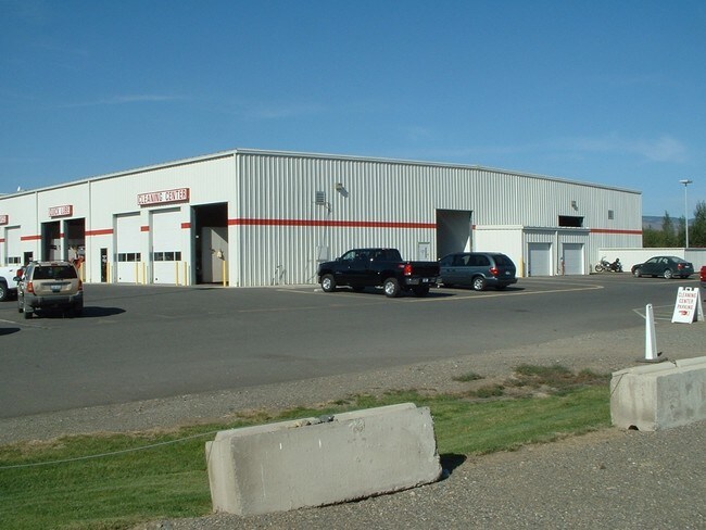
1817 Hwy 97
Ellensburg, WA
University Auto Short Plat
958478
ACRES 6.17; UNIVERSITY AUTO SHORT PLAT 12-6, LOT A; SEC 33, TWP 18, RGE 18
Storebuilding
Kittitas
X
Washington
53037C1064D
a
2024
6.17 AC
2025
Washington State Area
975500
Other Market Areas
29,696 SF
DEMOGRAPHICS near 1817 Hwy 97
1 Mile
3 Mile
5 Mile
2024 Total Population
882
17,407
25,762
2029 Population
997
19,377
28,642
Pop Growth 2024-2029
+ 13.04%
+ 11.32%
+ 11.18%
Average Age
36
34
36
2024 Total Households
288
7,559
11,089
HH Growth 2024-2029
+ 13.19%
+ 11.80%
+ 11.71%
Median Household Inc
$103,000
$52,700
$58,018
Avg Household Size
2.90
2.20
2.30
2024 Avg HH Vehicles
3.00
2.00
2.00
Median Home Value
$443,750
$347,109
$373,896
Median Year Built
1992
1989
1989
Nearby Places
Map Layers
Map Styles
 Street
 Aerial
- Restaurants
- Banks
- Shops
- Fitness
- Groceries
Nearby Properties
Address
Land Use
TOTAL SIZE
Lot Size
Zoning
Address
Land Use
TOTAL SIZE
Lot Size
Zoning
225,455 SF
12.45 AC
KC-A-3
Address
Land Use
TOTAL SIZE
Lot Size
Zoning
135,900 SF
10.06 AC
ECC-II
Address
Land Use
TOTAL SIZE
Lot Size
Zoning
212,223 SF
7.15 AC
EIH
Address
Land Use
TOTAL SIZE
Lot Size
Zoning
89,748 SF
4.17 AC
ERM
Address
Land Use
TOTAL SIZE
Lot Size
Zoning
77,376 SF
7.97 AC
ERM
Address
Land Use
TOTAL SIZE
Lot Size
Zoning
70,284 SF
9.96 AC
ERS
Address
Land Use
TOTAL SIZE
Lot Size
Zoning
45,125 SF
1.83 AC
CT
Address
Land Use
TOTAL SIZE
Lot Size
Zoning
55,944 SF
0.50 AC
ECC
Address
Land Use
TOTAL SIZE
Lot Size
Zoning
64,266 SF
3.20 AC
ERM
Address
Land Use
TOTAL SIZE
Lot Size
Zoning
57,777 SF
3.45 AC
ERM
Address
Land Use
TOTAL SIZE
Lot Size
Zoning
63,006 SF
4.48 AC
ERM
Address
Land Use
TOTAL SIZE
Lot Size
Zoning
63,296 SF
2.36 AC
ERM
Address
Land Use
TOTAL SIZE
Lot Size
Zoning
59,108 SF
4.28 AC
ERM
Address
Land Use
TOTAL SIZE
Lot Size
Zoning
100 AC
ERS
Address
Land Use
TOTAL SIZE
Lot Size
Zoning
48,106 SF
3.17 AC
ECC
Address
Land Use
TOTAL SIZE
Lot Size
Zoning
56,715 SF
4.47 AC
RS
Address
Land Use
TOTAL SIZE
Lot Size
Zoning
58,800 SF
5.40 AC
Address
Land Use
TOTAL SIZE
Lot Size
Zoning
49,575 SF
4.37 AC
ECH
Address
Land Use
TOTAL SIZE
Lot Size
Zoning
39,808 SF
2.13 AC
ERM
Address
Land Use
TOTAL SIZE
Lot Size
Zoning
86,334 SF
5.43 AC
ERS
Address
Land Use
TOTAL SIZE
Lot Size
Zoning
33,373 SF
1.44 AC
ECH
Address
Land Use
TOTAL SIZE
Lot Size
Zoning
41,912 SF
2.26 AC
ERM
Address
Land Use
TOTAL SIZE
Lot Size
Zoning
10,062 SF
6.51 AC
ECT
Address
Land Use
TOTAL SIZE
Lot Size
Zoning
106,115 SF
35.56 AC
KC-A-20
Address
Land Use
TOTAL SIZE
Lot Size
Zoning
34,196 SF
1.56 AC
ERM
Address
Land Use
TOTAL SIZE
Lot Size
Zoning
42.14 AC
ERS
Address
Land Use
TOTAL SIZE
Lot Size
Zoning
32,233 SF
1.84 AC
ERM
Address
Land Use
TOTAL SIZE
Lot Size
Zoning
93,112 SF
8.20 AC
KC-I-G
Address
Land Use
TOTAL SIZE
Lot Size
Zoning
106,722 SF
15.10 AC
EIL
Address
Land Use
TOTAL SIZE
Lot Size
Zoning
91,393 SF
6.02 AC
KC-I-G
The World's #1 Commercial Real Estate Marketplace
Connect with us
© 2026 CoStar Group
The information above has been obtained from sources believed reliable. While we do not doubt its accuracy we have not verified it and make no guarantee, warranty or representation about it. It is your responsibility to independently confirm its accuracy and completeness. Any projections, opinions, assumptions, or estimates used are for example only and do not represent the current or future performance of the property. The value of this transaction to you depends on tax and other factors which should be evaluated by your tax, financial, and legal advisors. You and your advisors should conduct a careful, independent investigation of the property to determine to your satisfaction the suitability of the property for your needs.